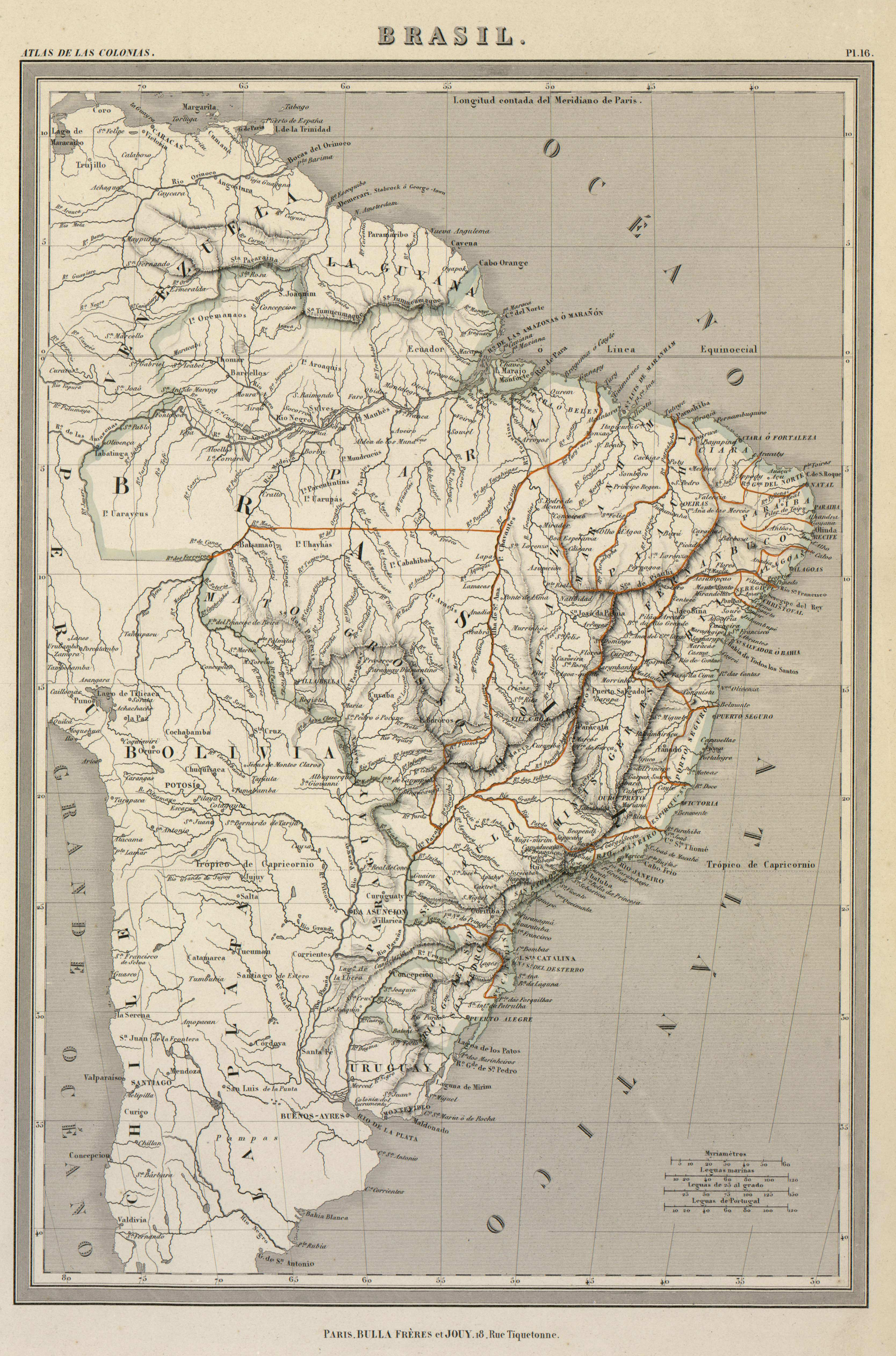
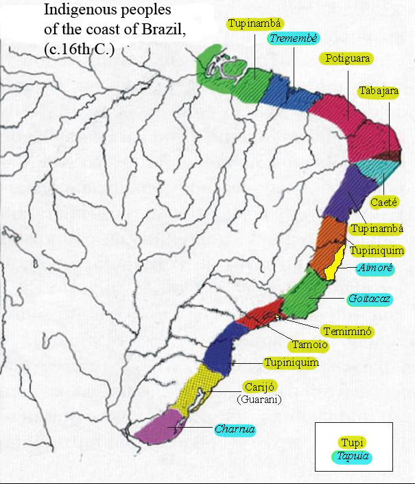
Dispossesions in the Americas

Dispossesions in the Americas

  • Home
  • Explore
  • About
  • Authors
  • Art
  • Bodies
  • Curricula
  • Cultural Heritage
  • Maps
  • Territories
Back to Explore
Map 1500 - 1599

Indigenous peoples of the coast of Brazil, (c. 16th C.)

    Published: 2011

    • Download Image

    Peoples

    • TUPINAMBA
    • TREMEMBE
    • POTIGUARA
    • TABAJARA
    • CAETE
    • TUPINIQUIM
    • AIMORE
    • GOITACAZ
    • TEMIMINO
    • TAMOIO
    • CARIJO
    • GUARANI
    • CHARRUA
    • TUPI
    • TAPUIA

    Citation

    "Indigenous peoples of the coast of Brazil, (c. 16th C.)." Map. Wikimedia Commons. June 26, 2011. https://commons.wikimedia.org/wiki/File:Map_of_indigenous_peoples_of_Brazil_(16th_C.).jpg.

    • Download Image

    Reading in Spanish

    Map 1500 - 1599

    Indigenous peoples of the coast of Brazil, (c. 16th C.)

      Published: 2011

      • Download Image
      • Download Image

      Reading in Portuguese

      Map 1500 - 1599

      Indigenous peoples of the coast of Brazil, (c. 16th C.)

        Published: 2011

        • Download Image

        Peoples

        • TUPINAMBA
        • TREMEMBE
        • POTIGUARA
        • TABAJARA
        • CAETE
        • TUPINIQUIM
        • AIMORE
        • GOITACAZ
        • TEMIMINO
        • TAMOIO
        • CARIJO
        • GUARANI
        • CHARRUA
        • TUPI
        • TAPUIA

        Citation

        "Indigenous peoples of the coast of Brazil, (c. 16th C.)." Map. Wikimedia Commons. June 26, 2011. https://commons.wikimedia.org/wiki/File:Map_of_indigenous_peoples_of_Brazil_(16th_C.).jpg.

        • Download Image

        Related Content

        Carta étnica del Gran Chaco en el umbral del s. XX

        Carta étnica del Gran Chaco en el umbral del s. XX

        Map 1890 - 1935
        Plan de la côte de la Guyane depuis la Riviere de Mahury jusqu'à celle de Macouria comprenant la rade de Cayenne Levé géométriquement en 1764 et 1765.

        Plan de la côte de la Guyane depuis la Riviere de Mahury jusqu'à celle de Macouria comprenant la rade de Cayenne Levé géométriquement en 1764 et 1765.

        Map 1764 - 1765
        Tierra [Earth]

        Tierra [Earth]

        Artwork
        Geographical Distribution of the Cuicatec

        Geographical Distribution of the Cuicatec

        Map 1969
        Mapa general de la Republica de Honduras

        Mapa general de la Republica de Honduras

        Map 1900 - 1999
        PUEBLO OTOMI

        PUEBLO OTOMI

        Map 2020
        PROVINCIE DELLO SPIRITO SANTO E DI PORTO SICURO

        PROVINCIE DELLO SPIRITO SANTO E DI PORTO SICURO

        Map 1600 - 1699
        Carte de la Guyane Française.

        Carte de la Guyane Française.

        Map 1951

        Dispossessions in the Americas

        A project by

        University of Pennsylvania

        Copyright 2024

        With support from

        Mellon Foundation

        Site design & development

        Element 84

        Art Credits

        “Indigenous peoples of the coast of Brazil, (c. 16th C.).” Map. Wikimedia Commons. June 26, 2011. https://commons.wikimedia.org/wiki/File:Map_of_indigenous_peoples_of_Brazil_(16th_C.).jpg.

        Site Pages

        • Home
        • Explore
        • About
        • Authors
        • Art
        • Bodies
        • Curricula
        • Cultural Heritage
        • Maps
        • Territories