Peoples
- ATIKUM
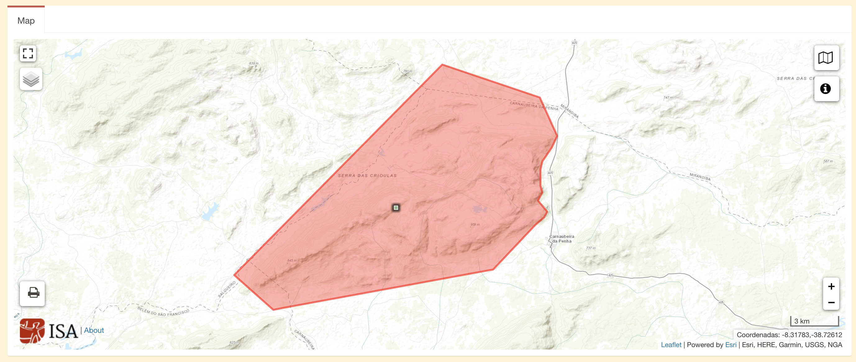
Citation
Instituto Socioambiental. "Terra Indígena Atikum." Map. Terras Indígenas no Brasil. June 10, 2021. https://terrasindigenas.org.br/pt-br/terras-indigenas/3605.
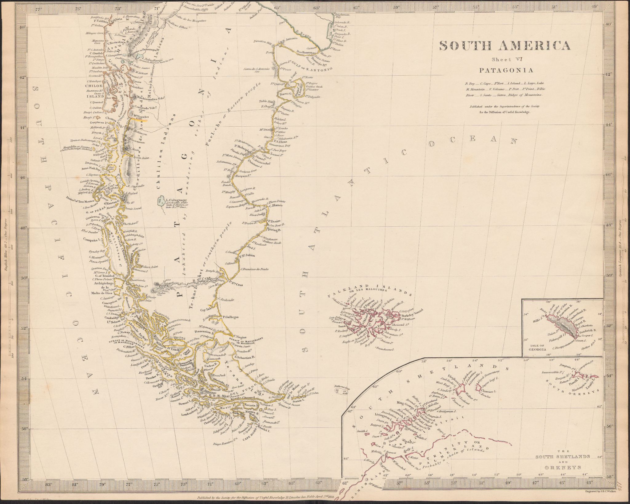
South America
Map 1800 - 1850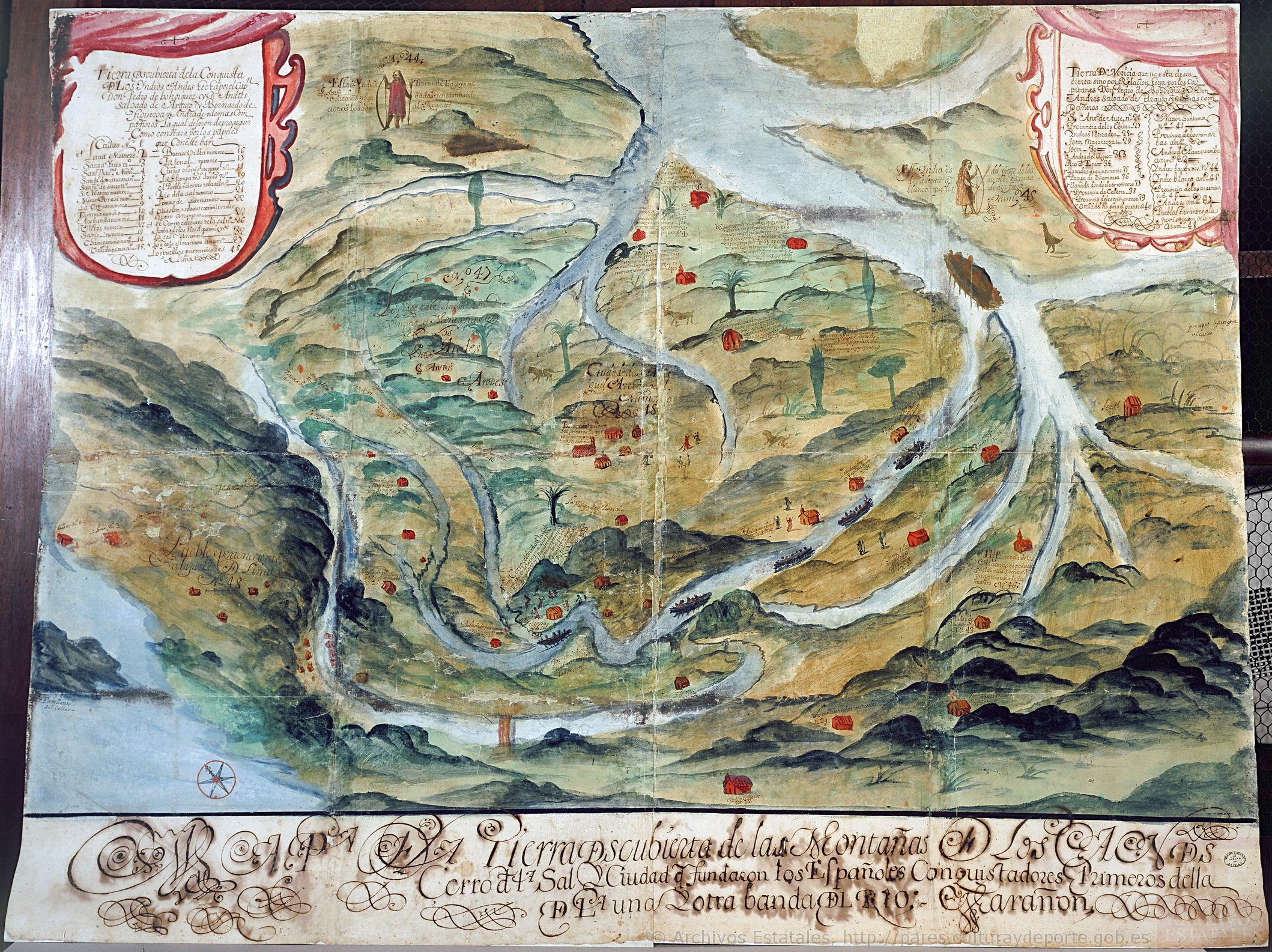
Mapa de la tierra descubierta de las montañas de los Andes, cerro de la Sal, y ciudad que fundaron los españoles conquistadores, primeros de ella, de la una y otra banda del río Marañón
Map 1663
REPRESENTACIÓN EN FORMA DE TRÍPTICO DE LAS TIERRAS DE TEPAL;CUENCA;CORRESPONDE AL EXPEDIENTE PROMOVIDO POR POSESIÓN DE TIERRAS ENTRE LOS INDÍGENAS DE SANTA ANA DE PICHACAY CONTRA MARÍA Y FRANCISCA CAZAR
Map 1828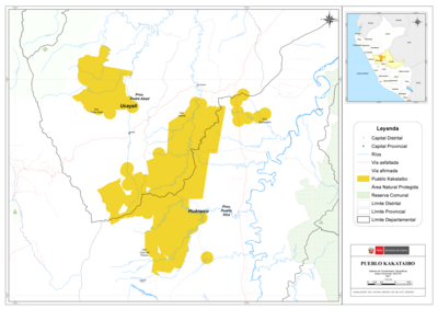
PUEBLO KAKATAIBO
Map 2021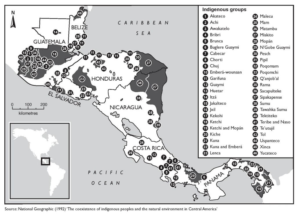
The coexistence of indigenous peoples and the natural environment in Central America
Map 1900 - 1999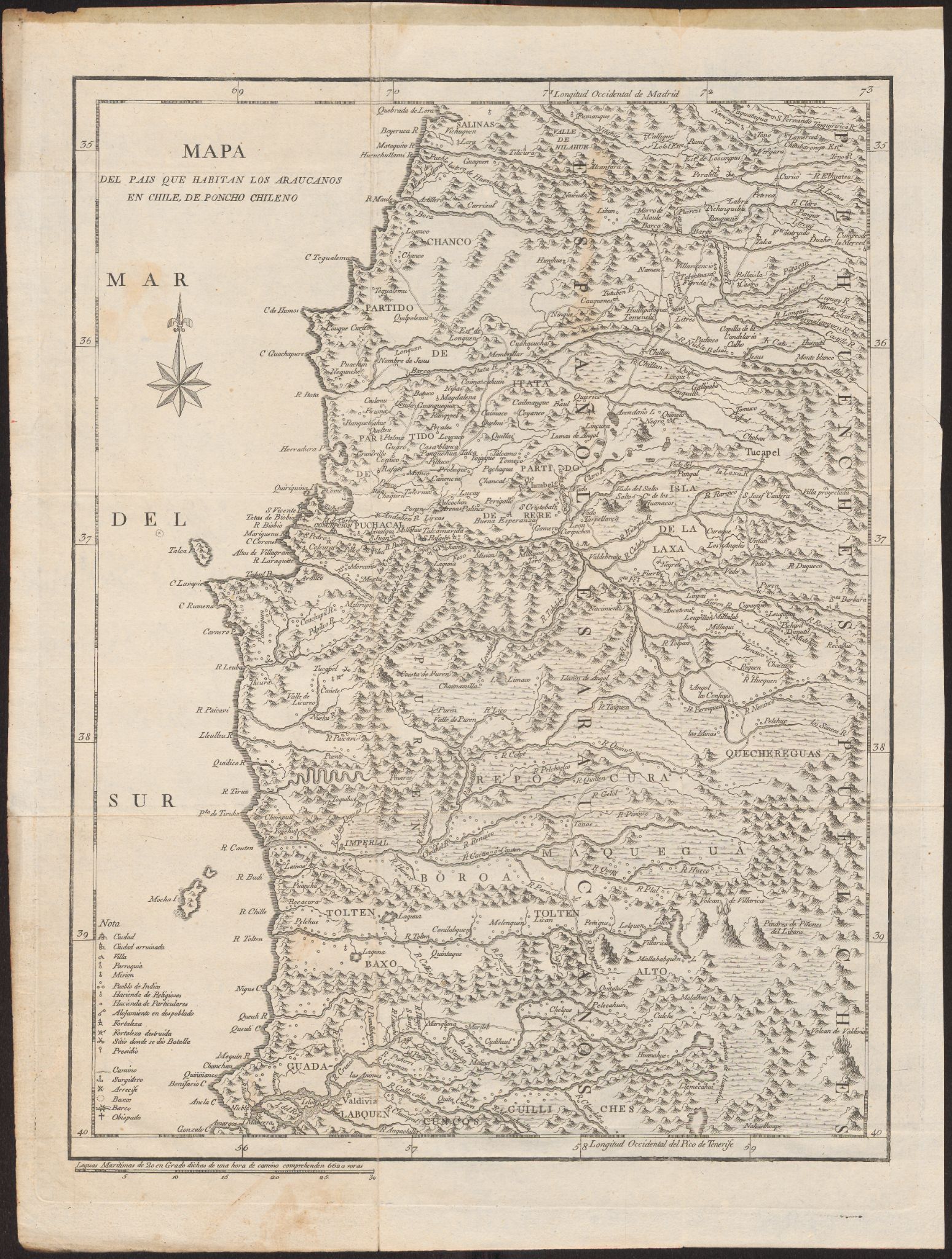
Mapa Del Pais Que Habitan Los Araucanos En Chile, De Poncho Chileno
Map 1700 - 1800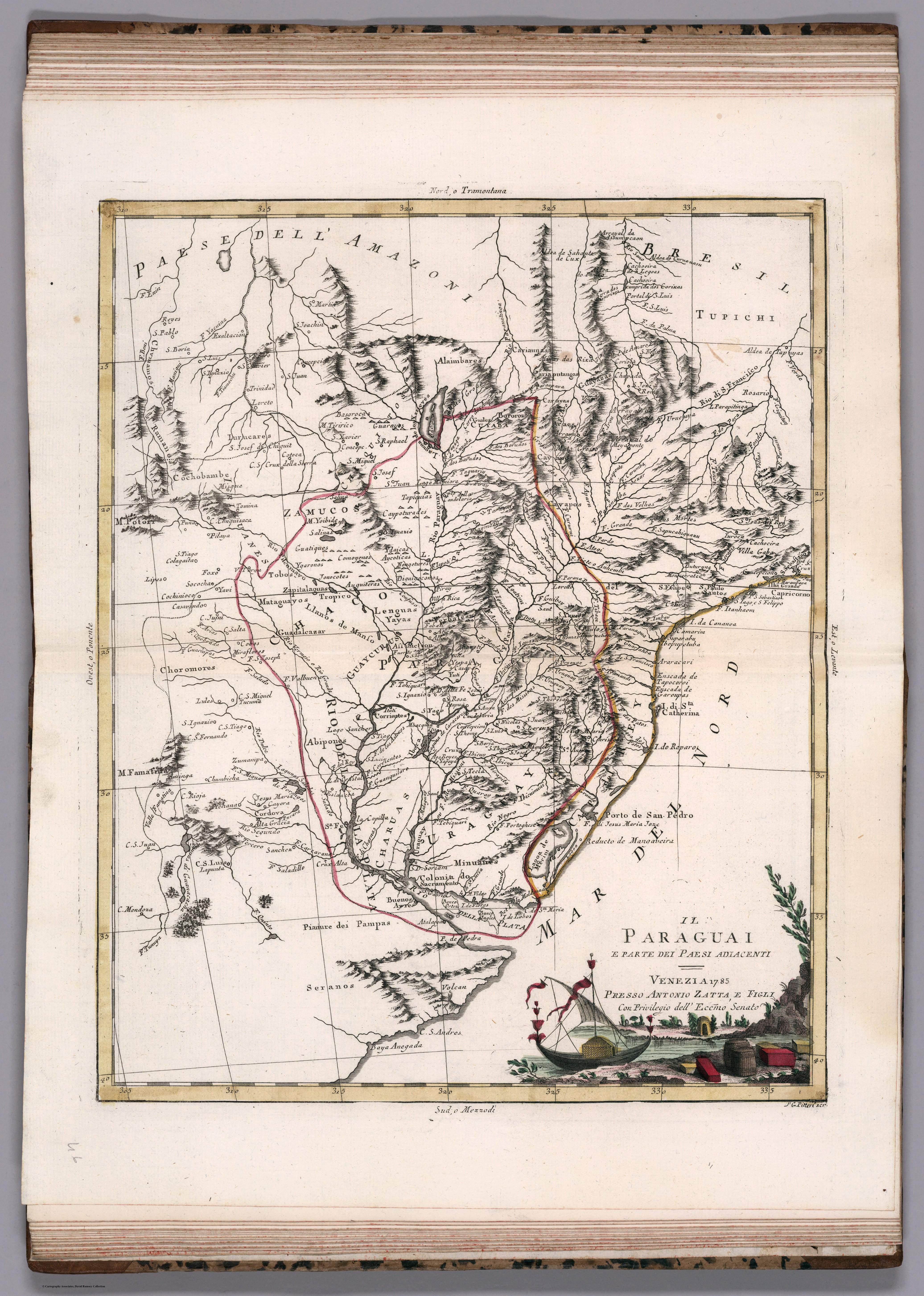
IL PARAGUAI E PARTE DEI PAESI ADIACENT
Map 1785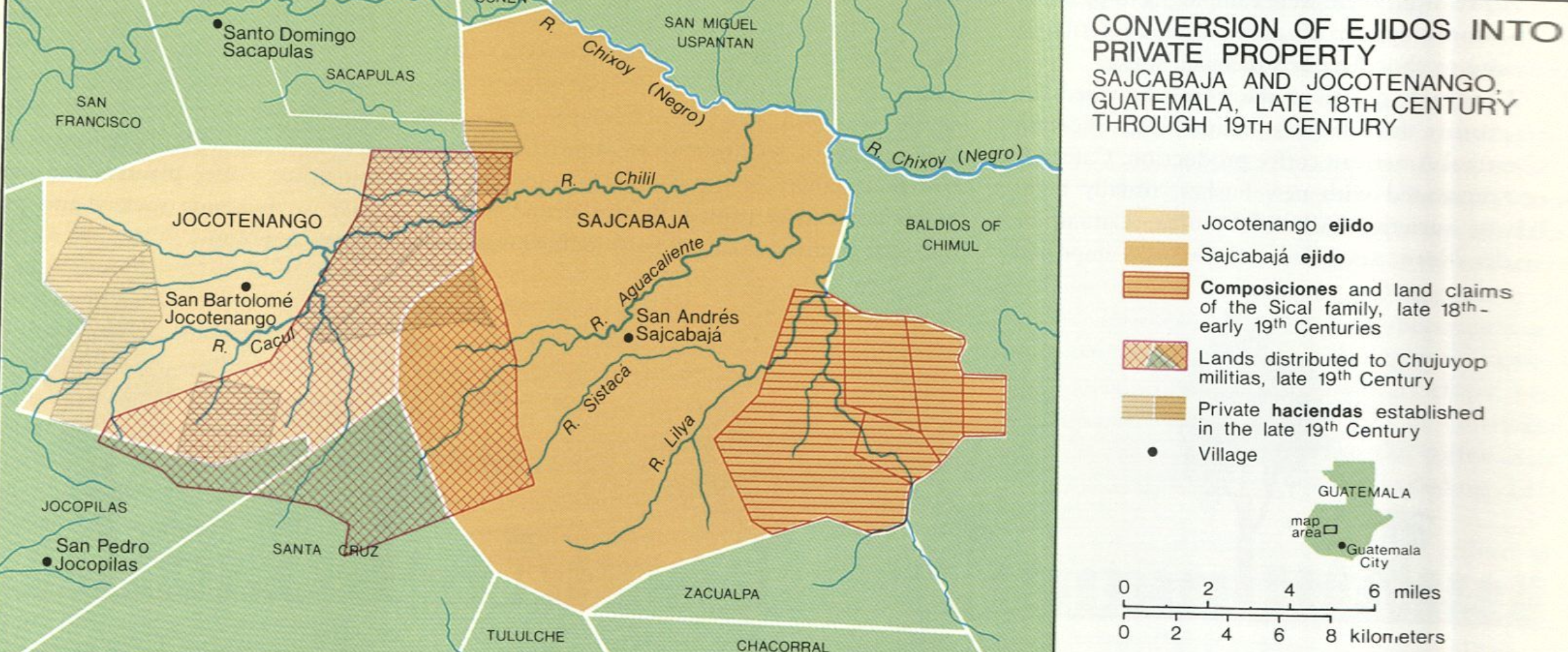
Conversion of Ejidos into Private Property, Sajcabaja and Jocotenango, Guatemala, Late 18th Century through 19th Century
Map 1700 - 1800