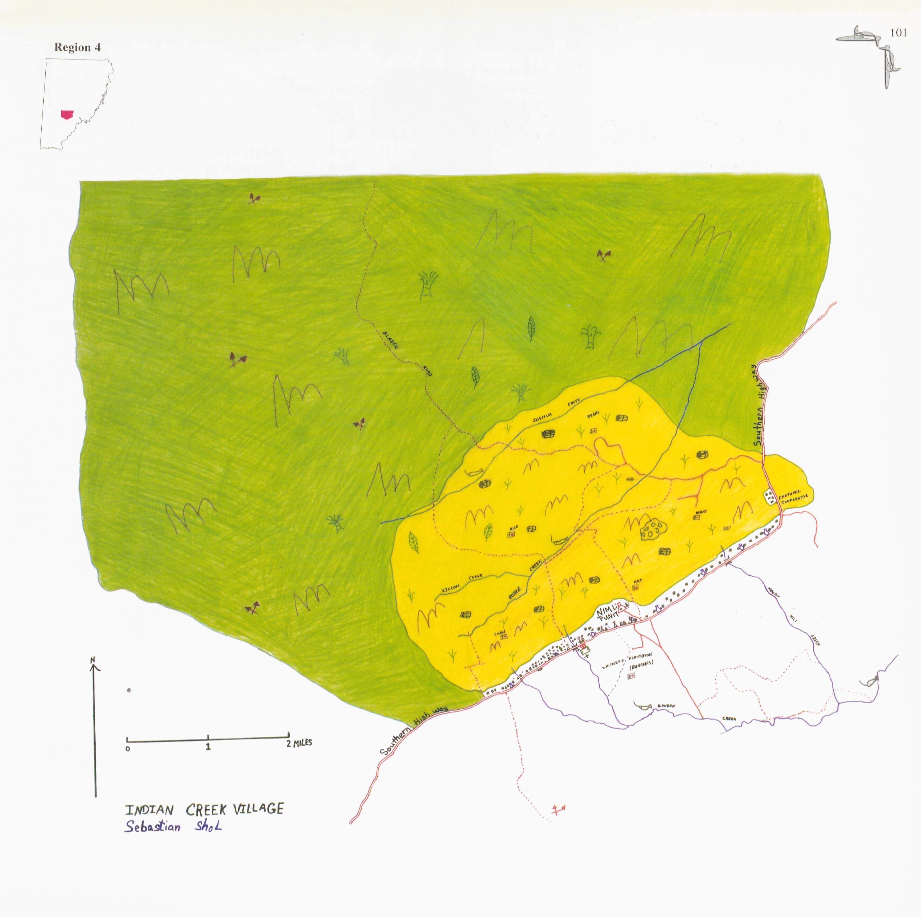
Peoples
- KE'KCHI
Citation
Sebastian Shol. 1997. "Indian Creek." In Maya Atlas: The Struggle to Preserve Maya Land in Southern Belize, 101. Berkeley, CA: North Atlantic Books. BOOK
CHART OF RIO DE LA PLATA IN SOUTH AMERICA
Map 1772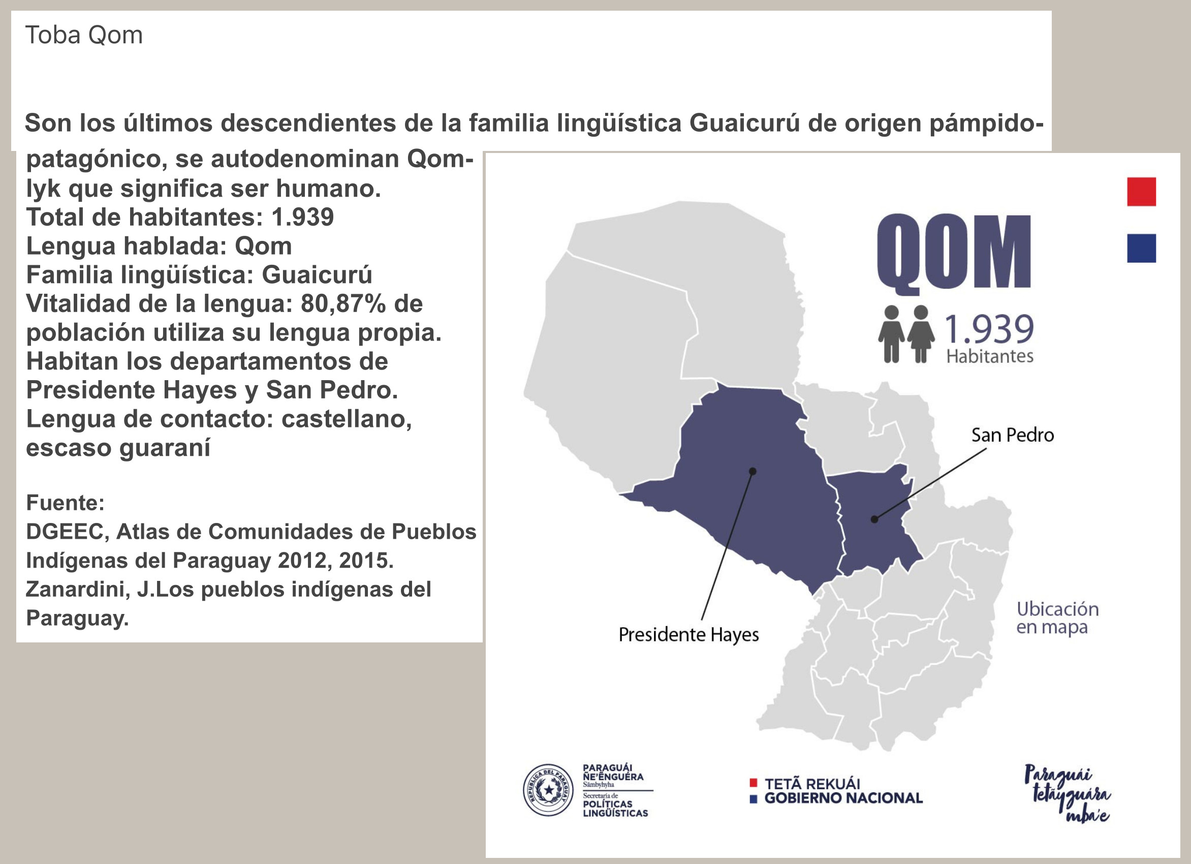
QOM
Map 2015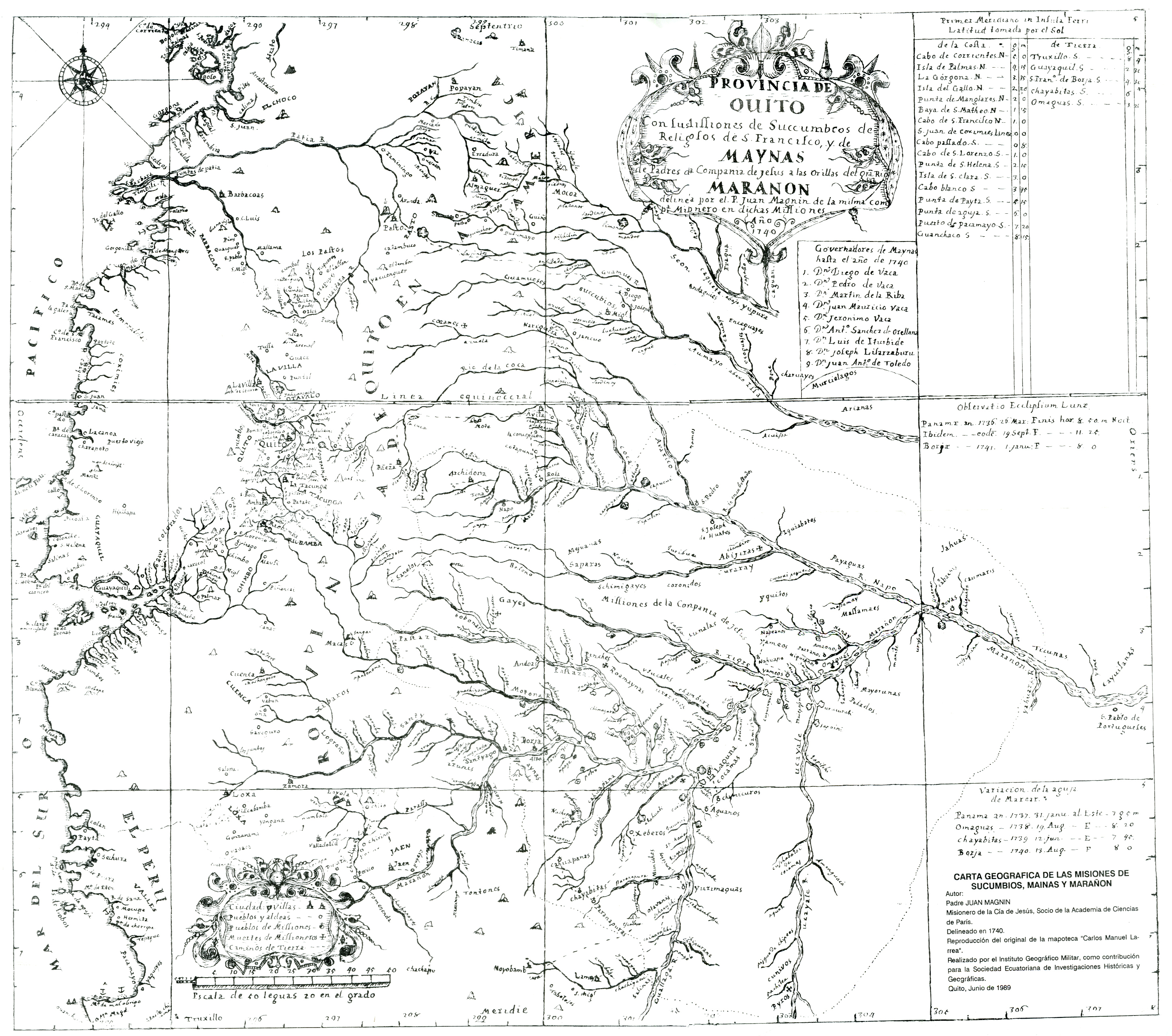
CARTA GEOGRAFICA DE LAS MISIONES DE SUCUMBIOS;MAINAS Y MARAÑON
Map 1740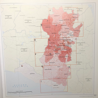
INTENDENCIA DE MÉXICO
Map 1800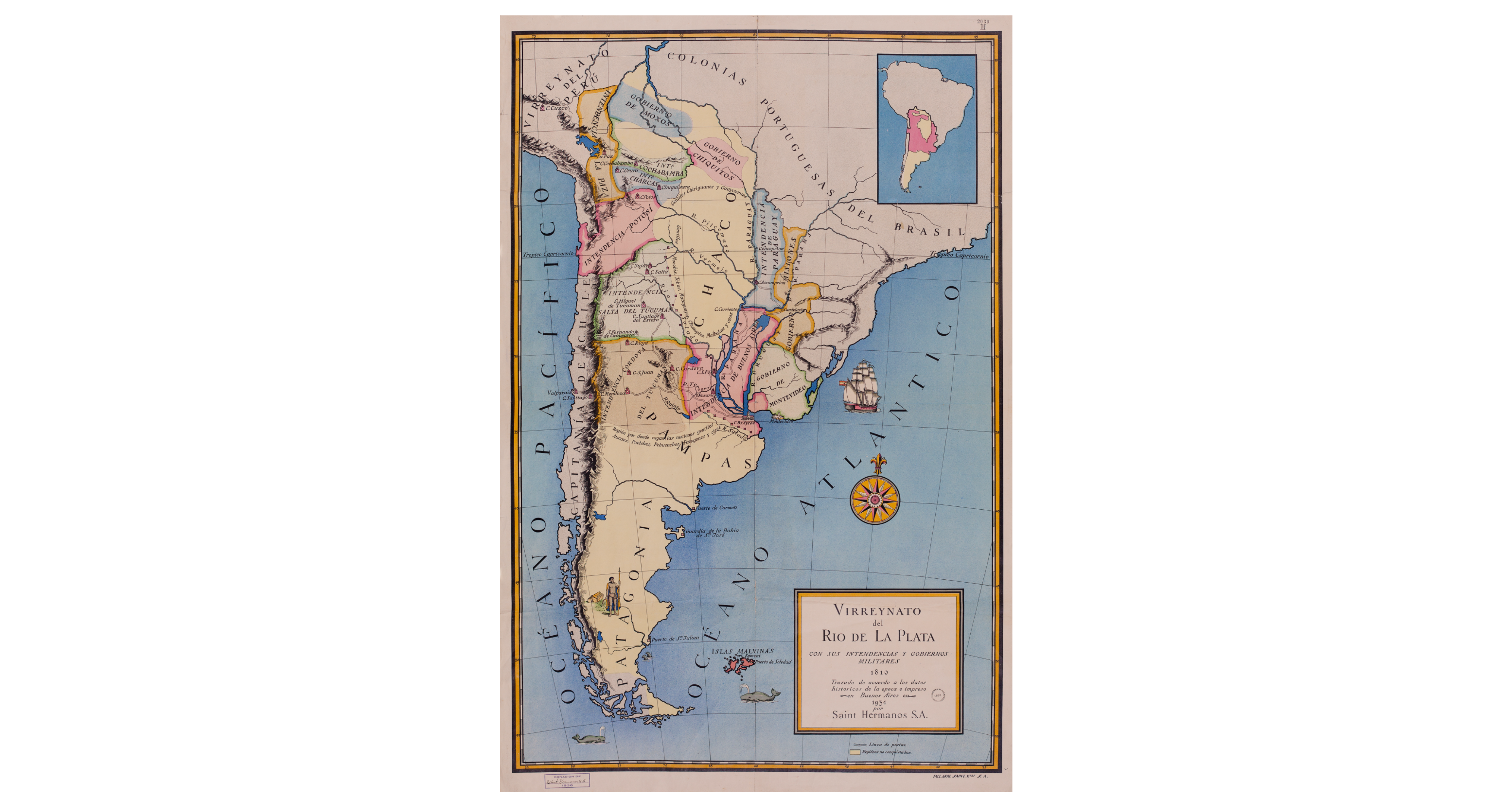
Virreynato del Río de La Plata con sus intendencias y gobiernos militares: 1810
Map 1810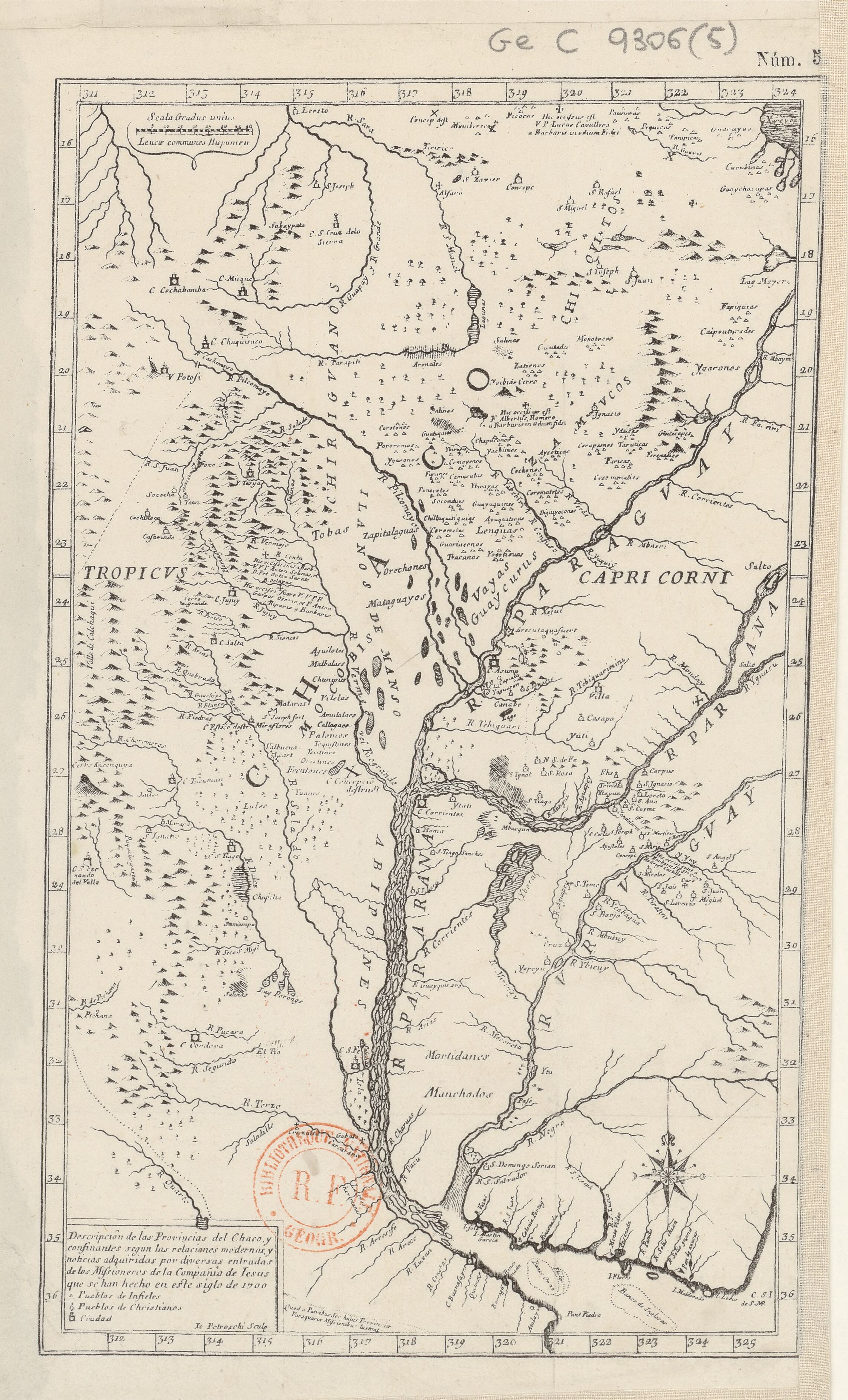
Descripción de las Provincias del Chaco, y confinantes segun las relaciones modernas, y noticias adquiridas por diversas entradas de los Misioneros de la Compañía de Jesús que se han hecho en este siglo de 1700.
Map 1800 - 1899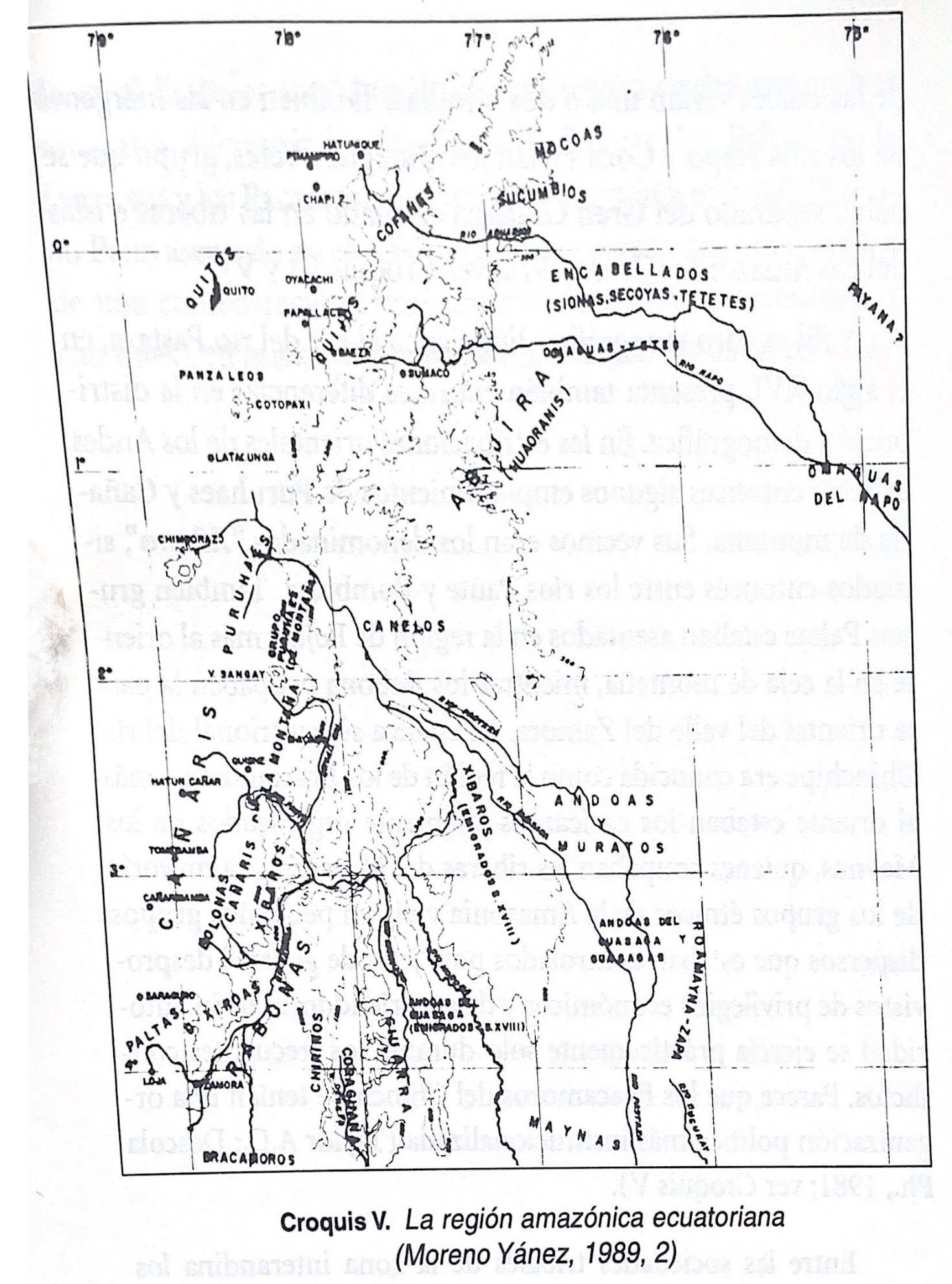
Croquis V. La región amazónica ecuatoriana (Moreno Yanez;1989;2)
Map -500 - 1530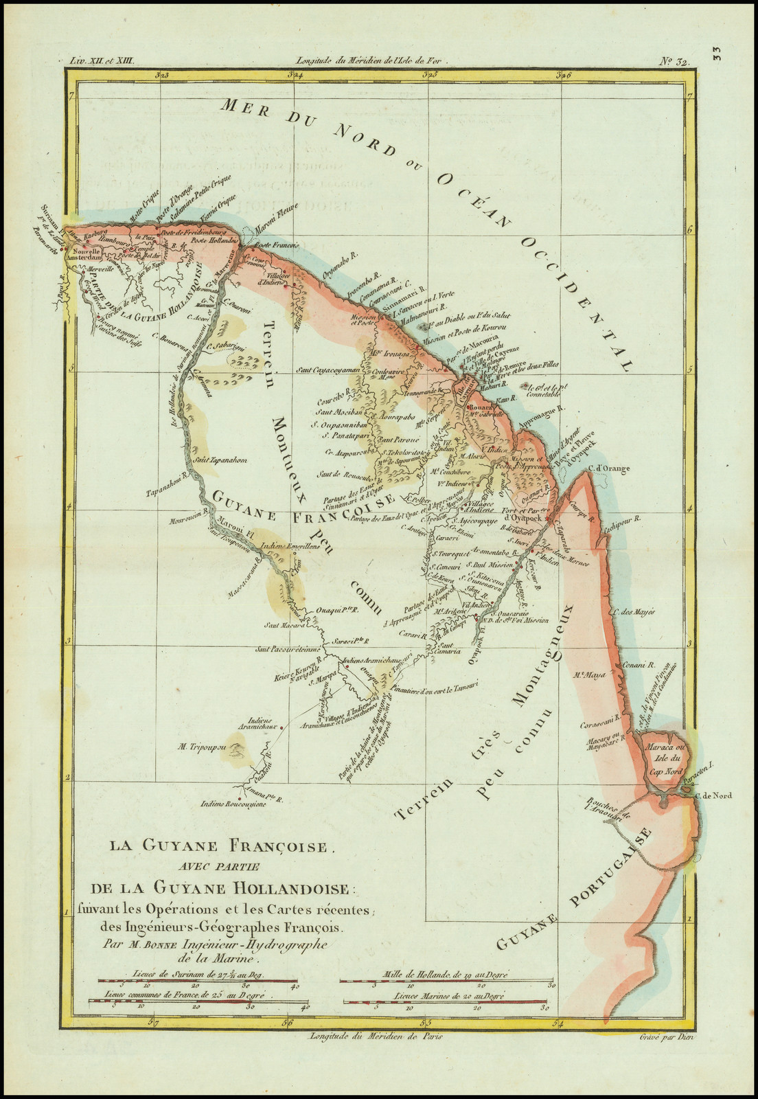
La Guyane Francoise, avec partie de la Guyane Hollandoise: suivant les Opérations et les Cartes récentes;des Ingênieurs-Géographes François.
Map 1787