Peoples
- KE'KCHI
Citation
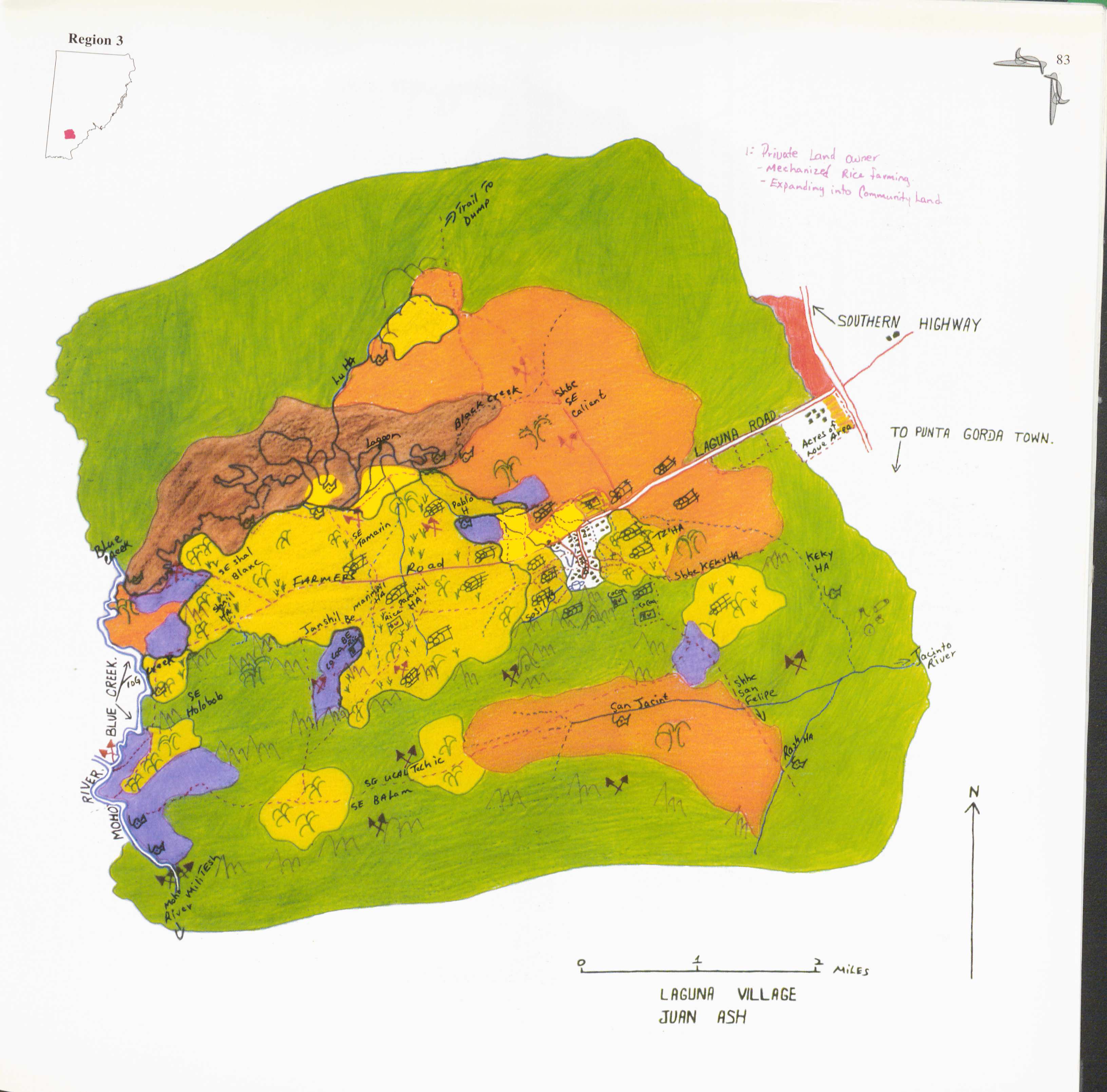
Juan Ash. 1997. "Laguna." In Maya Atlas: The Struggle to Preserve Maya Land in Southern Belize, 83. Berkeley, CA: North Atlantic Books. BOOK
![Jujeñazo Vol. 2084 con la "Vendedora de cultura" [Jujeñazo Vol. 2084 featuring the ‘Culture Seller’]](https://dnet8ble6lm7w.cloudfront.net/art_sm/AARG021.png)
Jujeñazo Vol. 2084 con la "Vendedora de cultura" [Jujeñazo Vol. 2084 featuring the ‘Culture Seller’]
Artwork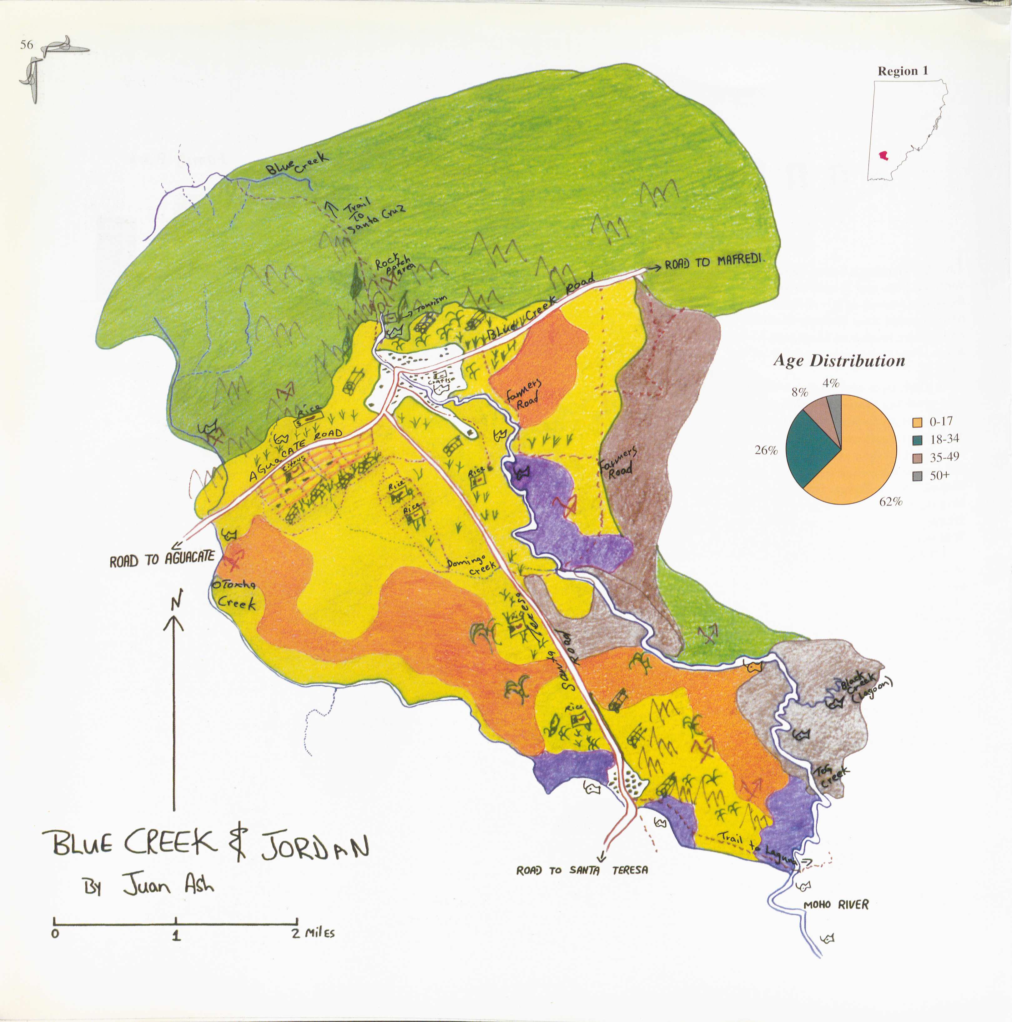
Blue Creek
Map 1997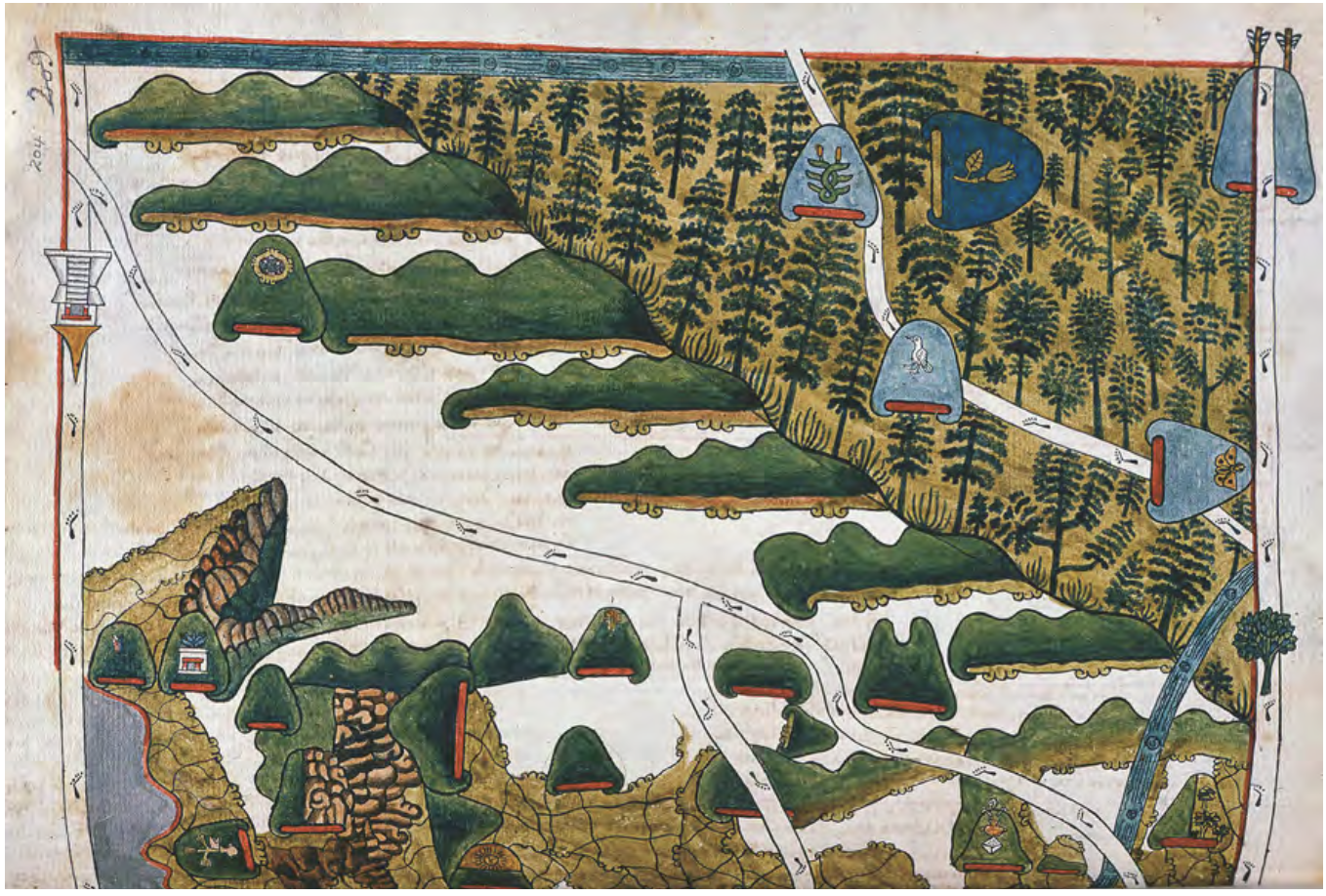
MAPA DE TEPETLAOZTOC
Map 1500 - 1599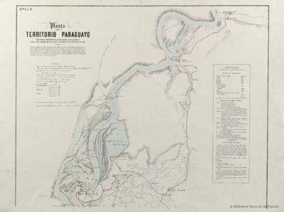
Planta do TERRITORIO PARAGUAYO
Map 1865 - 1868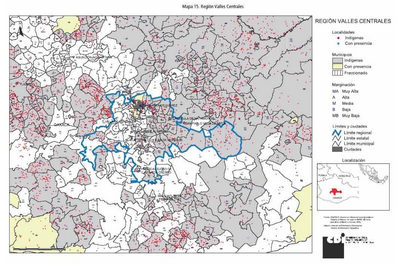
REGIÓN VALLES CENTRALES
Map 2000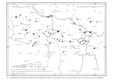
Distribution of Tarascan Speech by Settlements, 1940
Map 1940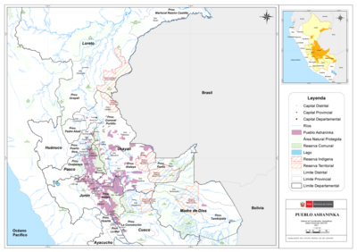
PUEBLO ASHANINKA
Map 2021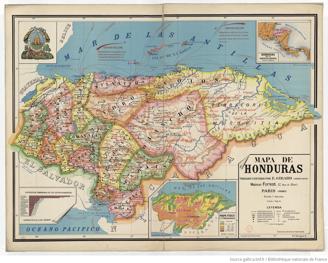
Mapa de Honduras, with Mapa Físico y Etnográfico (insert)
Map 1929