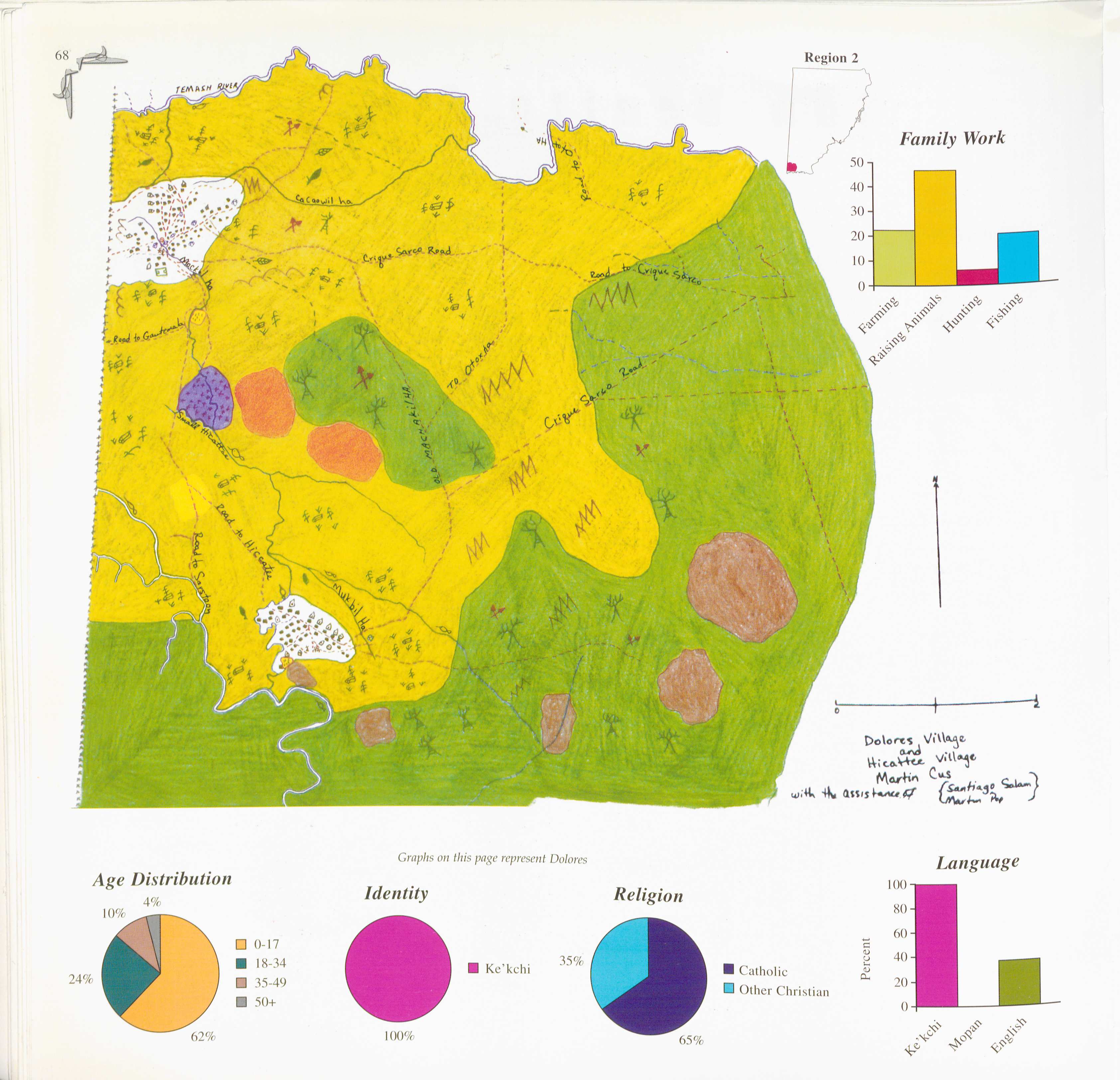
Peoples
- KE'KCHI
Citation
Martin Cus, Santiago Salam, and Martin Pop. 1997. "Dolores." In Maya Atlas: The Struggle to Preserve Maya Land in Southern Belize, 68. Berkeley, CA: North Atlantic Books. BOOK
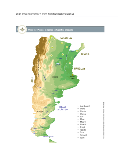
Pueblos indígenas en Argentina chaqueña
Map 2009![Serie Historia de la peruvian corporaishion [History of the Peruvian Corporaishion Series]](https://dnet8ble6lm7w.cloudfront.net/art_sm/APER037.png)
Serie Historia de la peruvian corporaishion [History of the Peruvian Corporaishion Series]
Artwork
A New Map of Part /of the Great River / De la Plata, /of Tucuman / and the adjacent Countries, from Buenos Ayres to Potosí
Map 1716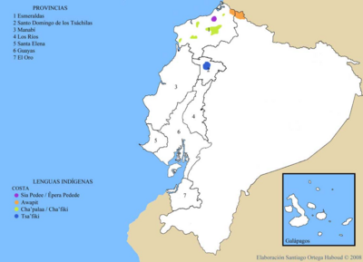
LENGUAS INDIGENAS COSTA
Map 2008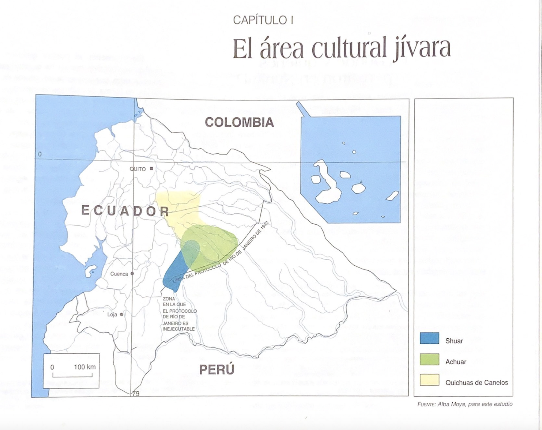
El área cultural jívara
Map 1997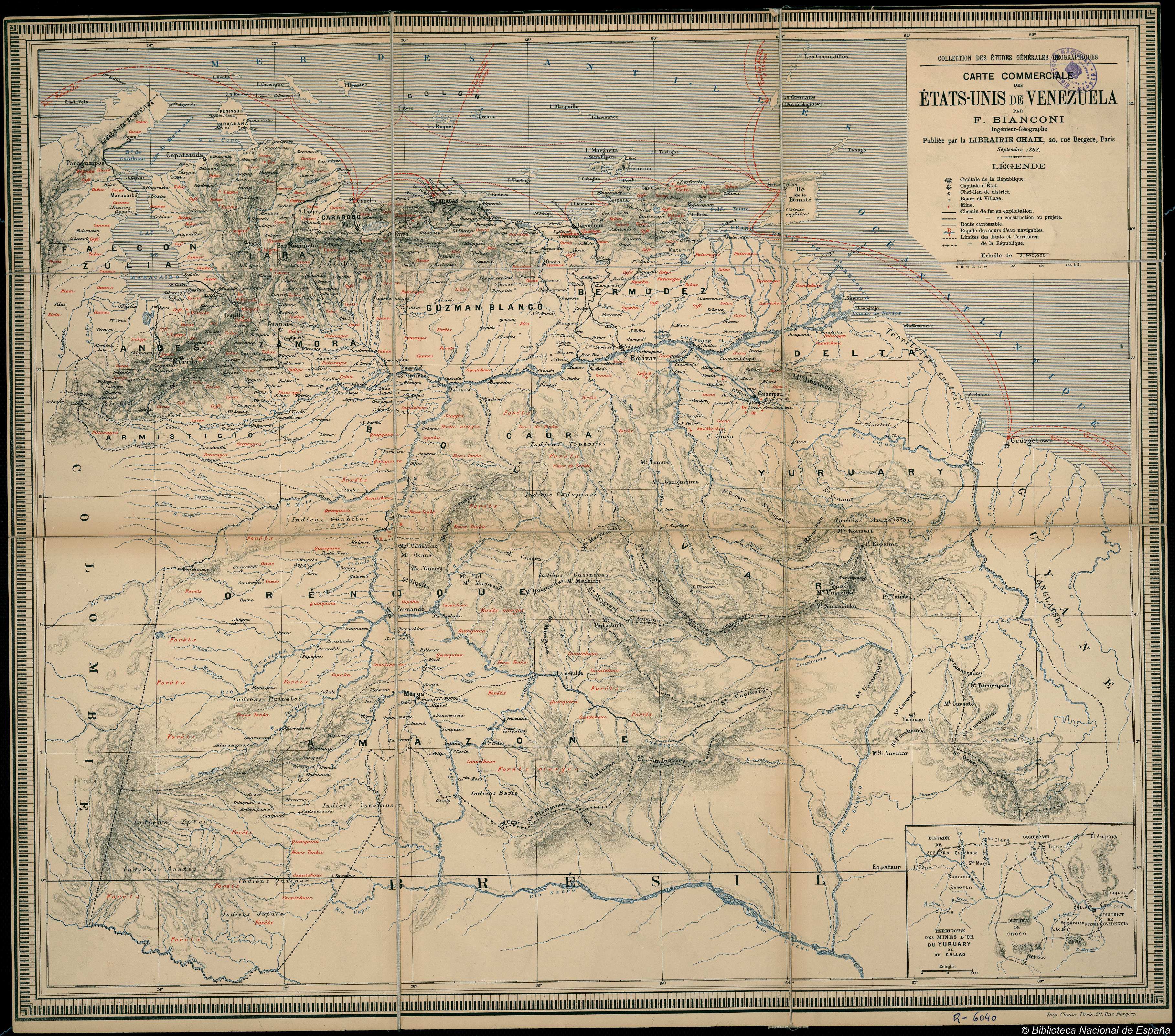
CARTE COMMERCIALE des ÉTATS UNIS de VENEZUELA
Map 1888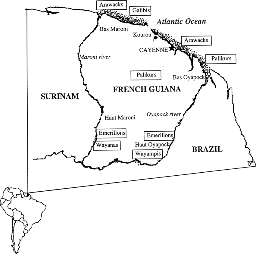
Fig. 1. Map of French Guiana with locations of the various Amerindian groups
Map 1999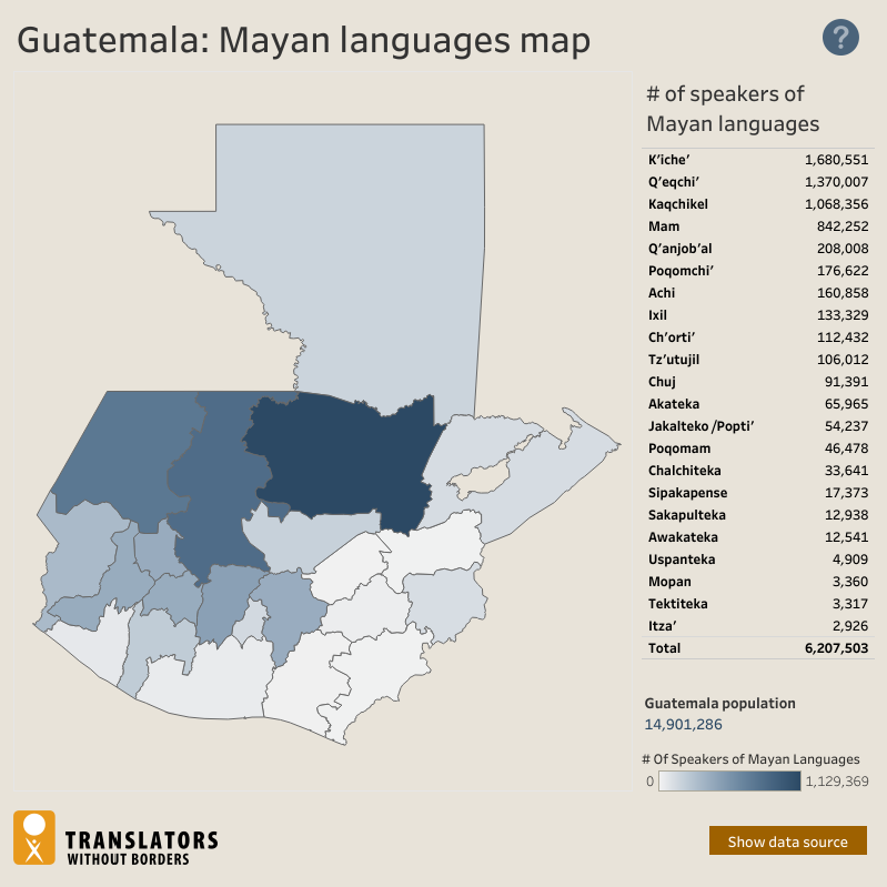
Guatemala: Mayan languages map
Map 2018