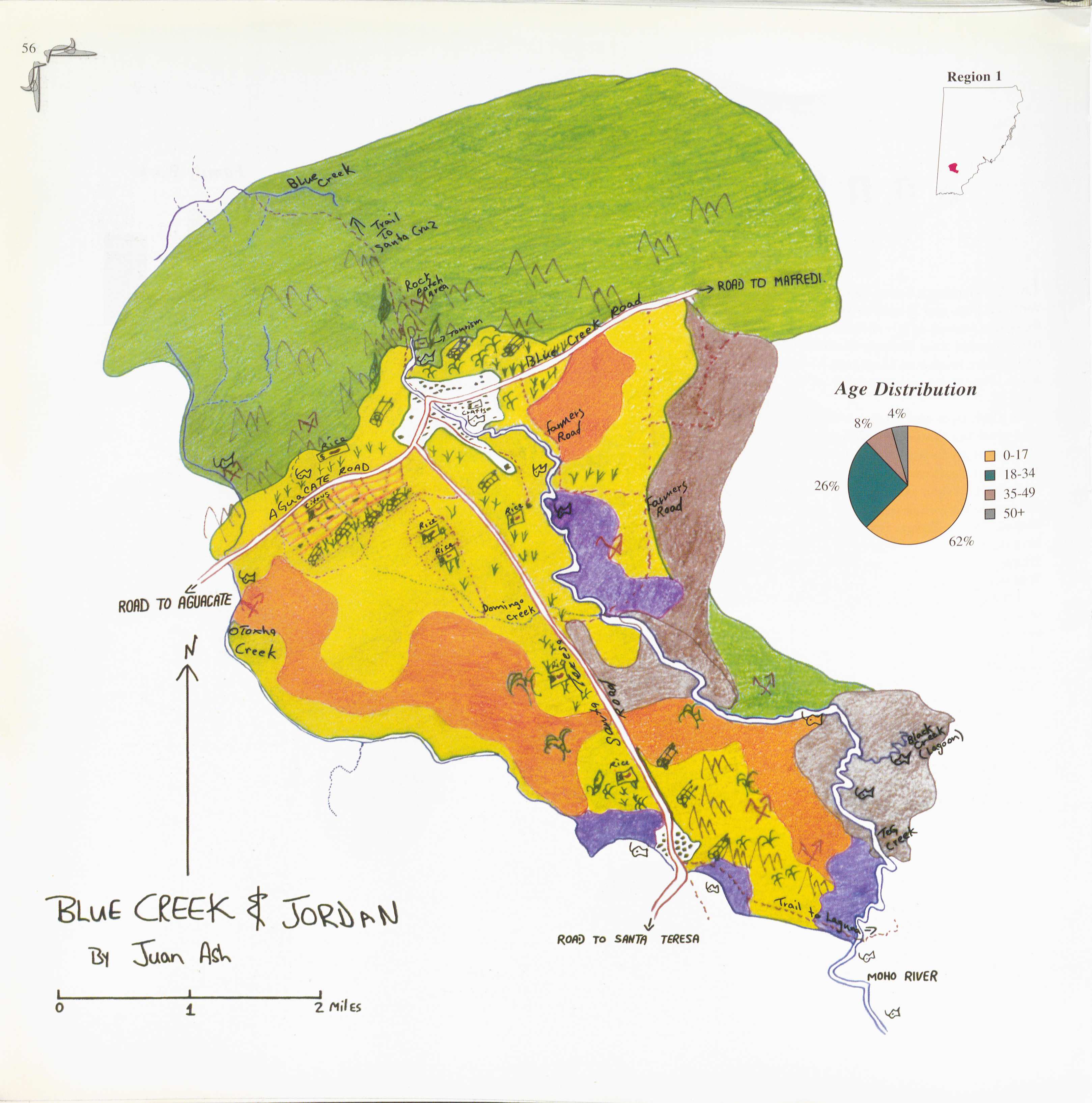
Peoples
- KE'KCHI
- MOPAN
Citation
Juan Ash. 1997. “Blue Creek.” In Maya Atlas: The Struggle to Preserve Maya Land in Southern Belize, 56. Berkeley, CA: North Atlantic Books. book
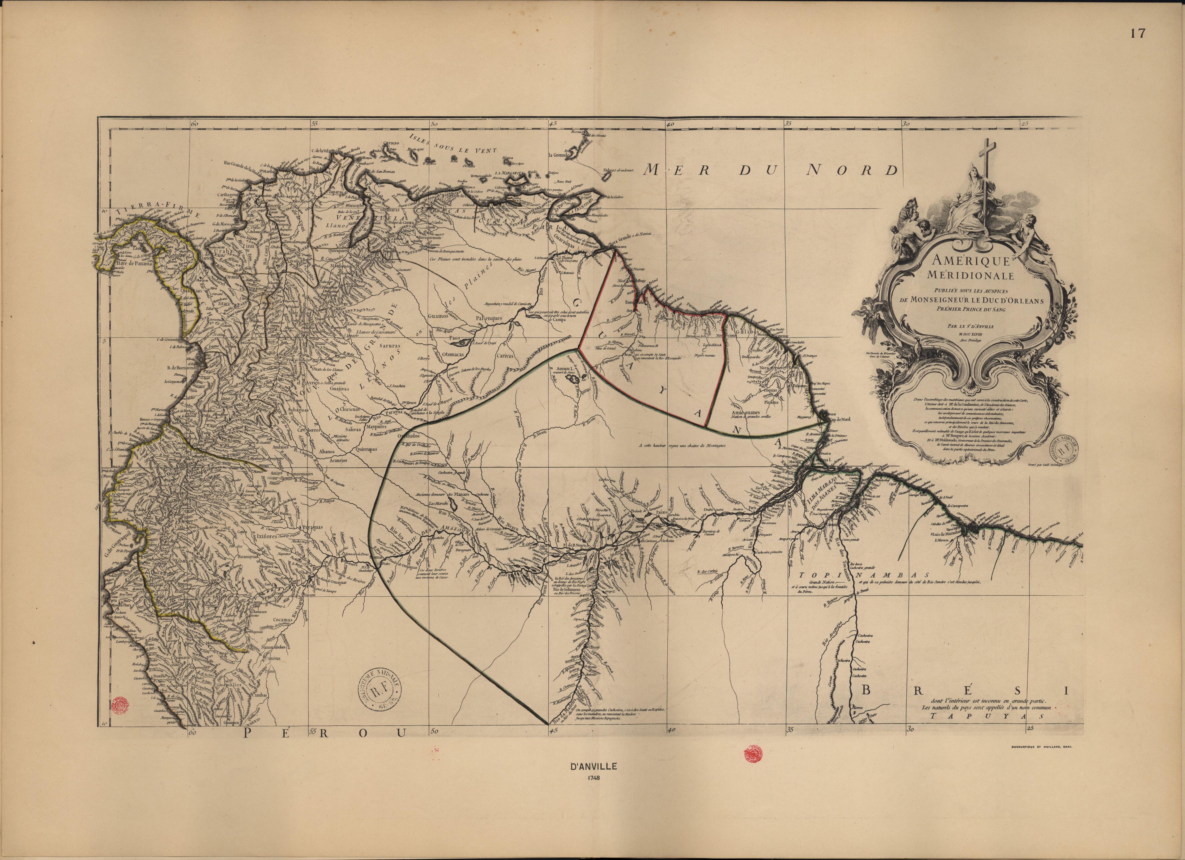
Amérique Méridionale. Publiée sous les auspices de Monseigneur Le Duc d'Orleans.
Map 1700 - 1799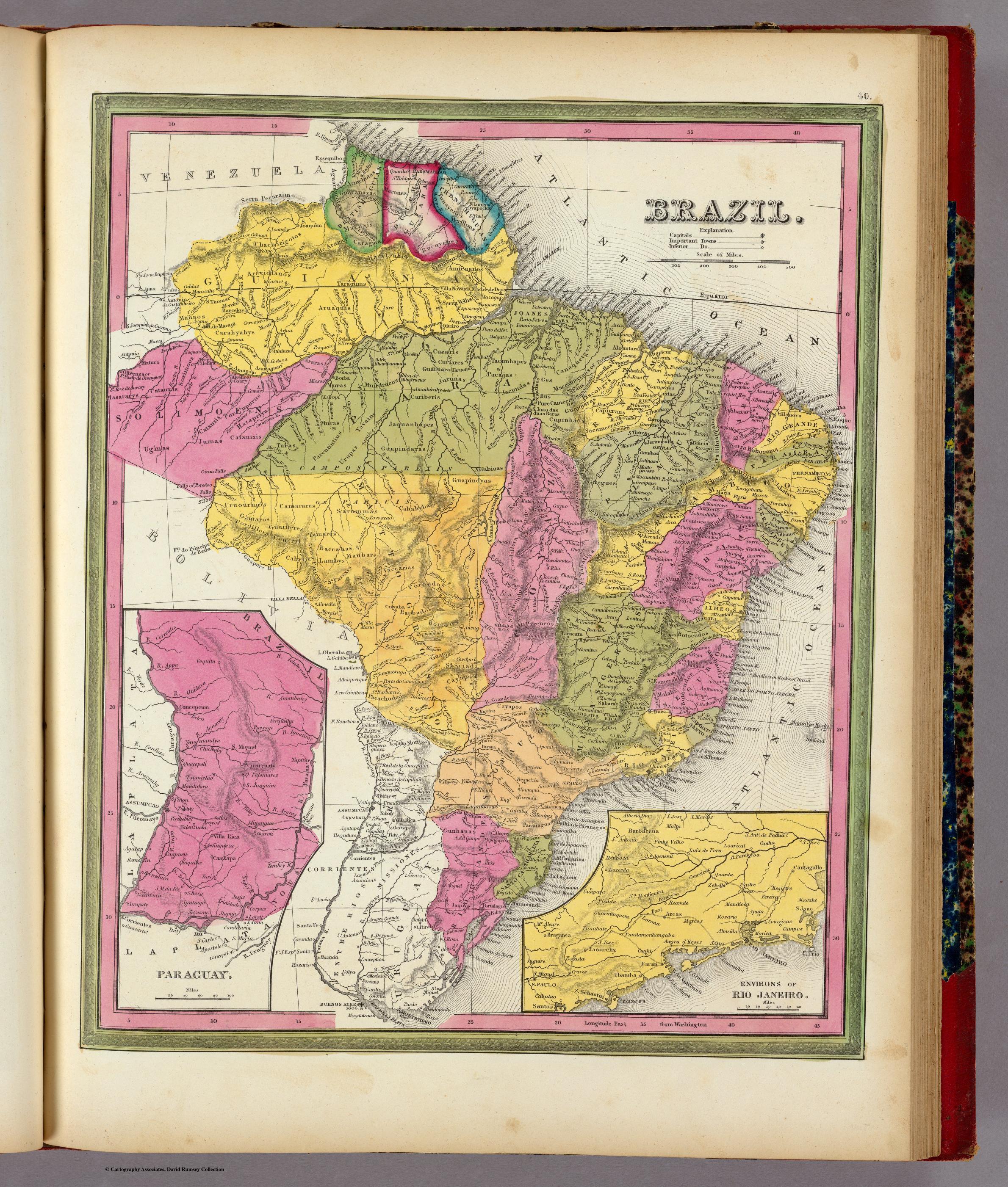
BRAZIL
Map 1846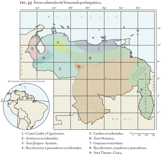
Áreas culturales de Venezuela prehispánica
Map 1490
TERRITORIOS DE LOS PUEBLOS Y NACIONALIDADES;TERRITORIOS DE VIDA Y AREAS PROTEGIDAS EN EL ECUADOR CONTINENTAL
Map 2016 - 2018
"Territorio Indígena Matambú (Chorotega)"
Map 2010
Terra Indígena Bananal (Peruíbe)
Map 2011
CARTE particuliere du cours de la RIVIERE DES AMAZONES ou de MARAGNON Depuis l'entrée du Para en remontant jusqu'au Confluent de la Rivière Noire.
Map 1729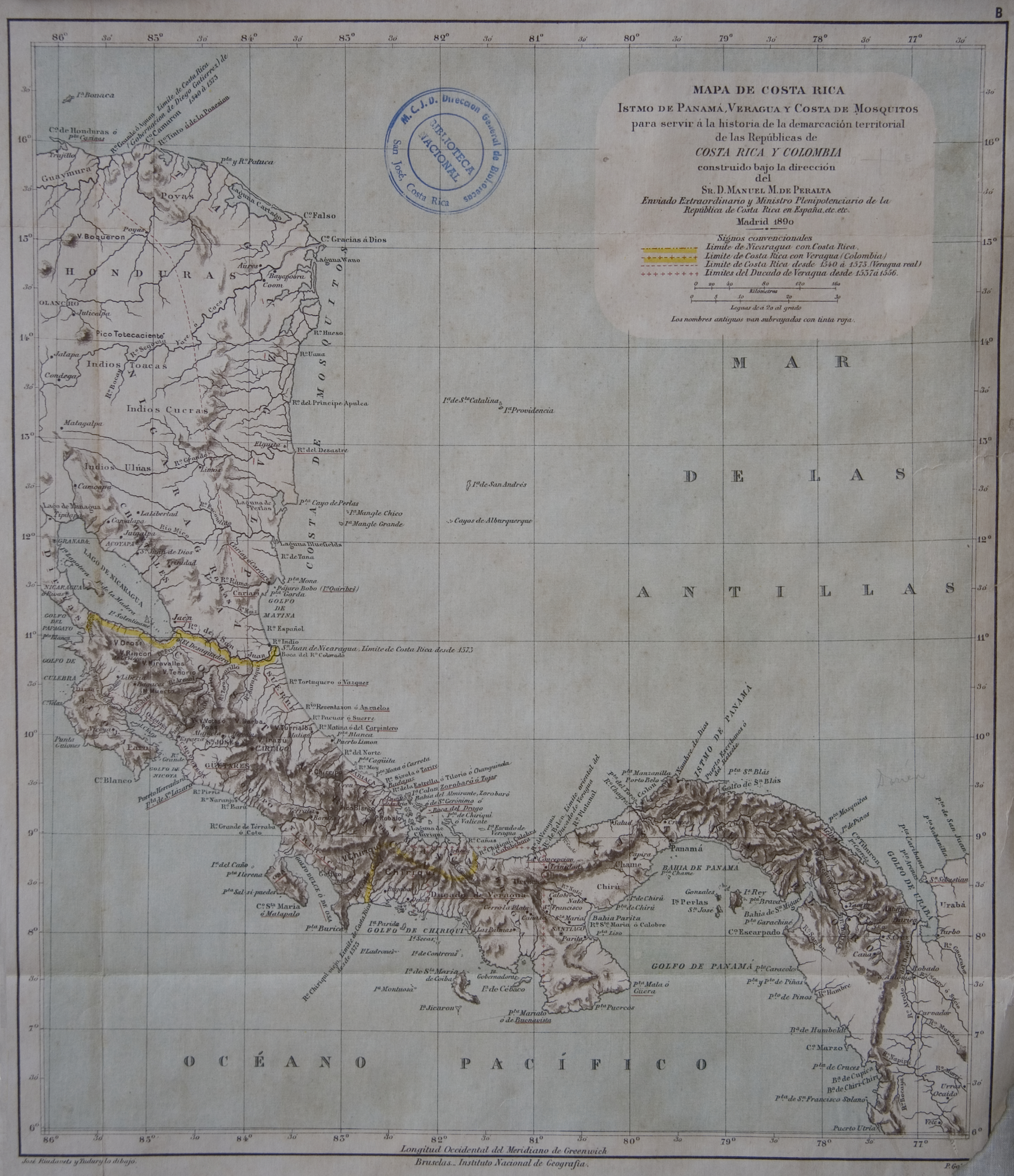
Mapa de Costa Rica, Veragua. Istmo de Panamá. y Costa de Mosquitos, para servir a la historia de la demarcacion territorial de las Republicas de Costa Rica y Colombia
Map 1800 - 1899