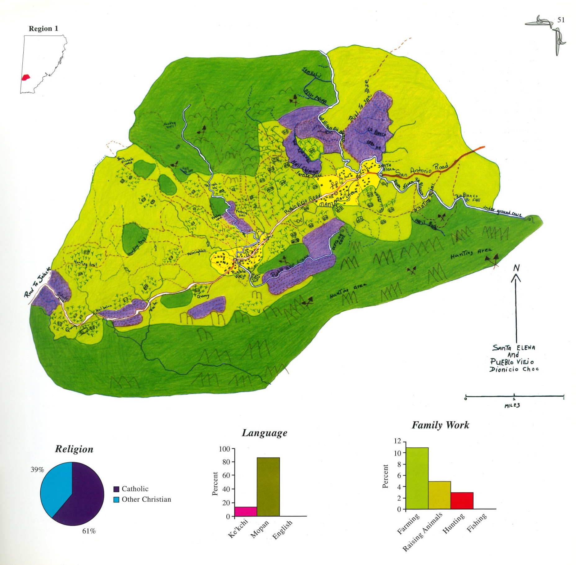
Peoples
- KE'KCHI
- MOPAN
Citation
Dionicio Choc. 1997. “Santa Elena and Pueblo Viejo.” In Maya Atlas: The Struggle to Preserve Maya Land in Southern Belize, 51. Berkeley, CA: North Atlantic Books. book
CARTA DO RIO IÇA
Map 1868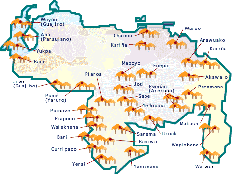
No Title
Map 2015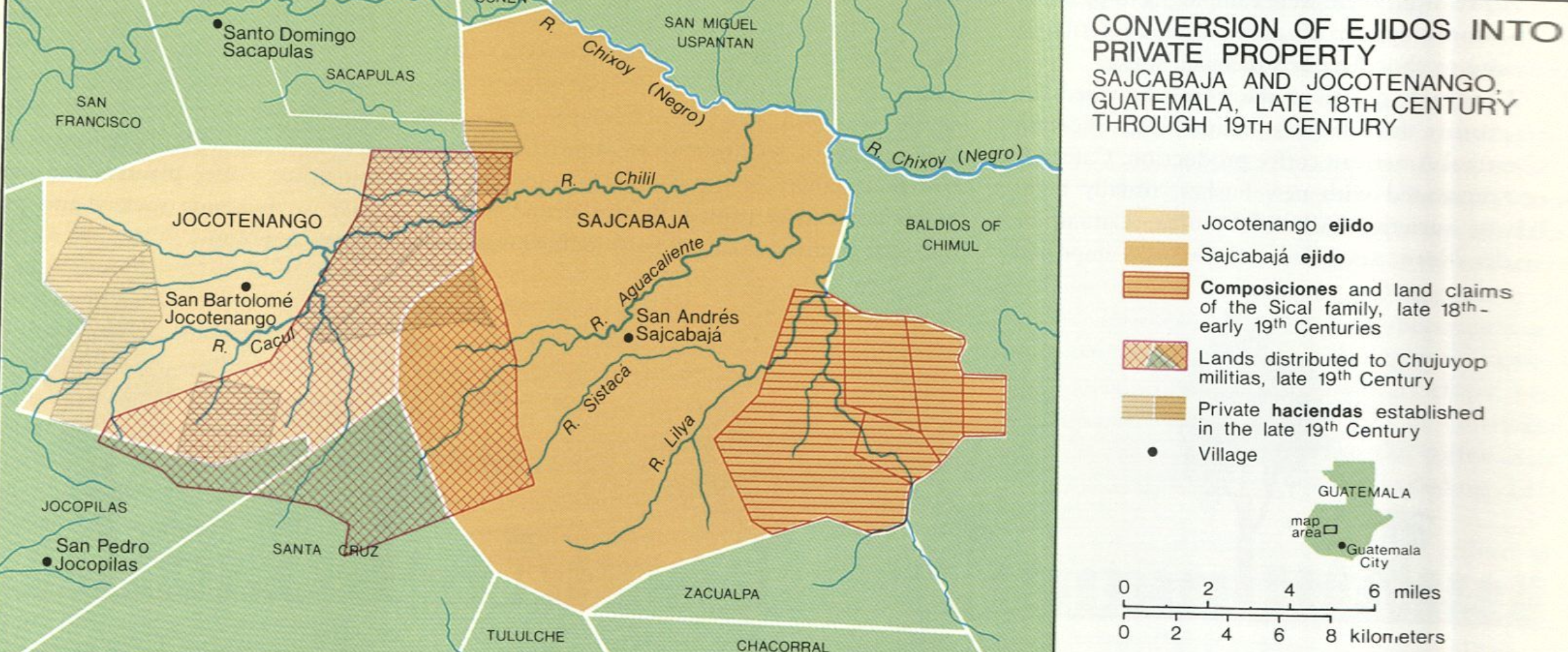
Conversion of Ejidos into Private Property, Sajcabaja and Jocotenango, Guatemala, Late 18th Century through 19th Century
Map 1700 - 1800![PEI desvío de un río [PEI Diversion of a River]](https://dnet8ble6lm7w.cloudfront.net/art_sm/AARG022.png)
PEI desvío de un río [PEI Diversion of a River]
Artwork![De gris a positHIVo [From Gray to PositHIVe]](https://dnet8ble6lm7w.cloudfront.net/art_sm/ACOL019.png)
De gris a positHIVo [From Gray to PositHIVe]
Artwork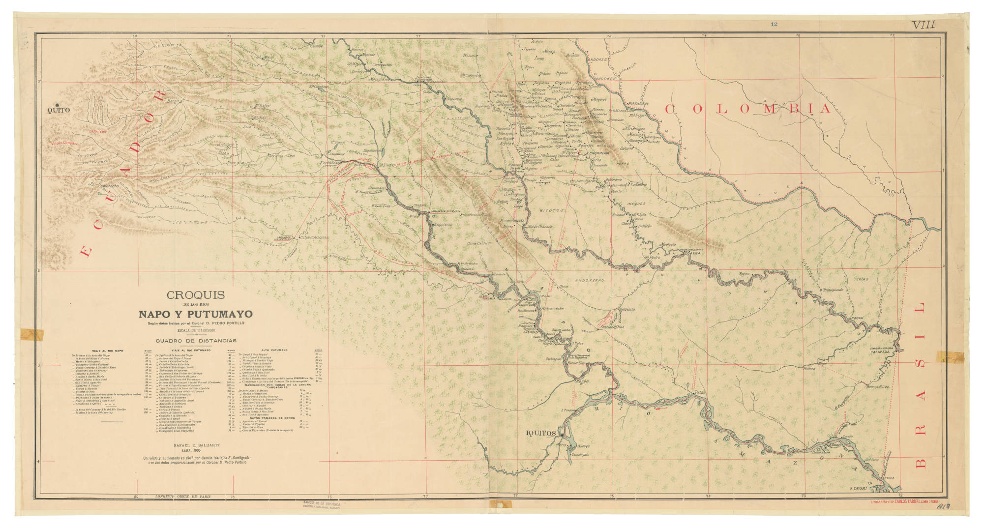
CROQUIS DE LOS RÍOS NAPO Y PUTUMAYO Según datos traídos por el Coronel D. PEDRO PORTILLO
Map 1905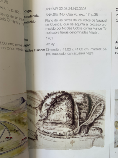
PLANO DE LAS TIERRAS DE SAYAUSÍ;EN CUENCA QUE SE ADJUNTA AL PROCESO PROMOVIDO POR NICOLÁS COBOS CONTRA MANUEL TACURI SOBRE TIERRAS DENOMIDAS MAPÁN
Map 1761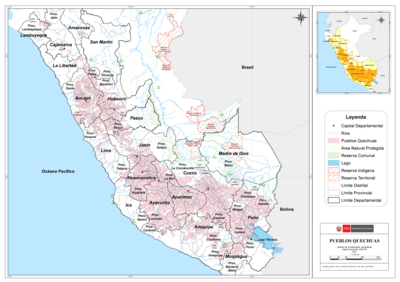
PUEBLOS QUECHUAS
Map 2021