
Citation
United States Department of Commerce, Transportation Department. 1920. "Railroad Map of British Honduras." https://hdl.loc.gov/loc.wdl/wdl.11329
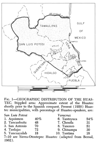
Geographic Distribution of the Huastec
Map 1969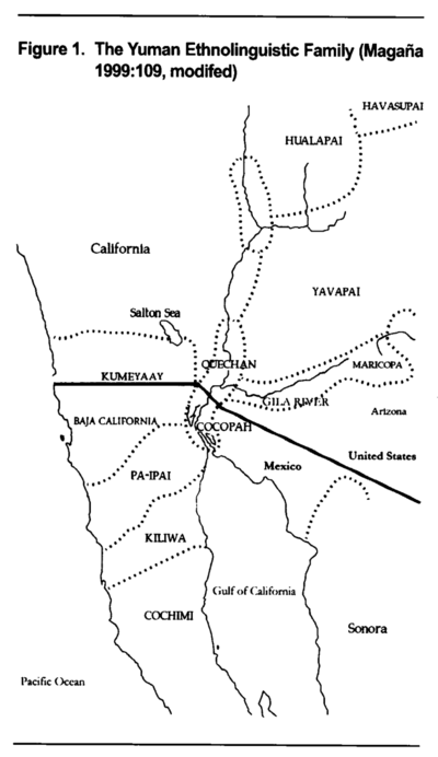
The Yuman Ethnolinguistic Family
Map 2016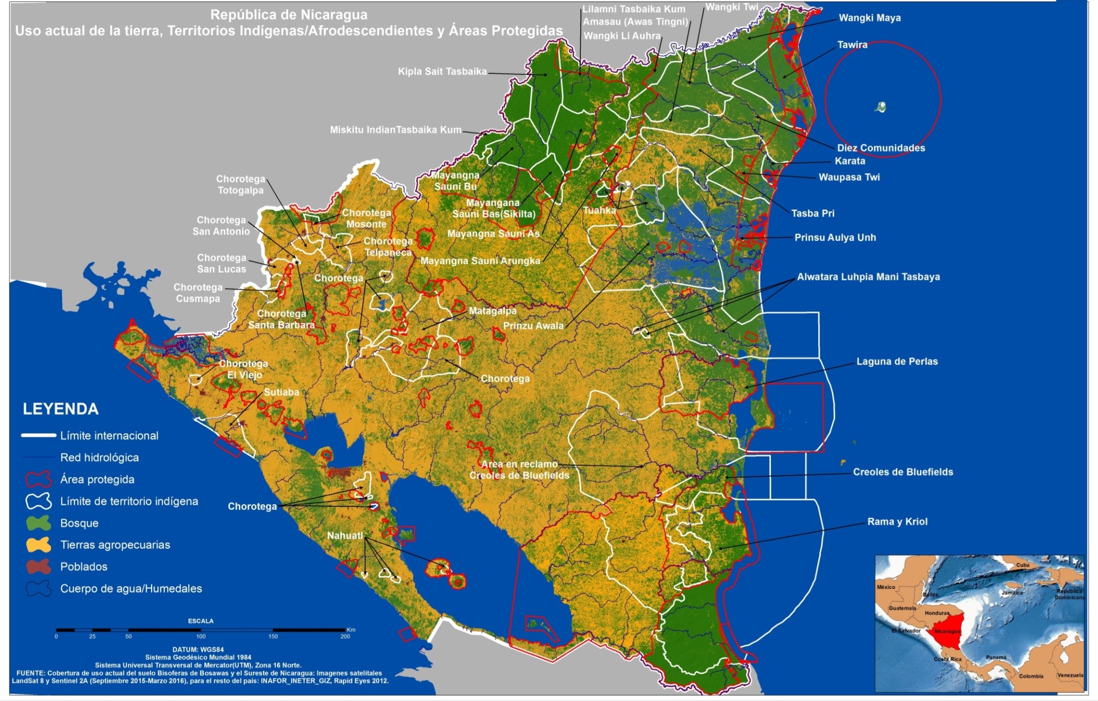
República de Nicaragua: uso actual de la tierra;Territorios Indígenas/Afrodescendientes y Areas Protegidas
Map 2012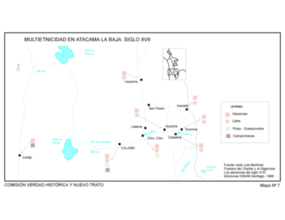
Pueblos del Chanar y el Algarrobo. Los Atacamas del Siglo XVII.
Map 1600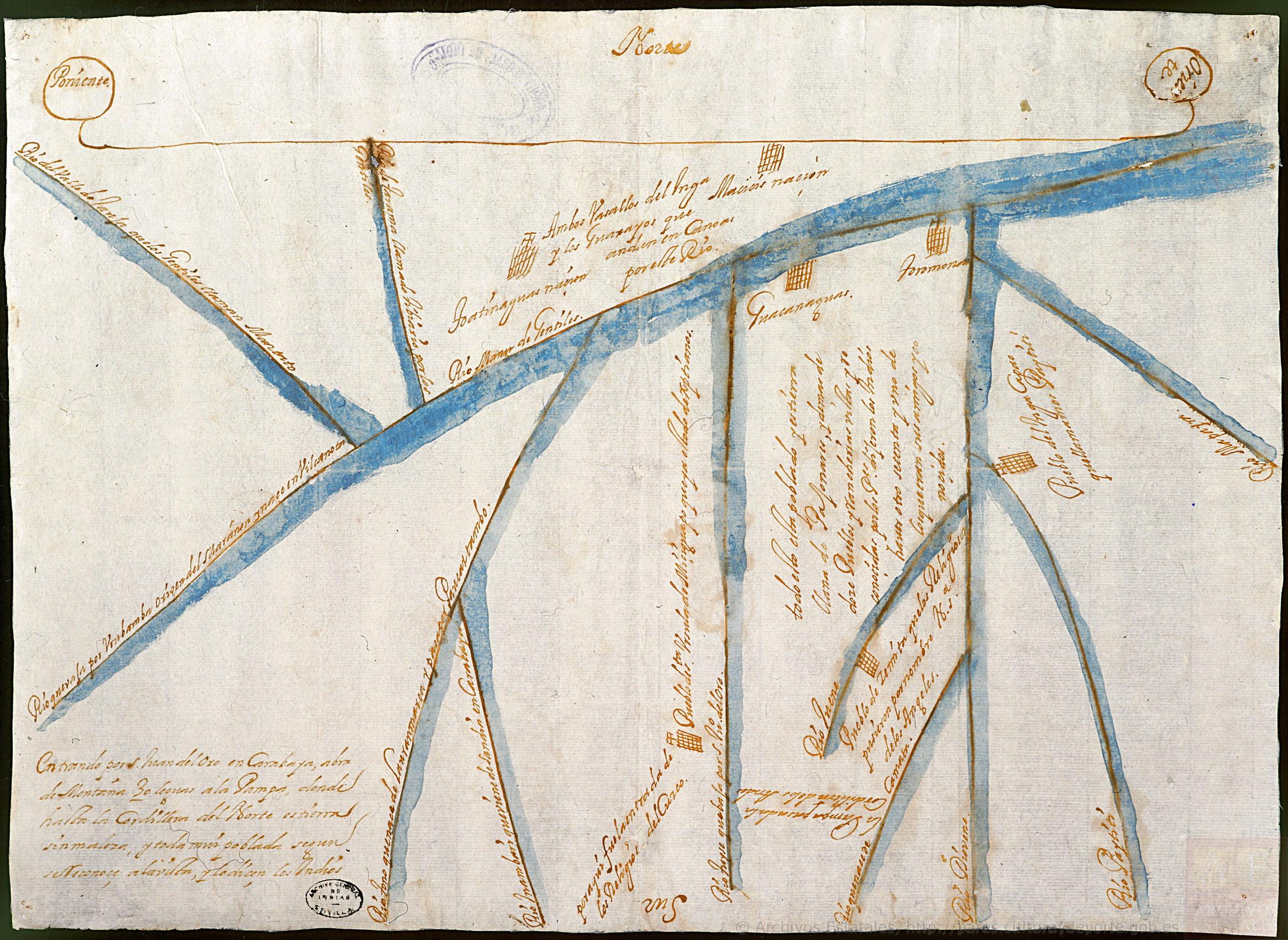
Mapa del territorio que misionaban los franciscanos al norte de Charcas y oriente de los Andes
Map 1678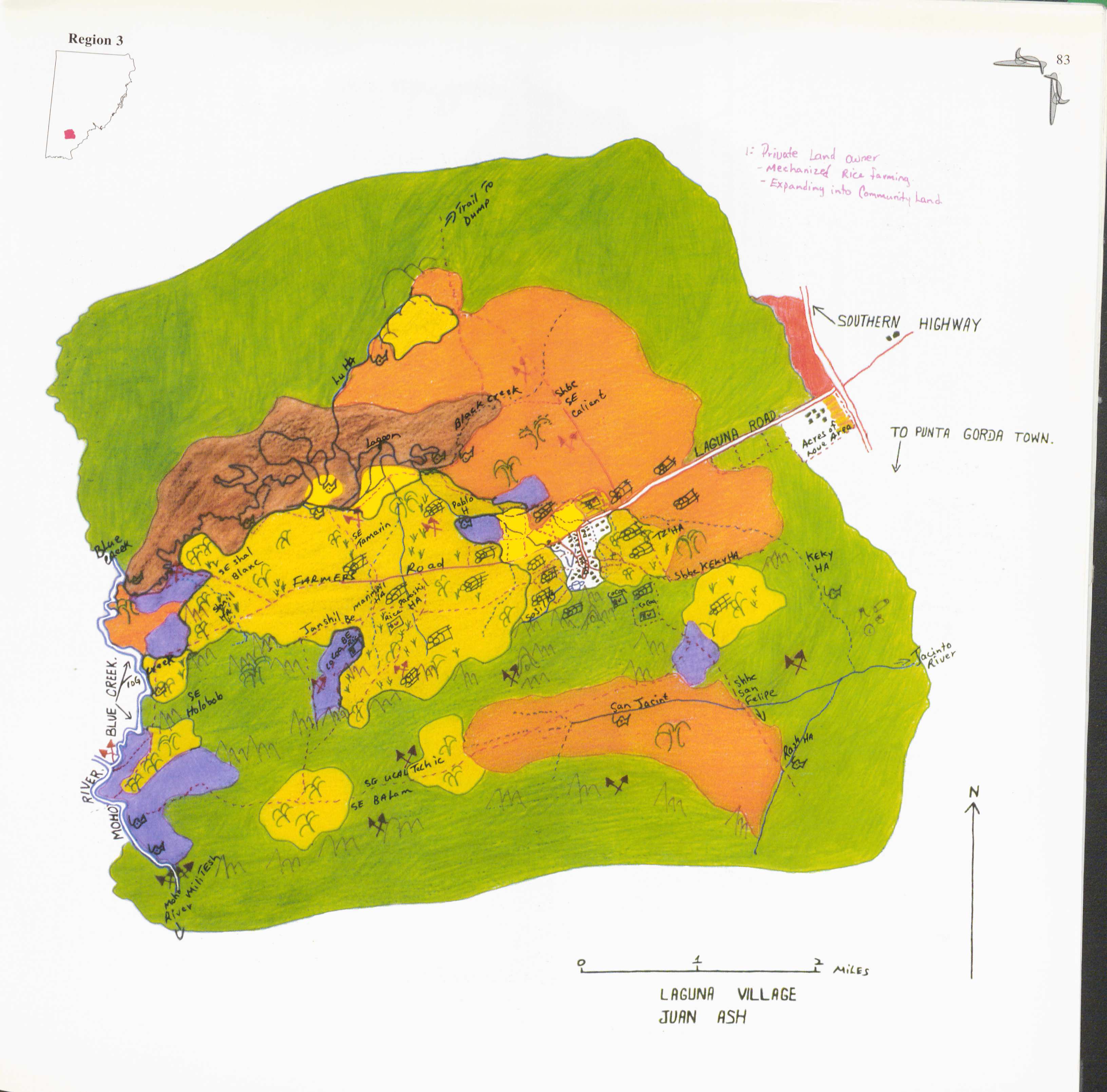
Laguna
Map 1997
Terra Indígena Bananal (Peruíbe)
Map 2012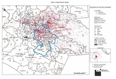
REGIÓN ALTOS DE CHIAPAS
Map 2000