
Peoples
- GUAYCURUES
- ABIPONES
- TOBAS
- CHIRIGUANOS
- CHARRUAS
- MOCOBI
Citation
D'anville, Parlee. "Le Paraguay." Map. In Cartografía jesuítica del Rio de la Plata, by Guillermo Furlongo Cardiff, 60. N.p., 1936.
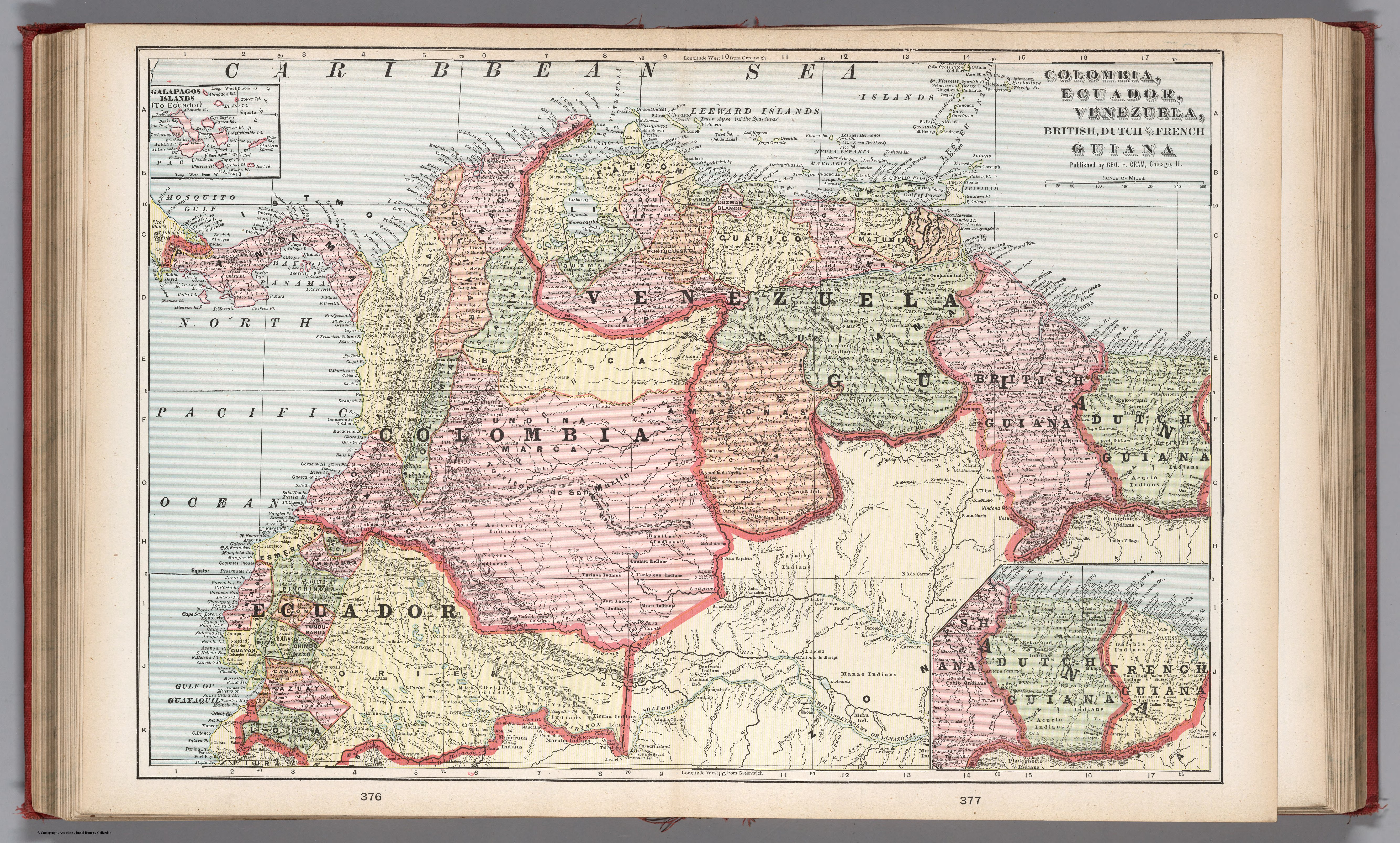
COLUMBIA;ECUADOR;VENEZUELA;BRITISH DUTCH AND FRENCH GUIANA
Map 1900 - 1999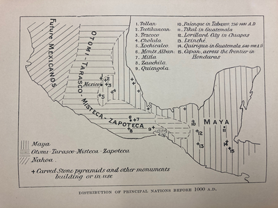
DISTRIBUTION OF PRINCIPAL NATIONS BEFORE 1000 AD
Map 1000![Walimanai People [Baniwa]
São Joaquim Village, Ayari River, Alto Rio Negro Indigenous Territory, AM (Amazonas), Brazil Plaque](https://dnet8ble6lm7w.cloudfront.net/art_sm/ABRA020.png)
Walimanai People [Baniwa] São Joaquim Village, Ayari River, Alto Rio Negro Indigenous Territory, AM (Amazonas), Brazil Plaque
Artwork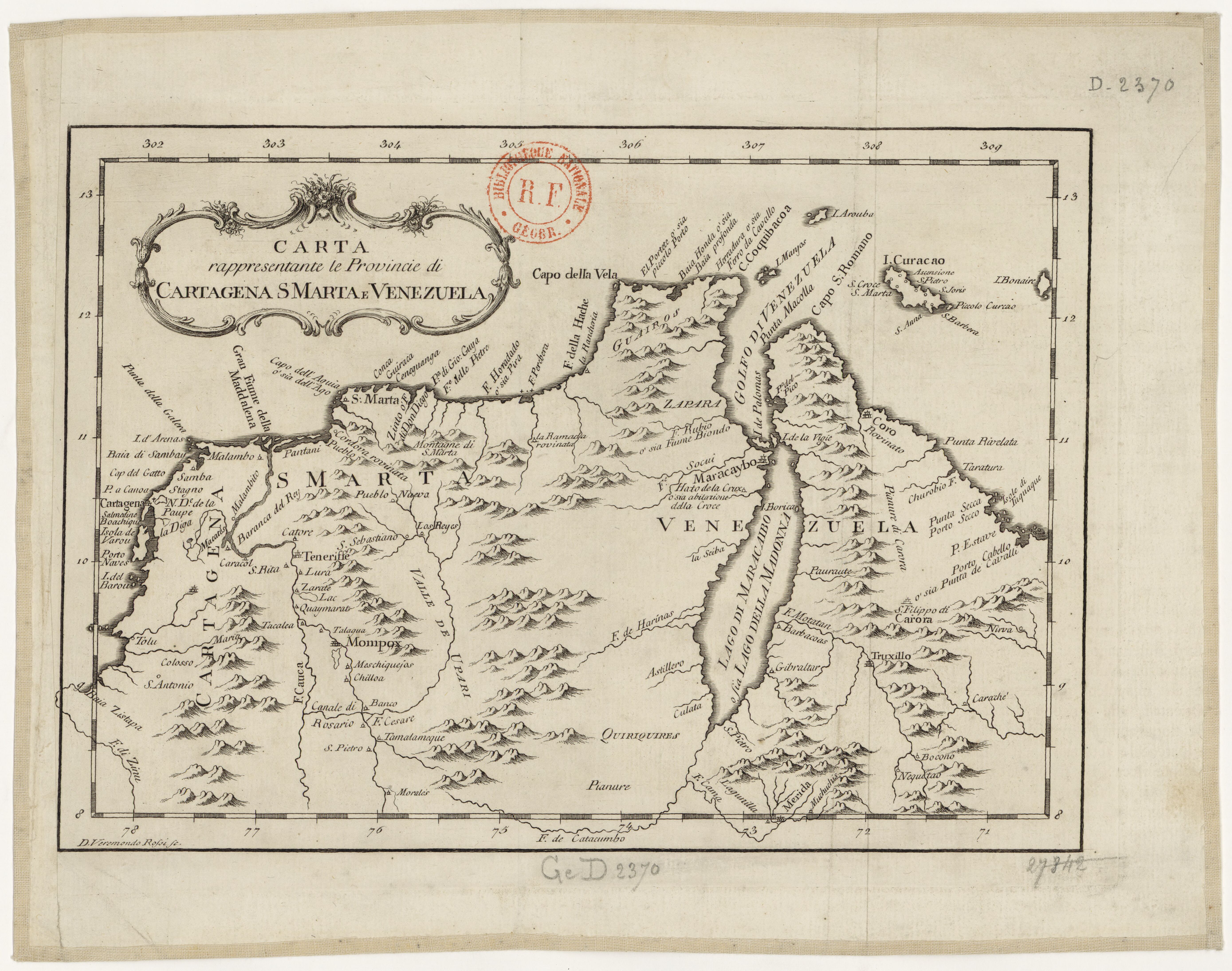
Carta rappresentante le Provincie di Cartagena;S Marta e Venezuela
Map 1754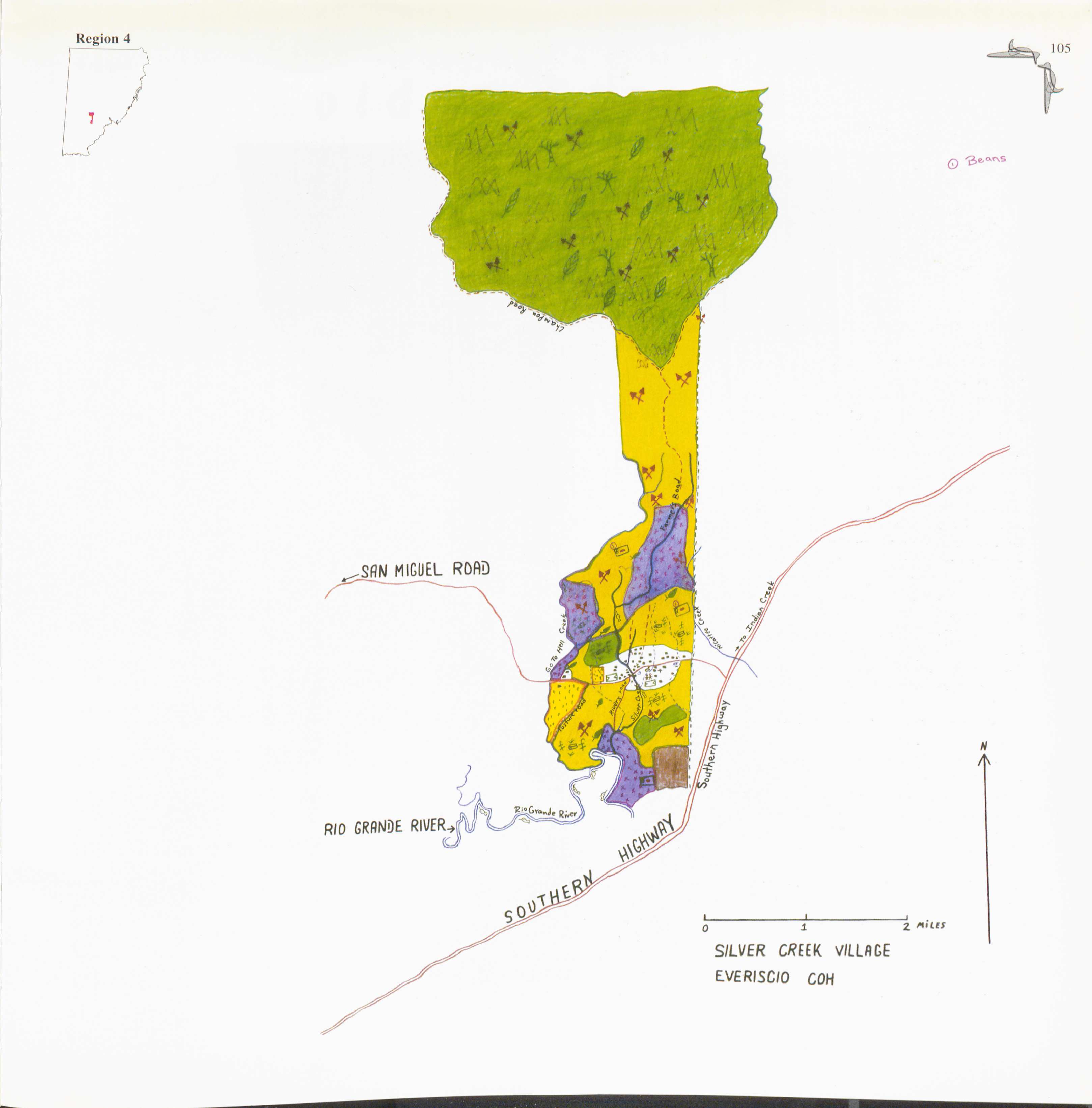
Silver Creek
Map 1997
Serie Fatherland / Padre Patria
Artwork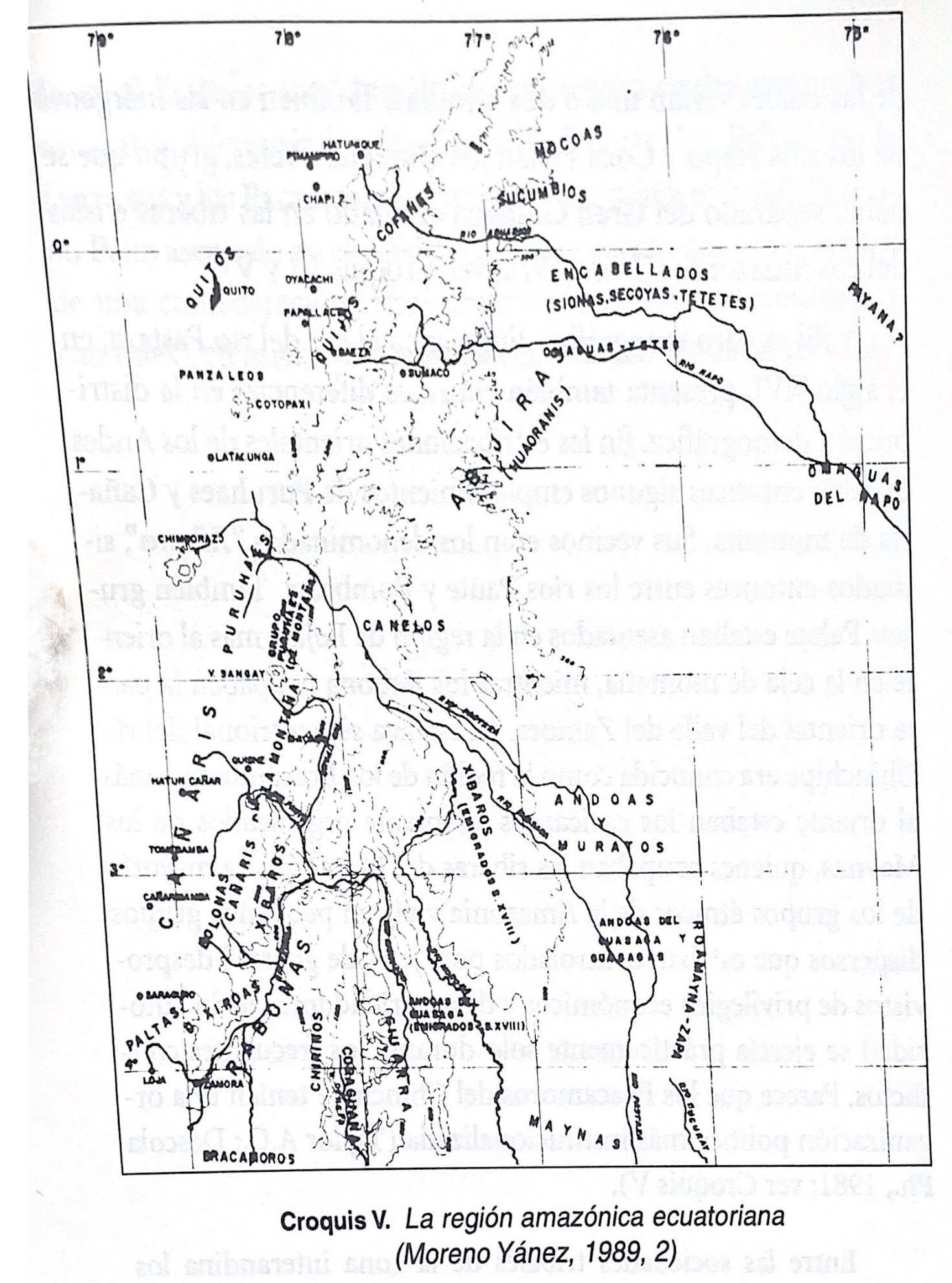
Croquis V. La región amazónica ecuatoriana (Moreno Yanez;1989;2)
Map -500 - 1530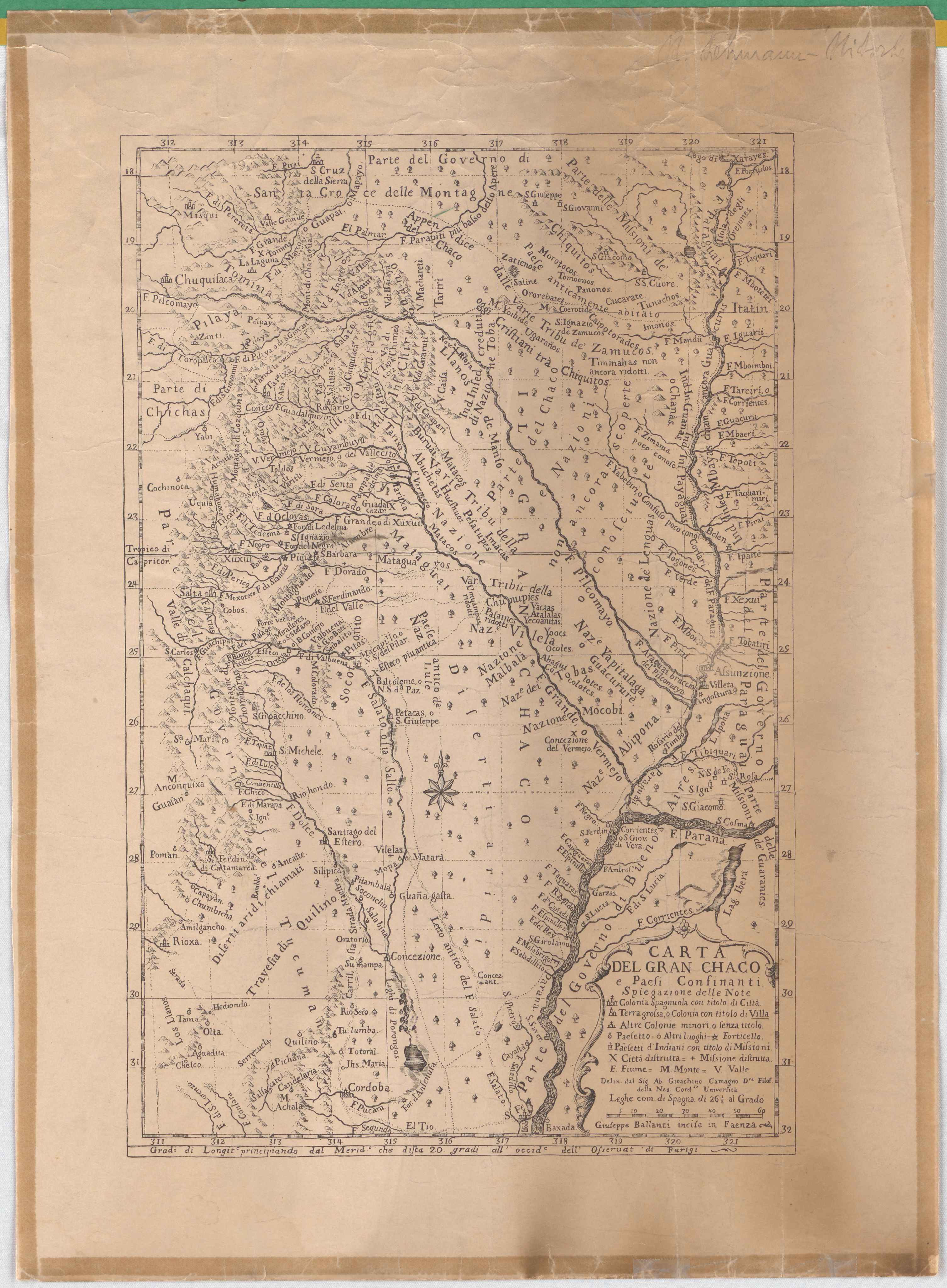
Carta Del Gran Chaco e Paesi Confinanti
Map 1700 - 1767