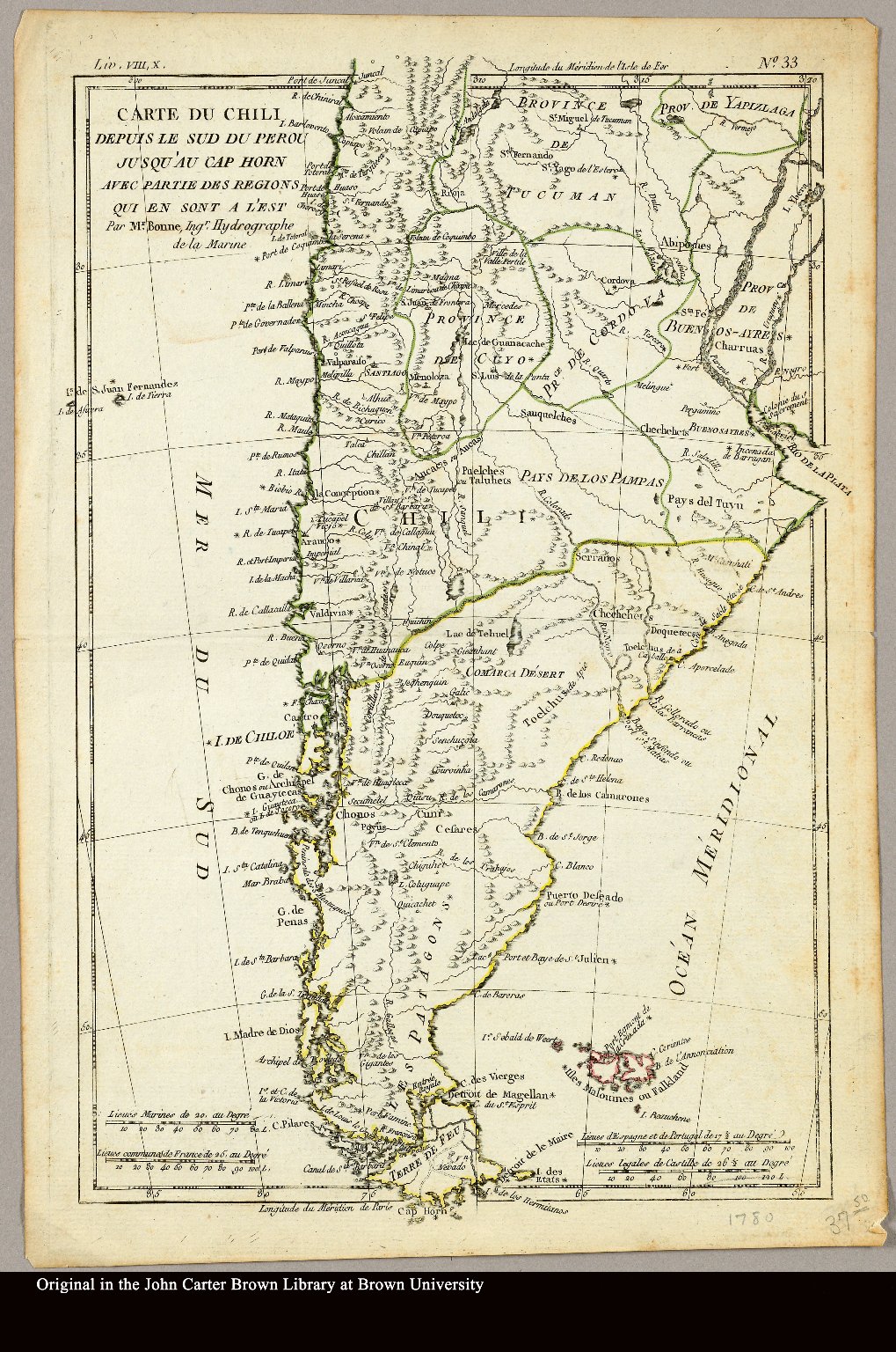
Dispossesions in the Americas

Dispossesions in the Americas

  • Home
  • Explore
  • About
  • Authors
  • Art
  • Bodies
  • Curricula
  • Cultural Heritage
  • Maps
  • Territories
Back to Explore
Map 1780

Carte du Chili depuis le sud du Perou jusqu'au Cap Horn ... par Mr. Bonne, Ingr. Hydrographe de la Marine.

  • Bonne, Rigobert

Published: 1780

  • Download Image

Peoples

  • PATAGONES
  • PUELCHES
  • PAMPAS
  • PEHUENCHES
  • TEHUELCHES
  • AUCAS
  • CHARRUAS

Citation

Bonne, Rigobert. "Carte du Chili depuis le sud du Perou jusqu'au Cap Horn ... par Mr. Bonne, Ingr. Hydrographe de la Marine." Map. 1780. Accessed April 3, 2022. https://jcb.lunaimaging.com/luna/servlet/detail/JCBMAPS~1~1~3469~101683:Carte-du-Chili-depuis-le-sud-du-Per?sort=normalized_date%2Cfile_name%2Csource_author%2Csource_title#

  • Download Image

Reading in Spanish

Map 1780

Carte du Chili depuis le sud du Perou jusqu'au Cap Horn ... par Mr. Bonne, Ingr. Hydrographe de la Marine.

  • Bonne, Rigobert

Published: 1780

  • Download Image
  • Download Image

Reading in Portuguese

Map 1780

Carte du Chili depuis le sud du Perou jusqu'au Cap Horn ... par Mr. Bonne, Ingr. Hydrographe de la Marine.

  • Bonne, Rigobert

Published: 1780

  • Download Image

Peoples

  • PATAGONES
  • PUELCHES
  • PAMPAS
  • PEHUENCHES
  • TEHUELCHES
  • AUCAS
  • CHARRUAS

Citation

Bonne, Rigobert. "Carte du Chili depuis le sud du Perou jusqu'au Cap Horn ... par Mr. Bonne, Ingr. Hydrographe de la Marine." Map. 1780. Accessed April 3, 2022. https://jcb.lunaimaging.com/luna/servlet/detail/JCBMAPS~1~1~3469~101683:Carte-du-Chili-depuis-le-sud-du-Per?sort=normalized_date%2Cfile_name%2Csource_author%2Csource_title#

  • Download Image

Related Content

PUEBLO CHATINO

PUEBLO CHATINO

Map 2020
A chart of the English trading part of the bay of Honduras

A chart of the English trading part of the bay of Honduras

Map 1791
"Territorio Indígena Altos de San Antonio (Ngöbes)"

"Territorio Indígena Altos de San Antonio (Ngöbes)"

Map 2010
Meditação da ferida 
ou a escola das facas [Meditation on the Wound
or the School of Knives](Nakoada version), 2022

Meditação da ferida ou a escola das facas [Meditation on the Wound or the School of Knives](Nakoada version), 2022

Artwork
Walimanai People [Baniwa]
São Joaquim Village, Ayari River, Alto Rio Negro Indigenous Territory, AM (Amazonas), Brazil Plaque

Walimanai People [Baniwa] São Joaquim Village, Ayari River, Alto Rio Negro Indigenous Territory, AM (Amazonas), Brazil Plaque

Artwork
Descripcion del audiencia de Guatimala. 1622

Descripcion del audiencia de Guatimala. 1622

Map 1600
Provincias de Cumana;Paria;la Isla de la Trinidad;y el Rio Orinoco. 1758.

Provincias de Cumana;Paria;la Isla de la Trinidad;y el Rio Orinoco. 1758.

Map 1758
Fig. 1. Map of French Guiana with locations of the various Amerindian groups

Fig. 1. Map of French Guiana with locations of the various Amerindian groups

Map 1999

Dispossessions in the Americas

A project by

University of Pennsylvania

Copyright 2024

With support from

Mellon Foundation

Site design & development

Element 84

Art Credits

Bonne, Rigobert. “Carte du Chili depuis le sud du Perou jusqu’au Cap Horn … par Mr. Bonne, Ingr. Hydrographe de la Marine.” Map. 1780. Accessed April 3, 2022. https://jcb.lunaimaging.com/luna/servlet/detail/JCBMAPS~1~1~3469~101683:Carte-du-Chili-depuis-le-sud-du-Per?sort=normalized_date%2Cfile_name%2Csource_author%2Csource_title#

Site Pages

  • Home
  • Explore
  • About
  • Authors
  • Art
  • Bodies
  • Curricula
  • Cultural Heritage
  • Maps
  • Territories