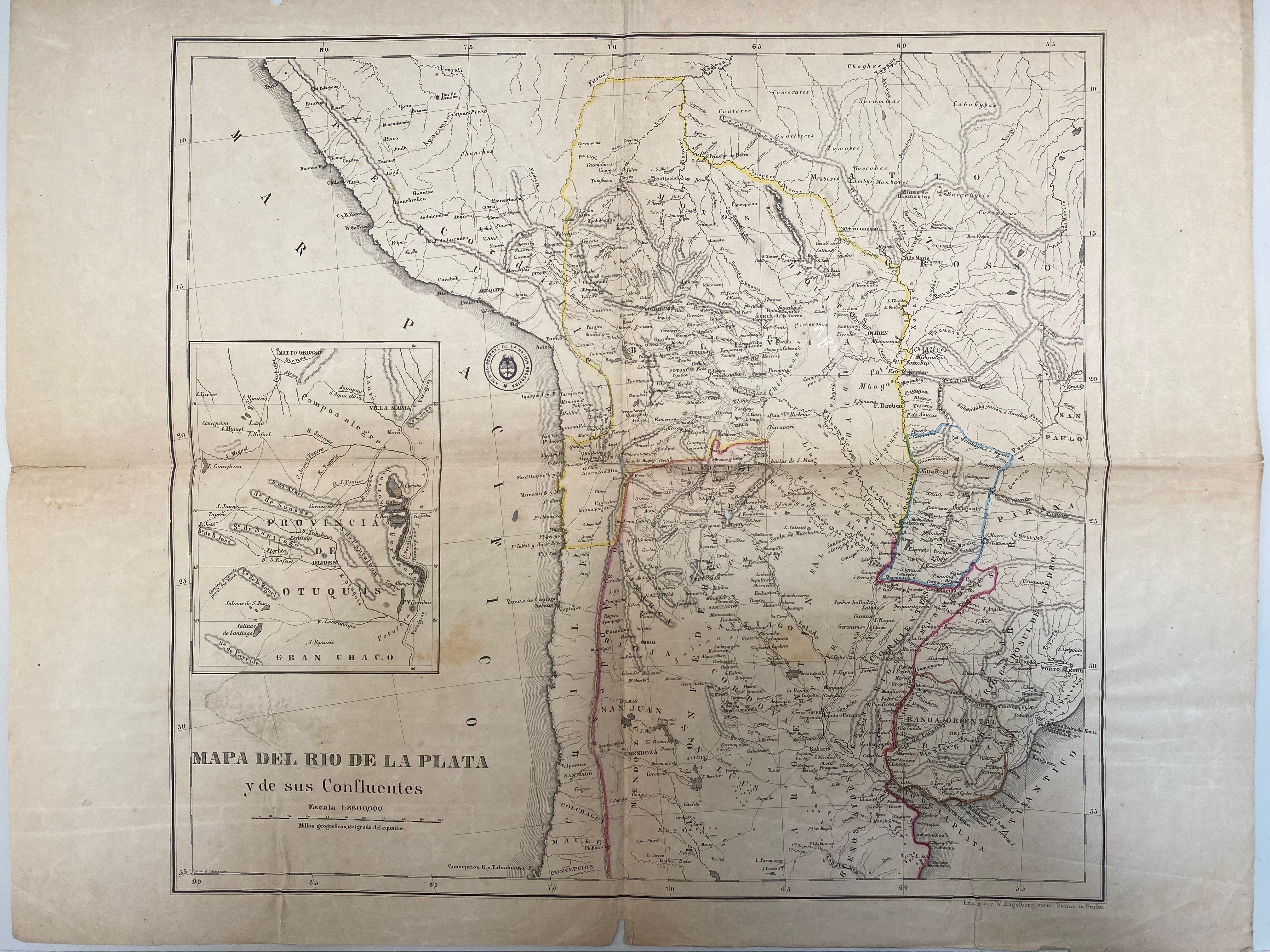
Dispossesions in the Americas

Dispossesions in the Americas

  • Home
  • Explore
  • About
  • Authors
  • Art
  • Bodies
  • Curricula
  • Cultural Heritage
  • Maps
  • Territories
Back to Explore
Map 1716

A New Map of Part /of the Great River / De la Plata, /of Tucuman / and the adjacent Countries, from Buenos Ayres to Potosí

  • Moll, H.

Published: 1716

  • Download Image

Peoples

  • MATACOS
  • TOBAS
  • GUAYCURUES
  • MOCOVIES
  • CHIRIGUANOS
  • OVANAS
  • GUISNAIS
  • TIRUMBAES

Citation

Moll, H. "A New Map of Part /of the Great River / De la Plata, /of Tucuman / and the adjacent Countries, from Buenos Ayres to Potosí." Map. 1716. 7 - 134 (1). Archivo General de la Nacion Argentina.

  • Download Image

Reading in Spanish

Map 1716

A New Map of Part /of the Great River / De la Plata, /of Tucuman / and the adjacent Countries, from Buenos Ayres to Potosí

  • Moll, H.

Published: 1716

  • Download Image
  • Download Image

Related Content

PLANO QUE SE ADJUNTA AL PROCESO QUE SIGUEN LOS INDÍGENAS DE LA COMUNIDAD DE COLAMBO;LOJA CONTRA DIEGO BRICINO A QUIEN ACUSAN DE HABERSE APROPIADO DE LAS TIERRAS DE ESTA COMUNIDAD

PLANO QUE SE ADJUNTA AL PROCESO QUE SIGUEN LOS INDÍGENAS DE LA COMUNIDAD DE COLAMBO;LOJA CONTRA DIEGO BRICINO A QUIEN ACUSAN DE HABERSE APROPIADO DE LAS TIERRAS DE ESTA COMUNIDAD

Map 1697
DISTRIBUCIÓN DE LOS GRUPOS INDÍGENAS EN EL SIGLO XVI

DISTRIBUCIÓN DE LOS GRUPOS INDÍGENAS EN EL SIGLO XVI

Map 1500 - 1599
RELACIÓN GEOGRÁFICA DEL PUEBLO Y MINAS DE ZIMAPÁN

RELACIÓN GEOGRÁFICA DEL PUEBLO Y MINAS DE ZIMAPÁN

Map 1500 - 1599
Mapa de las barras de la laguna de Maracaibo;de la ensenada que ay entre los dos cabos de Sancta Anna y Chichibacoa;y parte de las costas que desde ellos corren assí al este y vueste;cuyos paízes se reconocerán por sus demonstratibos;y las distancias por el tronco de dies leguas castellanas que son las que parecen abaxo

Mapa de las barras de la laguna de Maracaibo;de la ensenada que ay entre los dos cabos de Sancta Anna y Chichibacoa;y parte de las costas que desde ellos corren assí al este y vueste;cuyos paízes se reconocerán por sus demonstratibos;y las distancias por el tronco de dies leguas castellanas que son las que parecen abaxo

Map 1740 - 1750
THE AYMARA POLITY OF THE LUPAQA: COMMERCIAL DESTINIES AND VERTICALITY IN THE 16TH CENTURY

THE AYMARA POLITY OF THE LUPAQA: COMMERCIAL DESTINIES AND VERTICALITY IN THE 16TH CENTURY

Map 1500 - 1599
Carte des environs de Cap de Nord

Carte des environs de Cap de Nord

Map 1774
Typus Geographicus Chili, Paraguay

Typus Geographicus Chili, Paraguay

Map 1733
THE EASTERN BORDERS OF THE QULLASUYU - SOUTHERN DISTRICT OF THE INCA STATE - 16th CENTURY

THE EASTERN BORDERS OF THE QULLASUYU - SOUTHERN DISTRICT OF THE INCA STATE - 16th CENTURY

Map 1400 - 1499

Dispossessions in the Americas

A project by

University of Pennsylvania

Copyright 2024

With support from

Mellon Foundation

Site design & development

Element 84

Art Credits

Moll, H. “A New Map of Part /of the Great River / De la Plata, /of Tucuman / and the adjacent Countries, from Buenos Ayres to Potosí.” Map. 1716. 7 - 134 (1). Archivo General de la Nacion Argentina.

Site Pages

  • Home
  • Explore
  • About
  • Authors
  • Art
  • Bodies
  • Curricula
  • Cultural Heritage
  • Maps
  • Territories