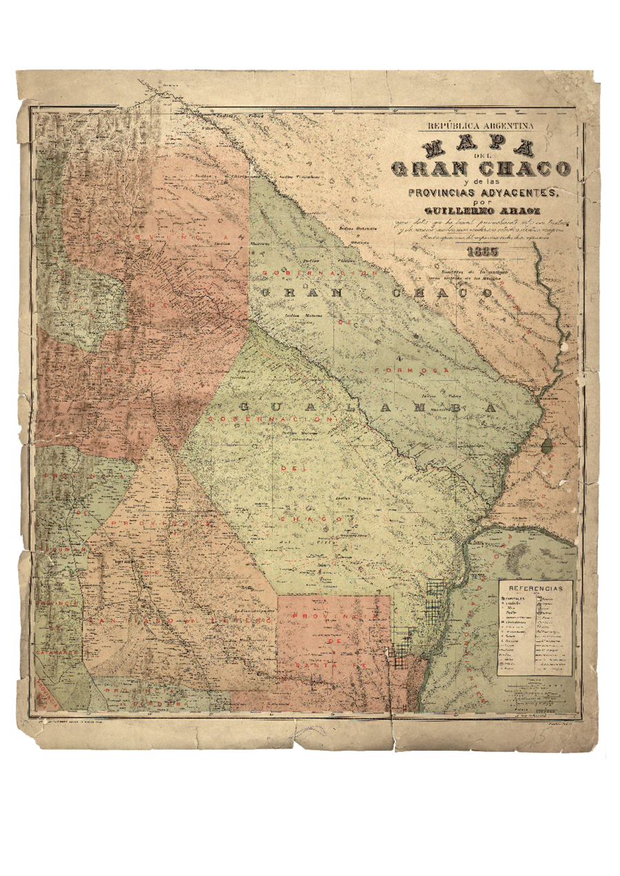
Peoples
- MATACOS
- TOBAS
- GUAYCURUES
- MOCOVIES
- CHIRIGUANOS
- GUANAS
- GUISNAIS
- TIRUMBAES
Citation
Araoz, Guillermo. "Mapa del Gran Chaco y Provincias Adyacentes." Map. 1885 https://www.argentina.gob.ar/sites/default/files/5._el_gran_chaco_0.pdf
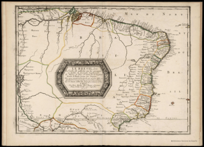
LE BRESIL, dont la Coste est posse dée par les portugais et divisée en Quatorze Capitanieries.
Map 1656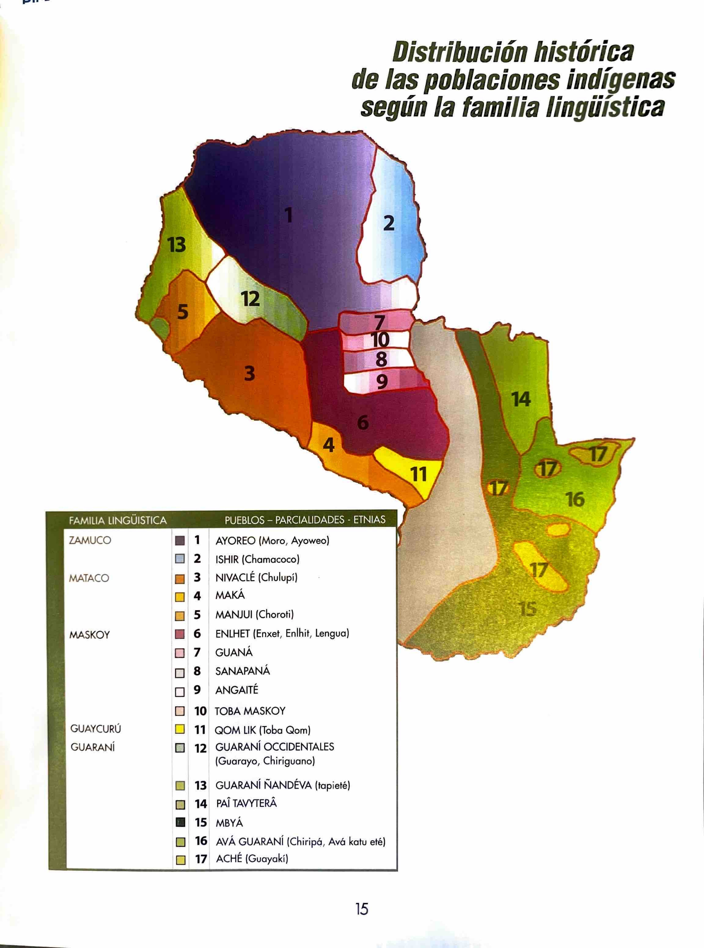
Distribución histórica de las poblaciones indígenas según la familia lingüística
Map 1490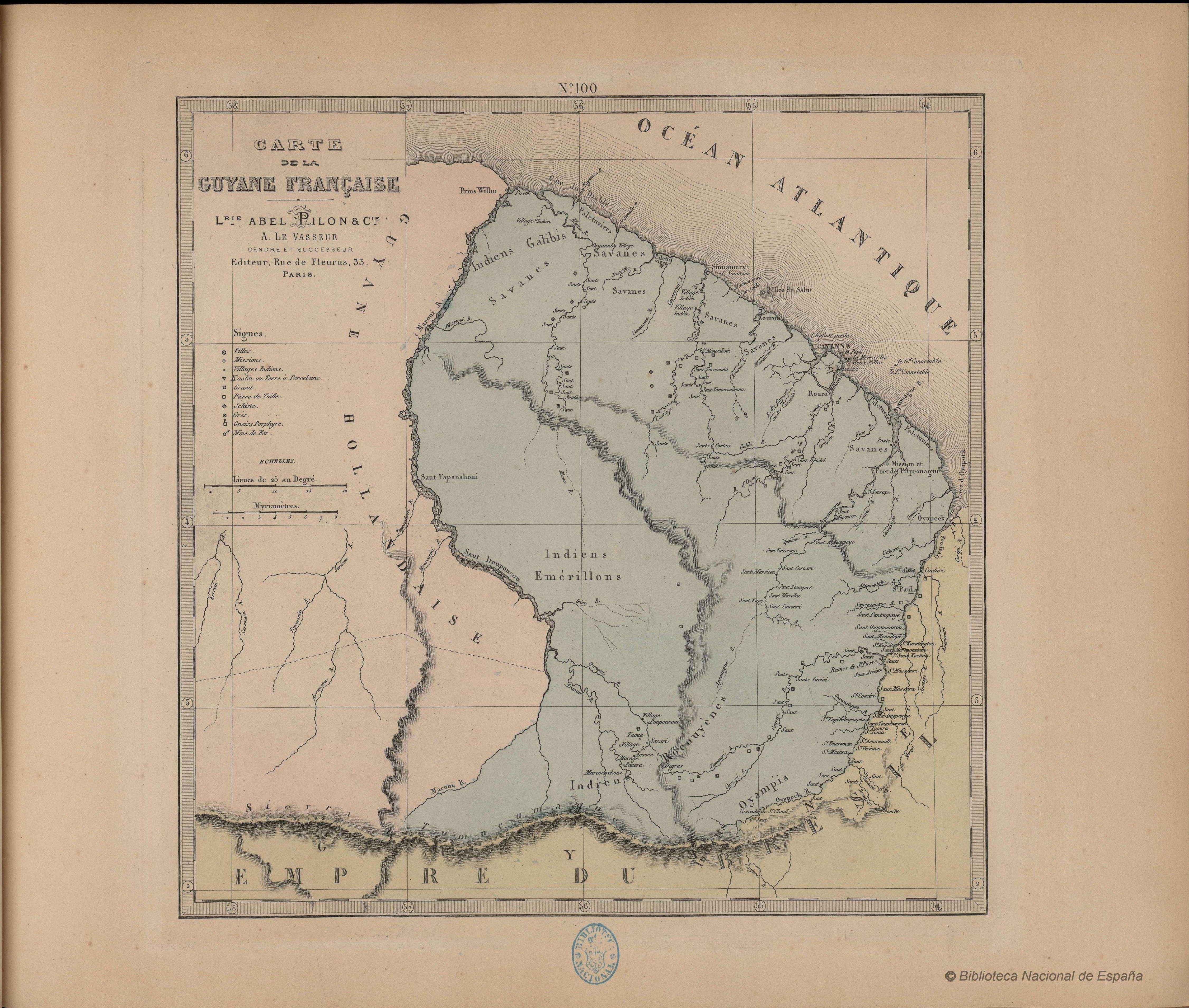
N. 100. Carte de la Guyane Française
Map 1878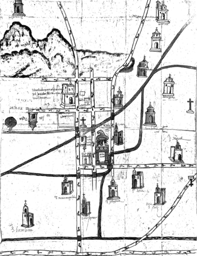
Map of Culhuacan (Valley of Mexico), 1580, Relacion geografica de Culhuacan
Map 1580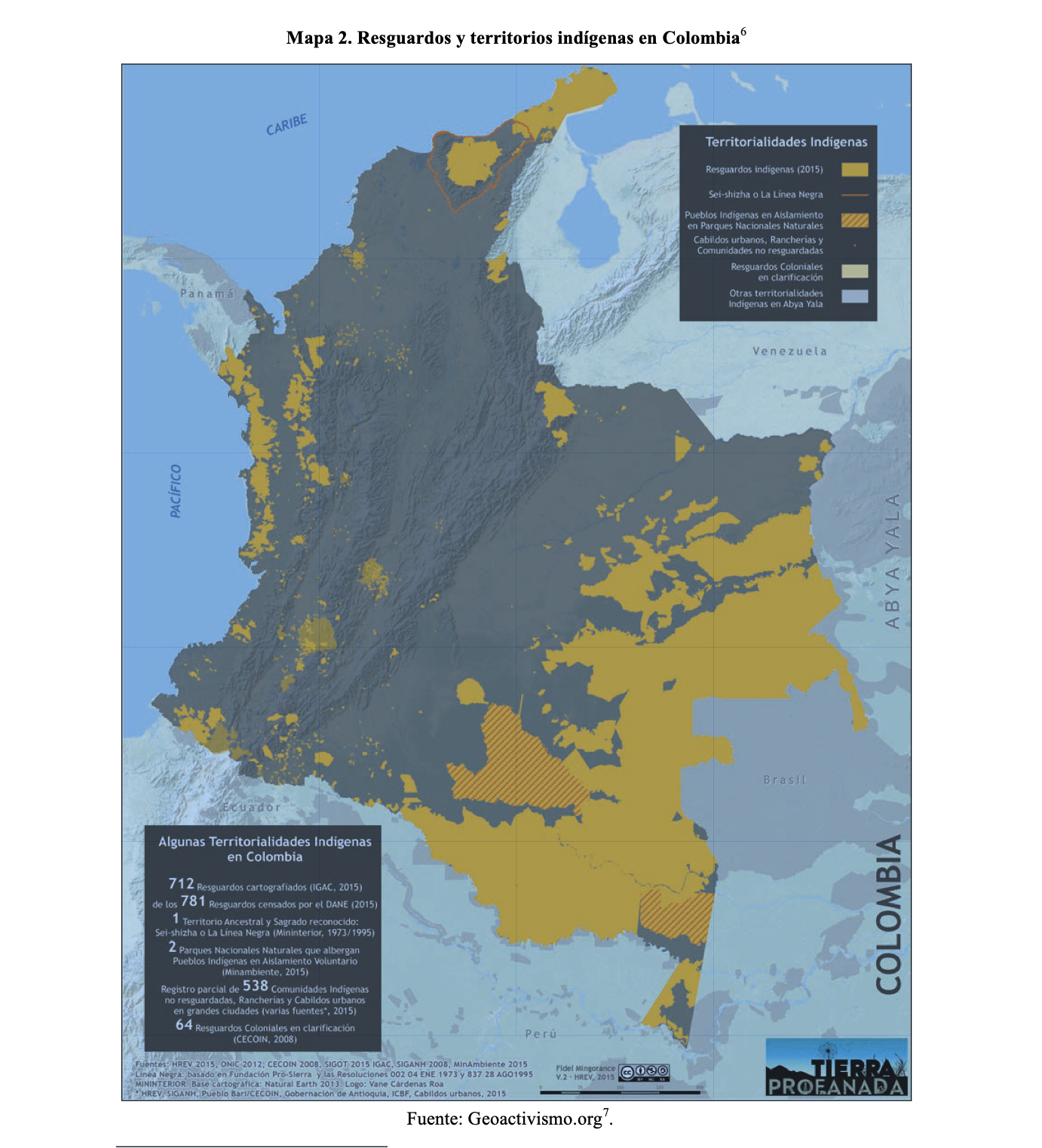
RESGUARDOS Y TERRITORIOS INDIGENAS EN COLOMBIA
Map 2015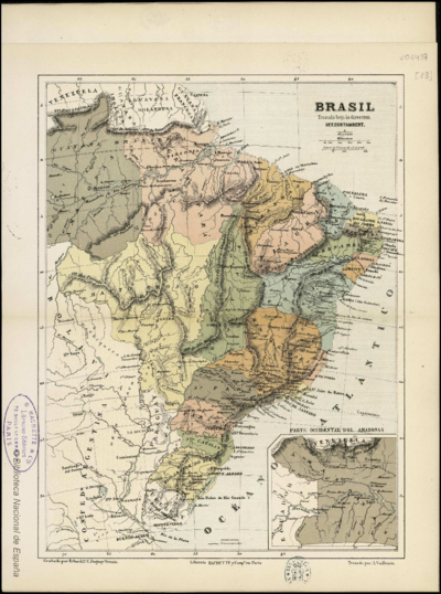
BRASIL
Map 1800 - 1899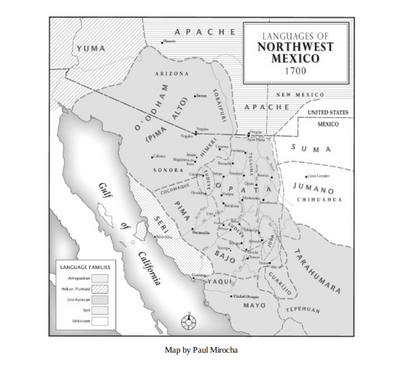
Languages of Northwest Mexico
Map 1700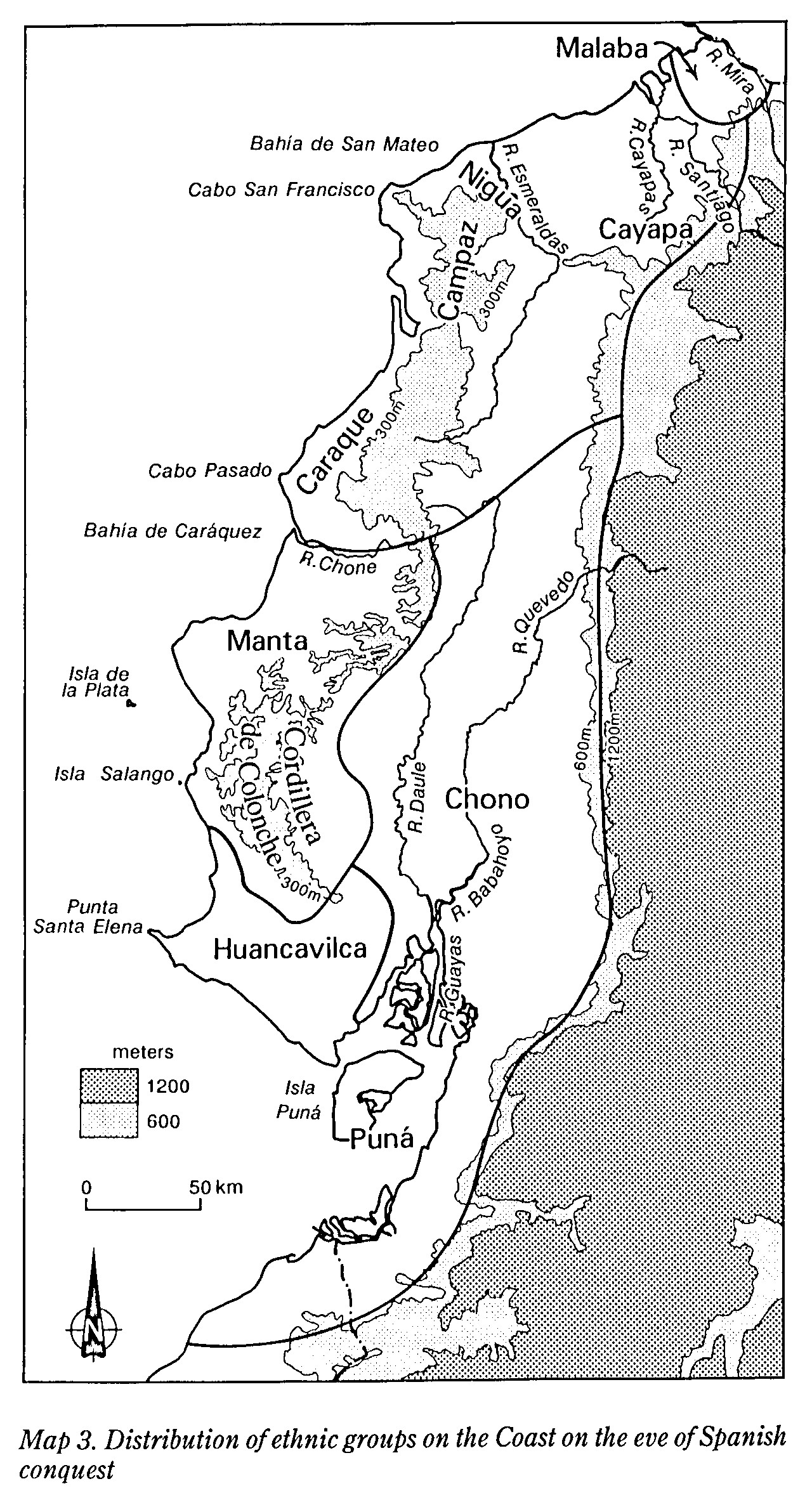
MAP 3. DISTRIBUTION OF ETHNIC GROUPS OF THE COAST ON THE EVE OF SPANISH CONQUEST
Map 1490