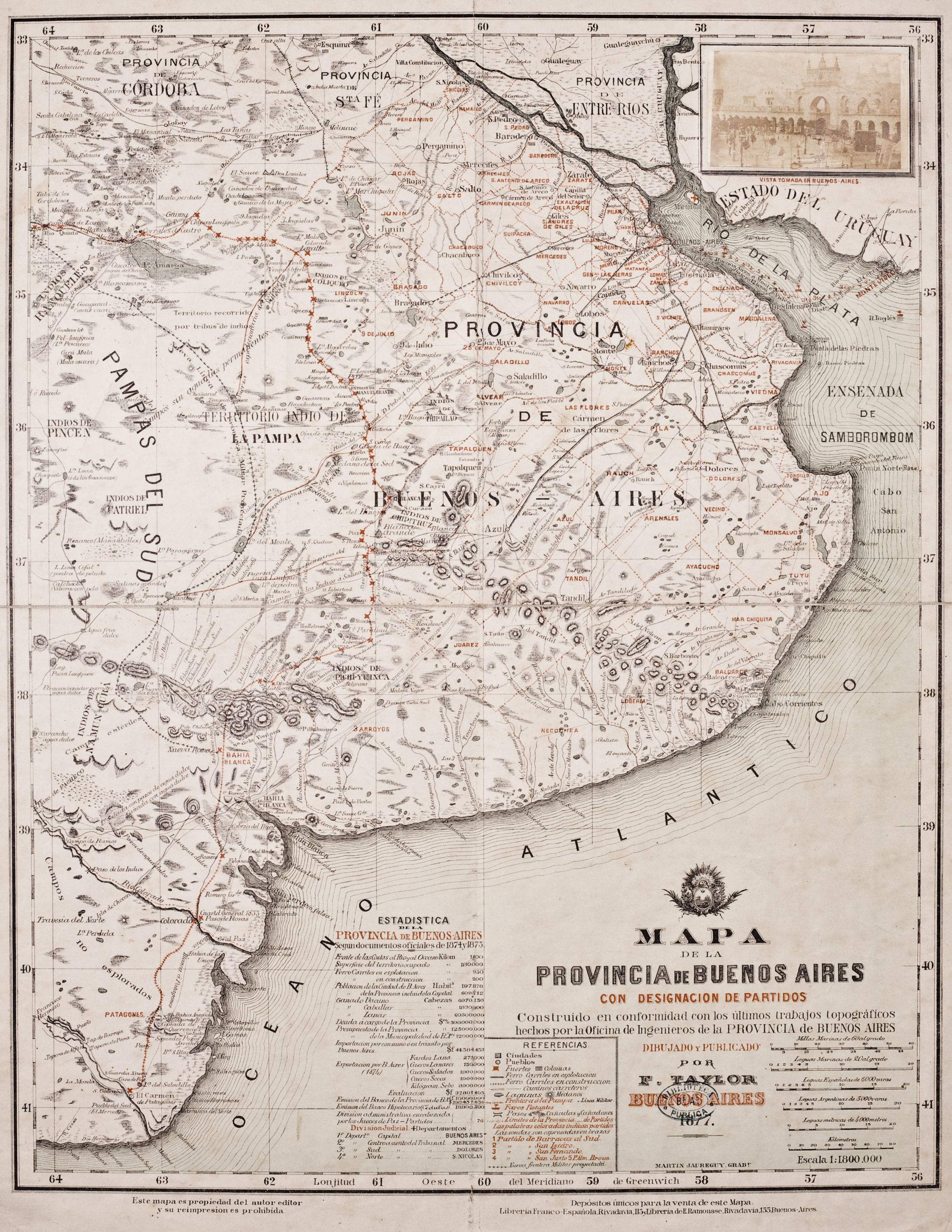
Peoples
- RANQUELES
- INDIOS DE NAMUN CURA
- INDIOS DE PINCEN
Citation
Jaureguy, Martin. Mapa de la Provincia de Buenos Aires. Map. Buenos Aires: F. Taylor, 1877. https://catalogo.bn.gov.ar/exlibris1/apache_media/8LSYEY3N33J813PYE3B7BU1XCKDIL6.jpg
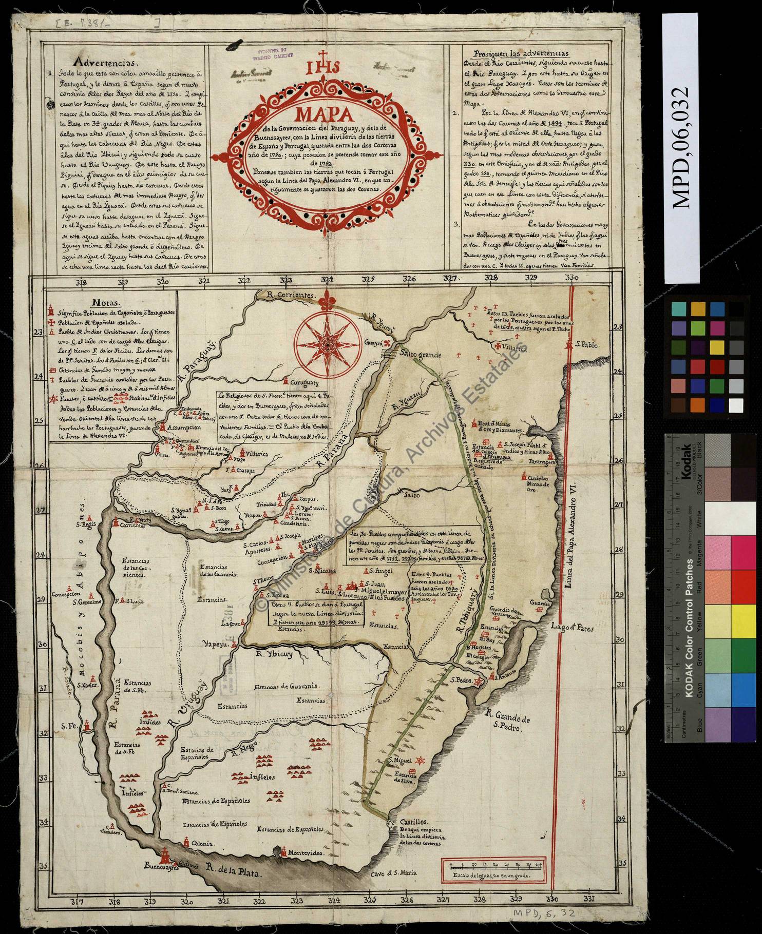
Mapa de la Governacion del Paraguay y de la de Buenos Ayres con la linea divisoria de las tierras de España y Portugal ajustada entre las dos Coronas año 1750 cuya posesion se pretende tomar este año de 1752
Map 1752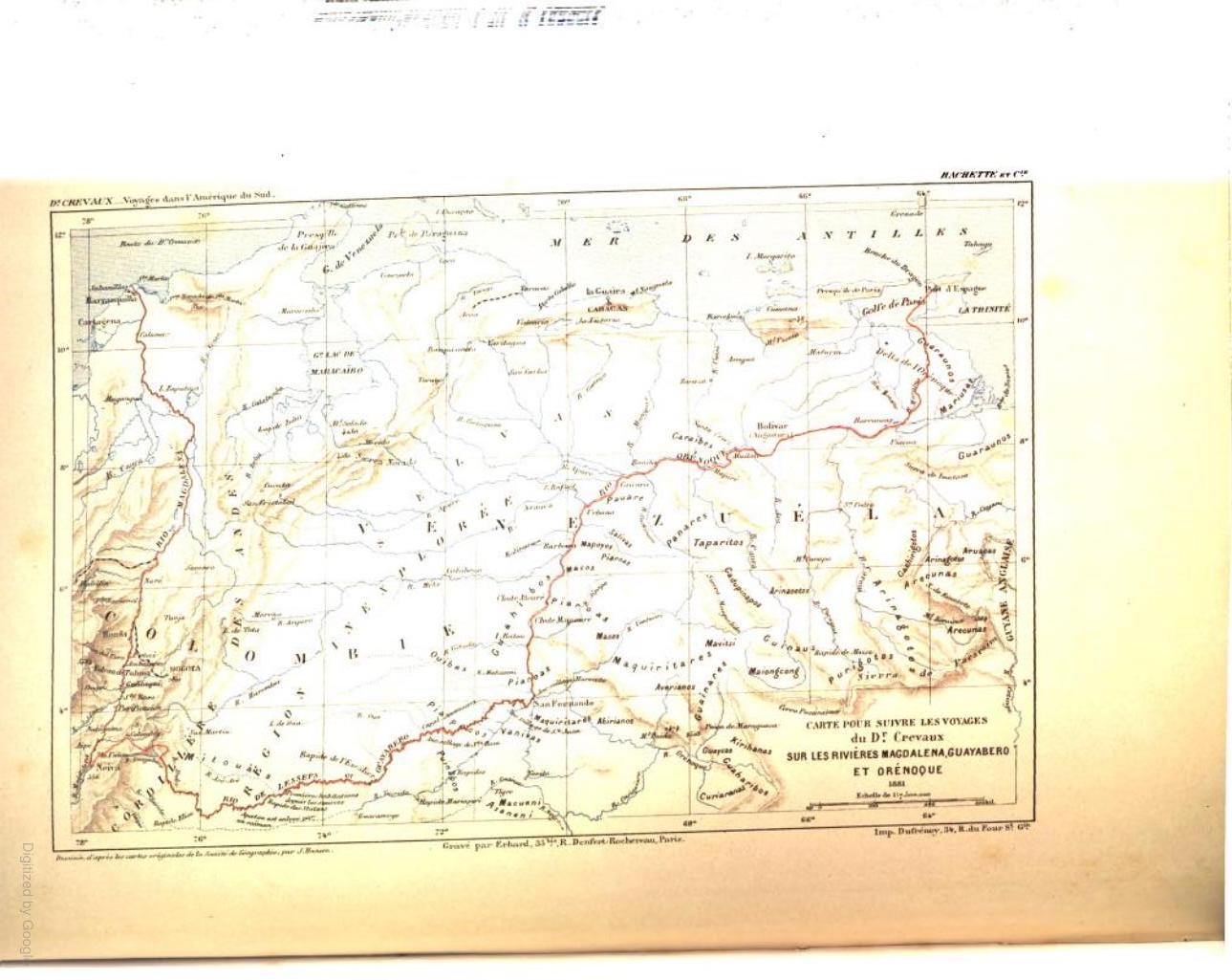
CARTE POUR SUIVRE LES VOYAGES du DR. CREVAUX SUR LES RIVIÈRES MAGDALENA;GUAYABERO ET ORÉNOQUE
Map 1881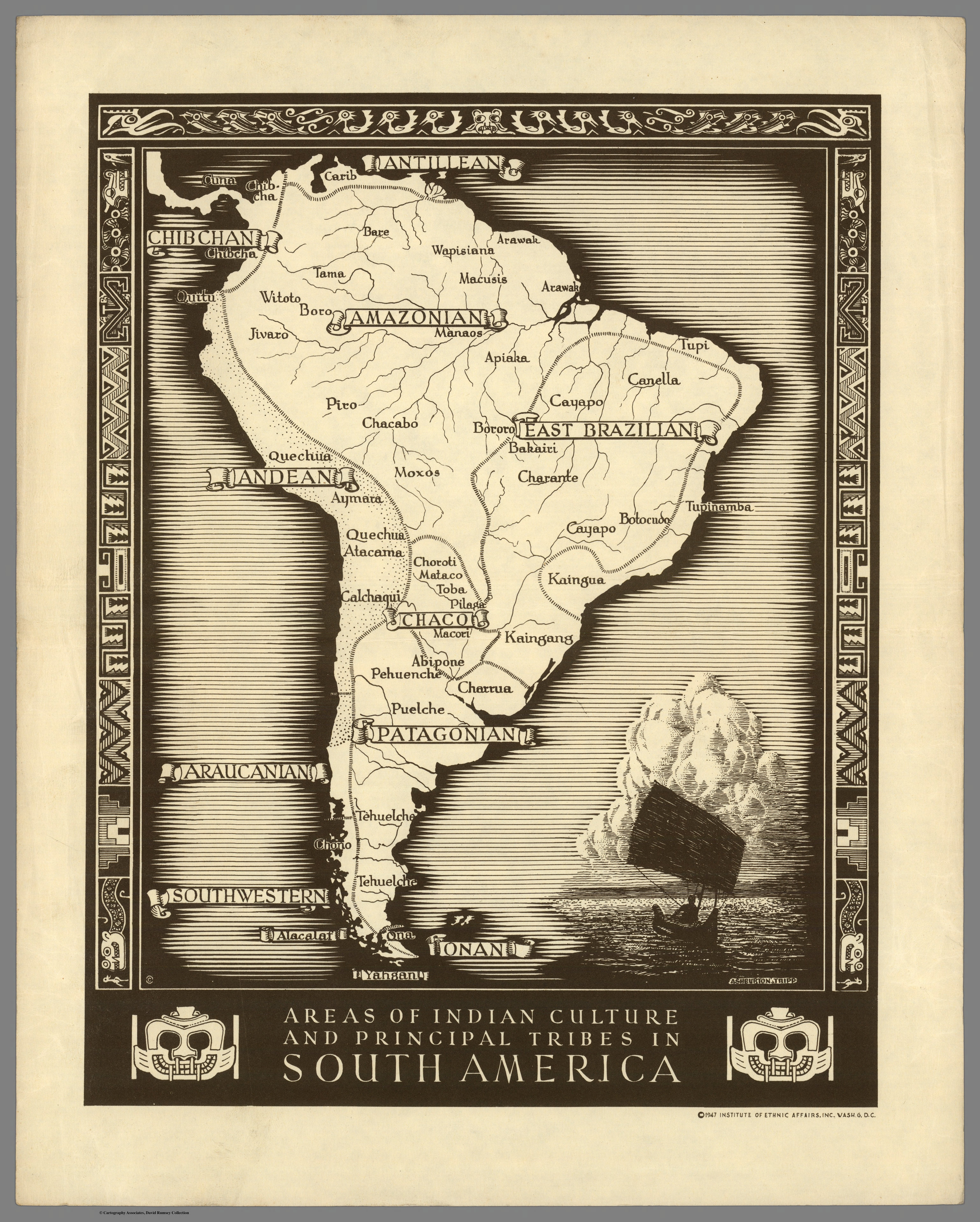
Areas of Indian Culture and Principal Tribes in South America
Map 1500 - 1900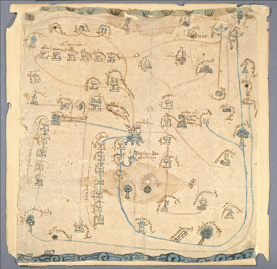
MAPA DE COATLINCHAN/ MAP OF COALINCHAN
Map 1500 - 1599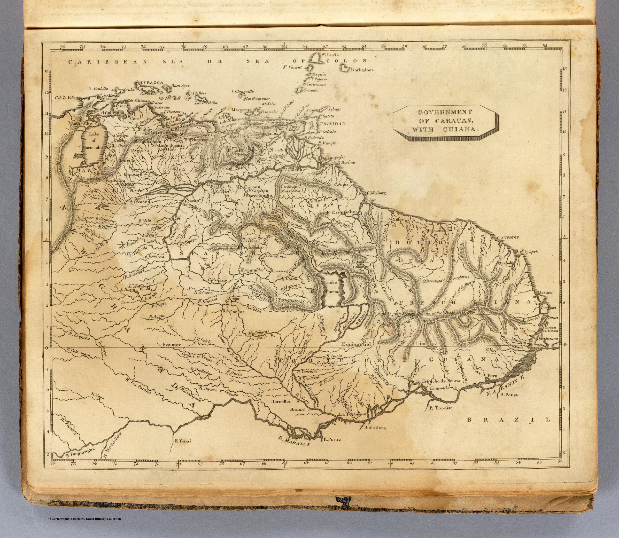
GOVERNMENT OF CARACAS;WITH GUIANA.
Map 1812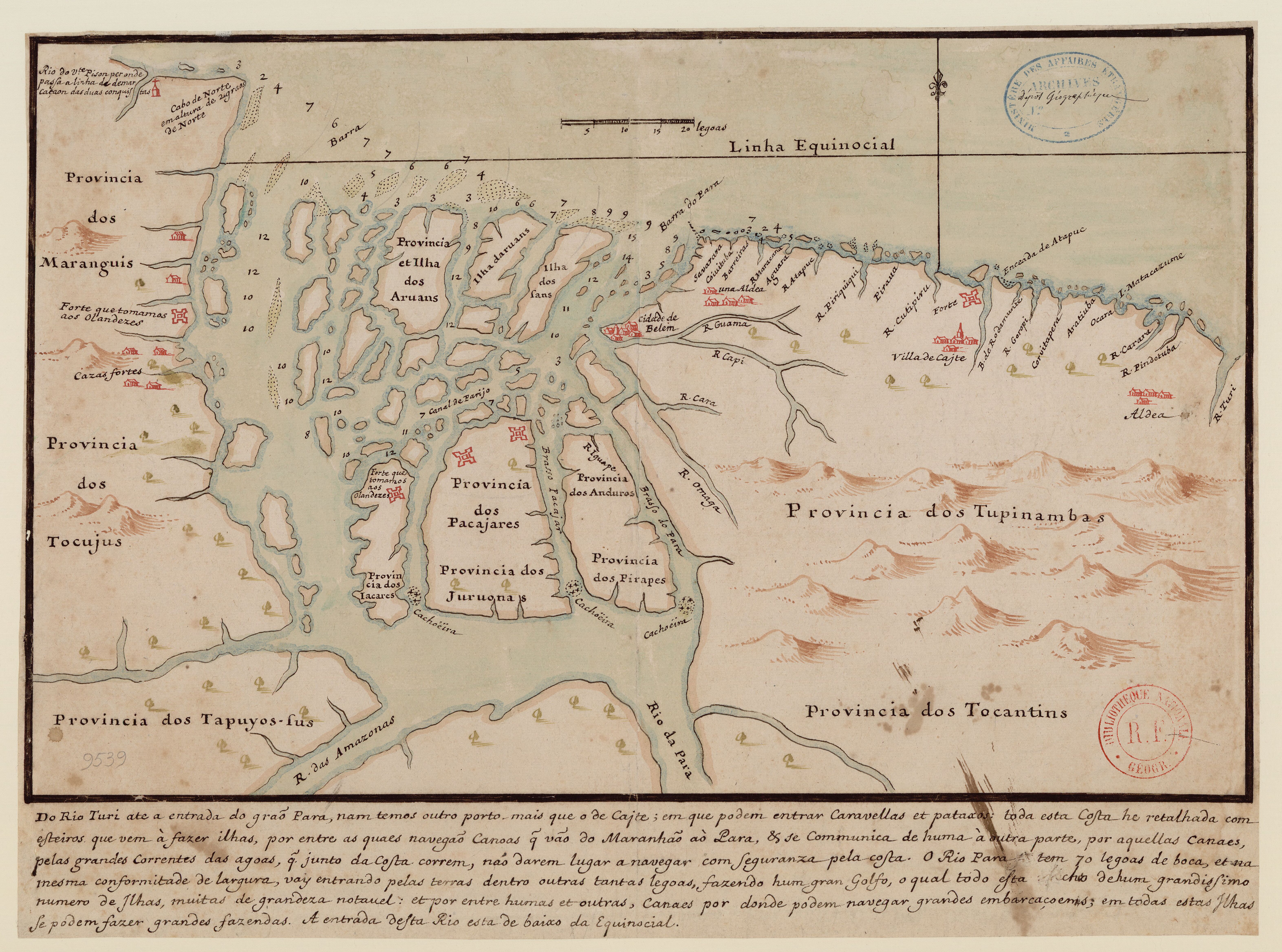
Do Rio Turi ate a entrada do Grao Para
Map 1600 - 1640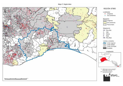
REGIÓN ISTMO
Map 2000
NLE. GRENADE;VENEZUELA;EQUATEUR;GUYANES.
Map 1860