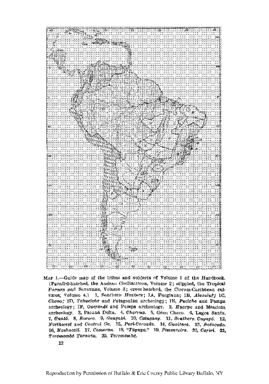
Peoples
- FUEGIANS
- ALACALUF
- CHONO
- TEHUELCHE
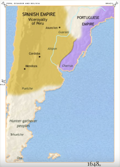
- PUELCHE
- QUERANDI
- HUARPE
- CHARRUA
- GUATO
- BORORO
- GUAYAKI
- CAINGANG
- CAYAPO
- PUTI-COROADO
- GUAITACA
- BOTOCUDO
- MASHACALI
- CAMACAN
- TAPUYA
- PIMENTEIRA
- CARIRI
- TEREMEMBE TARAIRIU
- TEREMEMBE
Citation
Steward Julian Haynes, Editor. Handbook of South American Indians. Washington, U.S. G.P.O.
![[Carta particolare della costa di Guiana]](https://dnet8ble6lm7w.cloudfront.net/maps/CNT/CNT0213.jpg)