Dispossesions in the Americas

Dispossesions in the Americas

  • Home
  • Explore
  • About
  • Authors
  • Art
  • Bodies
  • Curricula
  • Cultural Heritage
  • Maps
  • Territories
Back to Explore
StoryMap 1910 - 1950

The ​​United Fruit Company and Archaeology

  • Williams, Charlotte

Harvard Baker Library Archives Quirigua Ruins. United Fruit Photograph Albums, Guatemala. Box 5A. Mss:1 1891-1962 U860.

Harvard Baker Library Archives Quirigua Ruins. United Fruit Photograph Albums, Guatemala. Box 5A. Mss:1 1891-1962 U860.

Abstract

In the 20th century, the United Fruit Company (UFCO) was the largest private landholder in Central America. Notorious for its involvement in uprooting Central American governments to protect its assets, UFCO also upended past ones. By investing in and sometimes outright purchasing archaeological sites, UFCO created quasi-monopolies over ancient and contemporary Maya land and heritage. While many people have researched UFCO’s control of agriculture, few have studied the product of its archaeology. This project shows how UFCO used archaeology to accrue power and territory in Central America in the 20th century.

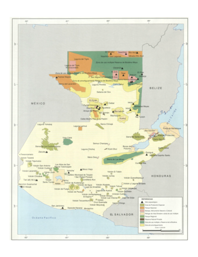
My multi-sited archive research synthesizes archaeological archives with business records, photographs, maps, and video footage to reveal how archaeological sites became quasi-American sovereign zones that funneled antiquities and American researchers through an academic-industrial complex. By UFCO’s logic, land—and its commercialization—was simultaneously valued for potential antiquities and yet threatened by agricultural over-extraction, creating a mechanism for companies to “salvage” sites by nestling and zoning them as protected within their own plantations and infrastructures. While dispossessing Indigenous people of sacred sites and arable land, UFCO positioned itself as an ideal entity to salvage sites from the very threat of its own agriculture, creating ambiguous territorial zones that persist today.

Go to StoryMap

Reading in Spanish

StoryMap 1910 - 1950

La United Fruit Company y la arqueología

  • Williams, Charlotte

Harvard Baker Library Archives Quirigua Ruins. United Fruit Photograph Albums, Guatemala. Caja 5A. Mss:1 1891-1962 U860.

Harvard Baker Library Archives Quirigua Ruins. United Fruit Photograph Albums, Guatemala. Caja 5A. Mss:1 1891-1962 U860.

Related Content

Sistema guatemalteco de áreas protegidas (SIGAP) y sitios arqueológicos en 2000.

Sistema guatemalteco de áreas protegidas (SIGAP) y sitios arqueológicos en 2000.

Map 2000
Principal Maya Archaeological Sites

Principal Maya Archaeological Sites

Map 1490
Planta regular de la fortaleza y castillo de Huehuetenango, sobre las márgenas de Socoleo.

Planta regular de la fortaleza y castillo de Huehuetenango, sobre las márgenas de Socoleo.

Map 1672
Indianische Ortsnamed im nördlichen Mittelamerika

Indianische Ortsnamed im nördlichen Mittelamerika

Map 1800 - 1900
Departamento de Chiquimula

Departamento de Chiquimula

Map 1830 - 1832
Map showing Sites Mentioned In Text

Map showing Sites Mentioned In Text

Map 200 - 900

Dispossessions in the Americas

A project by

University of Pennsylvania

Copyright 2024

With support from

Mellon Foundation

Site design & development

Element 84

Art Credits

Harvard Baker Library Archives Quirigua Ruins. United Fruit Photograph Albums, Guatemala. Box 5A. Mss:1 1891-1962 U860.

Site Pages

  • Home
  • Explore
  • About
  • Authors
  • Art
  • Bodies
  • Curricula
  • Cultural Heritage
  • Maps
  • Territories