Dispossesions in the Americas

Dispossesions in the Americas

  • Home
  • Explore
  • About
  • Authors
  • Art
  • Bodies
  • Curricula
  • Cultural Heritage
  • Maps
  • Territories
Back to Explore
Narrative 1492 - 2023

The 101 of Cartography

  • Pensa, Laura

Published: 2023

Jaillot; Alexis Hubert. "L’Amerique Meridionale Divisée en ses Principales Parties. Presenté à Monseigneur le Duc de Bourgogne." Map 1697

Jaillot; Alexis Hubert. “L’Amerique Meridionale Divisée en ses Principales Parties. Presenté à Monseigneur le Duc de Bourgogne.” Map 1697

What Is a Map?

Often, we hear that a map is a representation of the Earth on a flat surface, and while that is entirely true in most cases, there is much more to maps than meets the eye. Maps are, above all, the visualization of a certain point of view: one that highlights certain features of the world and occludes others. Think about a subway diagram of a major city. We will find no reference to the bus system there, but that doesn’t mean that buses are not running, or did not exist at the moment the map was made. We should keep in mind that maps, just like books and paintings, have authors, are created in different cultural contexts and, more importantly, are made to serve a purpose.

Whether that purpose is identifying the location of buildings or services, or something less neutral, such as the maps of social happiness levels according to country, maps always have an agenda. This agenda may not be so evident at first glance, it may even contradict what the map is explicitly saying through its title, so we must beware of jumping to easy conclusions when consulting these documents. On this site, you will find maps that represent the surface of the Earth on a planar surface, but these maps also show, hide, and convey so many more messages. We have selected these maps because they depict Indigenous and/or Afro-descendant Peoples of the Americas and their forms of territorial occupation, most often as seen by others. Keep in mind that some people across time and space have not always used maps like the ones in this collection, since they had different ways of guiding relations in space. Over time, Western knowledge has privileged cartography - “the science of princes’’, born in the dawn of Imperialism - as the ultimate way of representing space, resources, itineraries and distances, but we should understand that oral memory, tales, songs, and intimate knowledge of environments can also guide people of a given space as effectively as any map would do. One final thing to consider when looking at a map, you should always wonder: What is this map trying to show me? And why? (See our map collection methodology).

How Do Maps Age?

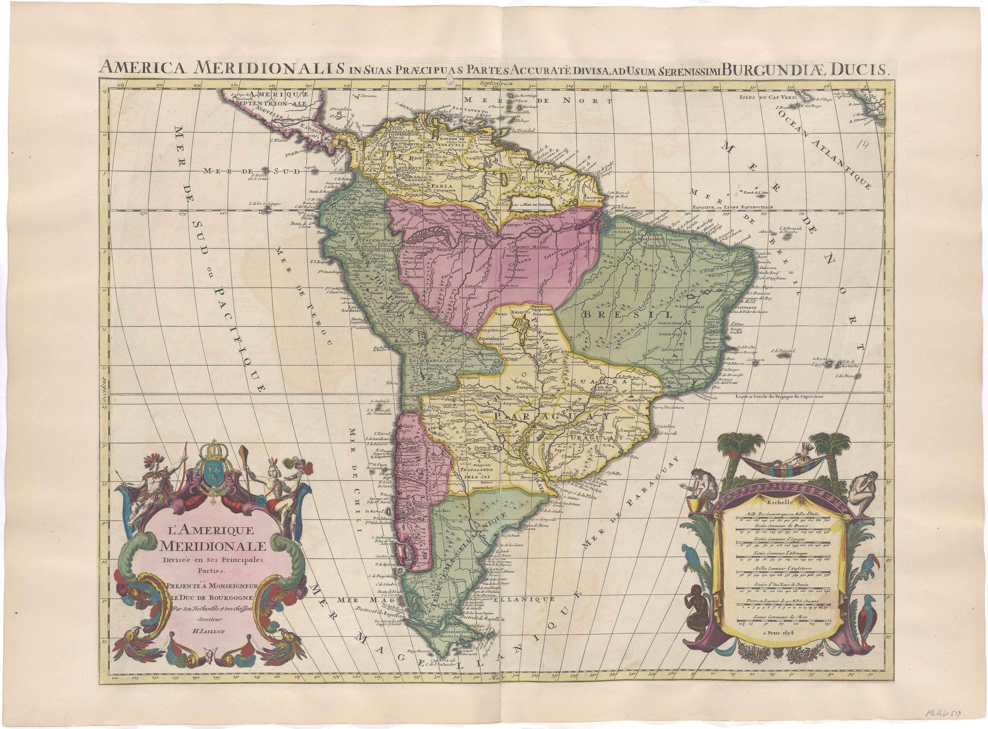
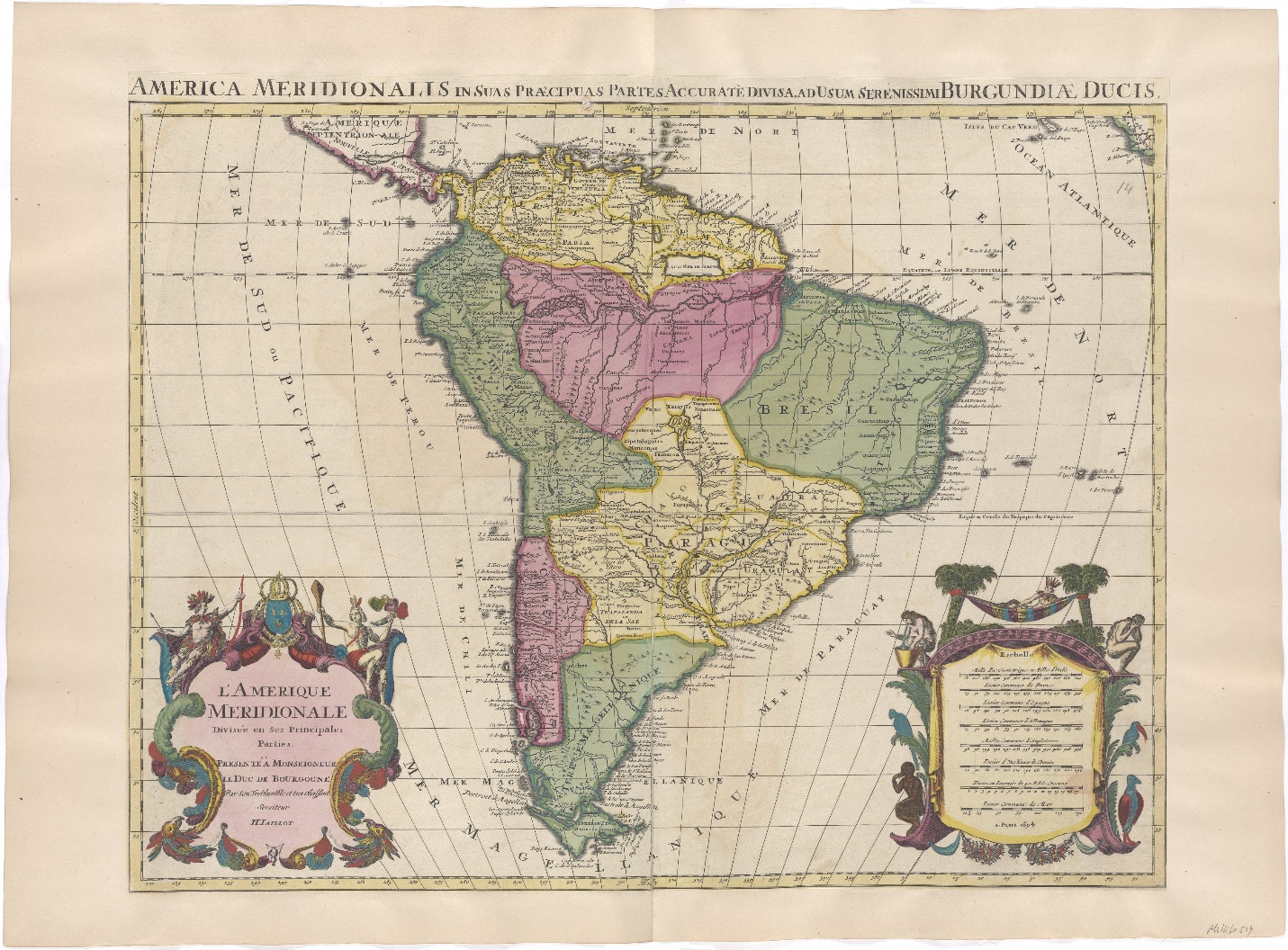
Like any other cultural object, maps age, and occasionally, they don’t age well. Sometimes the places they represent no longer exist as such, as is the case for WWII maps and the aftermath that brought several changes to Eastern Europe’s political divisions. This is the case too for colonial maps, which visualize political entities with borders, such as viceroyalties, that no longer speak for the present-day configurations of those terrains. If we go back in time enough, we will also find images that differ greatly from what we think today as our world map. Mind you, people in the 1500s did not have GPS, and folks who were map makers probably couldn’t have visited or even obtained accurate information of all the regions they attempted to represent. In time, and due to technological advancements, the success of the imperial projects and the prevalence of Western knowledge, maps became more and more accurate in terms of geospatial location. But this is only one way in which maps of the past can be inaccurate.

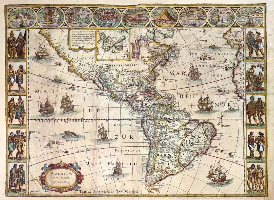
When consulting these documents, we must understand that maps incessantly reproduce the culture that gave them origin. That means that whatever was valid for the cultural context of the map makers, the image will tag along to the present. Say we are talking about a map of colonial Spanish America that depicts an Indigenous reduction. Most likely, this image contains and reproduces all the prejudices, false assumptions, and demeaning idealizations that many conquistadors held about the Indigenous and Afro-Indigenous Peoples of the Americas. One must be attentive to the use of terms that are degrading to native groups, such as “Indios”—due to the conquistadors’ mistakenly believing they had arrived to India—, “barbarians”, “savages”, “enemies”, “infidels”, and so on. It also means that we might find the word “desert,” implying uninhabited lands, on a place where in fact many people lived, just because the map makers didn’t consider them lawful inhabitants, or because they wanted to occupy the lands themselves. These maps could also contain drawings that are in some way demeaning, or inscriptions that qualify native’s actions, lifestyles, and ontologies as anything less than worthy of existence. These and other notions circulated in the common sense of past societies, had concrete, material and symbolic effects over the lives and futures of many individuals and Peoples. Their inclusion on the map, if nothing else, can provide us with clues to understand why and how native groups have differential representation in these documents, while also pushing us to consider the complexities of their resistance. Like so much of our history as humans, some of these documents can be uncomfortable to look at in the present, but engaging with them in an educational way can broaden our understanding about past inequalities that directly impact our present and futures.

Whose Map Is It Anyways?

Authorship is always controversial when one talks about maps. Who made the map? The cartographer who signed it? The workshop that stamped it, where many people worked? The drafter who drew it? The illustrator who painted it? The corrector of the final version? The people who ordered its making? The company that paid for it? The researchers who gathered the information for the map to be created? The explorers who took notes about the river courses, the elevations and borders? Maybe the other people, those who traditionally inhabited the land and are the original guides of any in-land excursion? Simply put, it’s never a straightforward answer. Maps consolidate an enormous amount of knowledge, and hence, indicate the enormous amount of power that was put to work to obtain that knowledge. Particularly when we are considering maps that represent Indigenous peoples to some extent, we should be prepared to find their authorship occluded, until very recent years.

Colonial and early republican maps very rarely acknowledged the intervention of Indigenous authorship - some exceptions to this are native Codices and pinturas - but we know that Indigenous Peoples participated actively in the making of these documents. How do we know? Oftentimes, maps are the prelude or the consequence of some other administrative record that, in writing, will admit as a minor detail, facts like the guiding of an Indigenous person through the unknown lands. In the case of expeditions to lands that conquerors and settlers did not know, it is safe to assume that, coercively or forcefully, Indigenous individuals were part of these enterprises, and many times, it was thanks to their knowledge that colonial expeditions could safely reach these destinations in the first place. When the conquest and colonization of the Americas began, all the imperial powers together did not amount to a number that would overpower the number of native peoples of the Americas. Despite the common underestimation of their traditional knowledge that we might find in other accounts, conquerors needed Indigenous and Afro-Indigenous peoples to construct colonial cities and roads from the ground up, and map making was a part of this enterprise. Indigenous peoples had the knowledge that is concentrated and represented in these maps, and if they are not the official authors, it is only because they didn’t have the power to claim authorship.

Why Are These Maps Important?

If maps are always an exercise in choosing which information to include, so too is a collection of maps. This is a larger scale selection of the millions of maps you might find in different online and offline archives, in manuals, museums, shops, in art, and fiction. We have designed this collection to address one particular, structural situation, but recognize that there could be many others to be addressed. These maps are important because they make visible what was hidden for so long: the Amerindian territories have been, are, and will be inhabited by many different Indigenous and Afro-Indigenous peoples.

Despite all historical and/or present efforts to undermine their longstanding vitality, creative resistance to the processes of dispossession and rightful traditional land rights, the Americas are Indigenous land, from top to bottom. Like many other resources you will find in this website, maps are here to carve out a space where processes of Indigenous dispossession and repossession are discussed in light of historical and present-day evidence. We have compiled these maps to visualize diverse forms of occupations, a broad spectrum of groups, and as many territories as we could comprehend. This collection is no way final, and it is imperfect and incomplete and will continue to grow overtime. As with any other research that is interested in the experiences of groups of people who were subalternized into the social, legal, and political structures of other groups, the road that leads to valued information about these groups in the past is never straight forward. Reading against the grain, and counter reading these maps are some of the strategies that we employed to craft this selection and write commentaries on some of the maps. We encourage you to find different messages in these maps, hidden meanings, and outspoken truths. Our effort aims to center the native experiences that were represented in cartographical records, as a way of visualizing the trans-epochal significance, persistence and impact of Indigenous lives on Amerindian territory. As we navigate the rise of anti-Black, and anti-Indigenous hate crimes and discourses, these efforts are more important than ever.

Citation

Pensa, Laura. 2023. 'The 101 of Cartography'. Dispossessions in the Americas. https://staging.dia.upenn.edu/en/content/PensaL001/

Reading in Spanish

Narrative 1492 - 2023

El ABC de la cartografía

  • Pensa, Laura

Published: 2023

Figura 1: Jaillot; Alexis Hubert. "L’Amerique Meridionale Divisée en ses Principales Parties. Presenté à Monseigneur le Duc de Bourgogne." Map 1697

Figura 1: Jaillot; Alexis Hubert. “L’Amerique Meridionale Divisée en ses Principales Parties. Presenté à Monseigneur le Duc de Bourgogne.” Map 1697

Reading in Portuguese

Narrative 1492 - 2023

O ABC da cartografia

  • Pensa, Laura

Published: 2023

Figura : Jaillot; Alexis Hubert. "L’Amerique Meridionale Divisée en ses Principales Parties.

Figura : Jaillot; Alexis Hubert. “L’Amerique Meridionale Divisée en ses Principales Parties.

O que é um mapa?

É comum ouvir que um mapa é uma representação da Terra ou parte dela em uma superfície plana, e, embora na maior parte dos casos isso seja verdade, há muito mais para dizer sobre os mapas do que vemos a olho nu. Antes de tudo, os mapas são a visualização de um ponto de vista determinado: uma perspectiva que destaca certas características do mundo enquanto oculta outras. Pense em um diagrama do metrô de uma grande cidade. Ali não vamos encontrar nenhuma referência ao sistema de ônibus, mas isso não significa que os ônibus não estejam circulando, ou que não existiam no momento em que se traçou o mapa. Devemos ter em conta que os mapas, assim como os livros, as pinturas e as canções, têm autores, são criados em diferentes contextos culturais e, o que é mais importante, são concebidos para cumprir um propósito.

Seja seu propósito o de identificar a localização de edifícios ou serviços, ou algo menos neutro, como são os mapas de níveis de felicidade social segundo o país, os mapas sempre têm uma agenda. Essa agenda ou objetivo pode passar despercebido no início, e inclusive pode contradizer o que o mapa está dizendo explicitamente através de seu título, razão pela qual convém ter cautela antes de tirar conclusões rápidas ao consultar esses documentos. Neste site você encontrará mapas que representam a superfície da Terra em uma superfície plana, mas também mapas que mostram, ocultam e transmitem várias outras mensagens. Selecionamos esses mapas porque representam os Povos Indígenas e/ou Afrodescendentes das Américas e suas formas de ocupação territorial em geral, e — em particular — como essas formas foram registradas por outros. É importante saber que muitos grupos humanos ao longo do tempo e do espaço não utilizaram mapas como os dessa coleção, já que tinham e têm distintas maneiras de se orientar no espaço. Com o tempo, o estilo de conhecimento ocidental privilegiou a cartografia, chamada também de “a ciência dos príncipes”, nascida nos primórdios do imperialismo, como a melhor maneira de representar o espaço, os recursos, os itinerários e as distâncias. No entanto, devemos entender que a memória oral, os contos, as canções e o conhecimento intrínseco dos territórios também podem guiar as pessoas de um determinado espaço com a mesma eficácia que um mapa. A última questão a ter em conta quando observamos um mapa é sempre a seguinte: O que este mapa tenta me mostrar? E por quê? (Ver nossa metodologia de coleção de mapas).

Como os mapas envelhecem?

Como qualquer outro objeto cultural, os mapas envelhecem, e às vezes não envelhecem da melhor maneira. Pode ocorrer que os lugares que representam já não existam como tais, como é o caso dos mapas da Segunda Guerra Mundial, cujas consequências trouxeram importantes mudanças nas divisões políticas da Europa Oriental. Este também é o caso dos mapas coloniais, que visualizam entidades políticas com fronteiras, como vice-reinados, que já não refletem as configurações atuais desses territórios. Se retrocedermos o suficiente no tempo, também encontraremos imagens que diferem significativamente do que hoje entendemos como nosso mapa mundial. Levemos em conta que as pessoas no ano 1500 não tinham GPS, e é provável que os cartógrafos não visitassem os lugares que traçavam em seus mapas, mas sim obtinham informação — nem sempre precisa ou verdadeira — de todas as regiões que tentavam representar. Com o passar do tempo, graças aos avanços tecnológicos, ao sucesso dos projetos imperiais e à supremacia do conhecimento ocidental, os mapas se tornaram cada vez mais precisos em termos de localização geoespacial. Mas a questão geopolítica é apenas uma forma em que os mapas do passado podem ser inexatos.

Ao consultar esses documentos, devemos entender que os mapas reproduzem inevitavelmente a cultura que lhes deu origem. Isso significa que o que era válido para o contexto cultural dos cartógrafos será transmitido pela imagem até nossos dias. Suponhamos que estamos falando de um mapa da América colonial espanhola que representa uma “redução” indígena. É muito provável que essa imagem compreenda, abarque e reproduza todos os preconceitos, suposições falsas e idealizações degradantes que muitos conquistadores tinham sobre os Povos Indígenas e Afro-Indígenas das Américas. Devemos ser cuidadosos com o uso de termos que degradam os grupos nativos, como por exemplo a palavra “Índios” — cunhada a partir da crença equivocada dos conquistadores de que haviam chegado às Índias — “bárbaros”, “selvagens”, “inimigos” e “infiéis”, entre outros. Esses rastros do passado também podem nos mostrar a palavra “deserto” como sinônimo de terras inabitadas em lugares onde de fato se assentaram populações, simplesmente porque os cartógrafos não as consideravam habitantes legítimos, ou porque queriam ocupar aquelas terras eles mesmos. Esses mapas também poderiam conter desenhos que de alguma maneira fossem degradantes, ou inscrições que qualificassem as ações, estilos de vida e ontologias dos nativos como algo indigno de existência. Essas e outras noções circulavam no coletivo das sociedades passadas, tendo efeitos concretos, materiais e simbólicos sobre as vidas e futuros de muitas pessoas e povos. Sua inclusão no mapa, na melhor das hipóteses, pode nos fornecer pistas para entender por que e como os grupos nativos eram representados de diversas maneiras nesses documentos, ao mesmo tempo que nos impulsionam a considerar as complexidades de sua resistência. Como ocorre com grande parte de nossa história social, alguns desses documentos podem resultar incômodos em sua análise hoje em dia, mas lidarmos com eles a partir de uma perspectiva educativa pode ampliar nossa compreensão sobre as desigualdades do passado que impactam diretamente em nosso presente e futuro.

De quem é o mapa realmente?

A autoria sempre gera disputa quando se trata de mapas. Quem fez o mapa? O cartógrafo que o assinou? A oficina que o assinou, onde trabalharam muitas pessoas? O artista que o desenhou? O ilustrador que o pintou? O revisor que conseguiu a versão final? As pessoas que solicitaram sua criação? A empresa que pagou por sua confecção? Os pesquisadores que compilaram a informação para que se criasse o mapa? Os exploradores que tomaram notas sobre os cursos dos rios, as elevações e as fronteiras? Talvez as outras pessoas, aqueles que tradicionalmente habitavam a terra e eram os guias originários de qualquer excursão terra adentro. Em poucas palavras, a resposta nunca é simples. Os mapas consolidam um formidável acervo de saberes e, portanto, evidenciam a enorme quantidade de poder que foi colocada em jogo para obter esse conhecimento. Quando estamos considerando mapas que representam os Povos Indígenas em particular, devemos estar preparados para encontrar sua autoria oculta.

Os mapas coloniais e os primeiros mapas republicanos raramente reconheceram a intervenção da autoria indígena, com exceção dos Códices e pinturas. No entanto, temos a certeza de que os Povos Indígenas participaram ativamente na elaboração desses documentos. Como sabemos? Frequentemente, os mapas são o prelúdio ou a consequência de algum outro registro administrativo que, por escrito, admitirá como um detalhe menor a orientação de uma pessoa indígena através de terras desconhecidas. No caso das expedições a terras que os conquistadores e colonos desconheciam, podemos supor que, de maneira coercitiva ou forçada, as pessoas indígenas foram parte dessas iniciativas, e muitas vezes foi graças ao seu conhecimento que as expedições coloniais puderam chegar de forma segura a esses destinos. Quando começou a conquista e colonização das Américas, o contingente das potências imperiais não atingia o número de pessoas necessário para superar a quantidade de povos originários das Américas. Apesar da frequente depreciação de seu conhecimento tradicional, que pode se desprender de outros relatos, os conquistadores necessitavam dos Povos Indígenas e Afro-Indígenas para construir cidades coloniais e caminhos do zero, e a elaboração de mapas foi parte dessa iniciativa. Os povos indígenas possuíam o conhecimento reunido e representado nesses mapas, e se não aparecem oficialmente como seus autores, é apenas porque não alcançaram o poder para reivindicar essa autoria.

Por que esses mapas são importantes?

Se os mapas são sempre um exercício de seleção sobre que informação incluir, o mesmo pode ser dito de uma coleção de mapas. Esta é uma seleção feita em grande escala sobre os milhões de mapas que podem ser encontrados em diferentes arquivos físicos e digitais, em manuais, museus, lojas, na arte e na ficção. Projetamos esta coleção para abordar uma situação estrutural particular, mas reconhecemos que há muitas outras esperando ser visibilizadas. Esses mapas são importantes porque tornam visível o que esteve oculto durante muito tempo: os territórios ameríndios foram, são e serão habitados por diversos Povos Indígenas e Afro-Indígenas.

Apesar de todos os esforços históricos e/ou presentes para minar sua inexorável vitalidade, sua resistência criativa aos processos de desapropriação e seus direitos legítimos sobre terras ancestrais, as Américas são territórios indígenas, de norte a sul. Assim como muitos outros recursos que você encontrará neste site, os mapas estão aqui para abrir um espaço onde se abordem os processos de desapropriação e de recuperação indígenas à luz de evidências históricas e atuais. Compilamos esses mapas para dar visibilidade a diversas formas de ocupação, a uma ampla variedade de grupos e à maior quantidade de territórios possível. Esta coleção de modo algum é definitiva: é imperfeita, está incompleta e seguirá crescendo com o tempo. Como ocorre ao pesquisar as experiências de grupos de pessoas que foram subjugadas nas estruturas sociais, legais e políticas de outros grupos no passado, o caminho que leva a obter informação valiosa sobre os mesmos nunca é direto. Ler “a contrapelo” e contradizer a leitura desses mapas são algumas das estratégias que empregamos para elaborar esta seleção e comentar sobre alguns deles. Encorajamos você a encontrar diferentes mensagens nesses mapas, significados ocultos e verdades indiscutíveis. Nosso esforço tem como objetivo centralizar as experiências nativas que se representaram nos registros cartográficos, como uma forma de dar visibilidade à importância histórica e atual, à persistência e ao impacto das vidas indígenas no território ameríndio. Imersos em uma época em que os crimes e discursos de ódio com matizes anti-afro e anti-indígenas estão em ascensão, esses esforços são mais relevantes que nunca.

Citation

Pensa, Laura. 2023. 'O ABC da cartografia'. Dispossessions in the Americas. https://staging.dia.upenn.edu/pt/content/PensaL001/

Related Content

About the Map Collection

About the Map Collection

Narrative
Resistance, Dispossessions and Violence in La Guajira

Resistance, Dispossessions and Violence in La Guajira

Narrative 1500 - 1817
L'Amerique Meridionale Divisée en ses Principales Parties. Presenté à Monseigneur le Duc de Bourgogne

L'Amerique Meridionale Divisée en ses Principales Parties. Presenté à Monseigneur le Duc de Bourgogne

Map 1694

Dispossessions in the Americas

A project by

University of Pennsylvania

Copyright 2024

With support from

Mellon Foundation

Site design & development

Element 84

Art Credits

Jaillot; Alexis Hubert. “L’Amerique Meridionale Divisée en ses Principales Parties. Presenté à Monseigneur le Duc de Bourgogne.” Map 1697

Site Pages

  • Home
  • Explore
  • About
  • Authors
  • Art
  • Bodies
  • Curricula
  • Cultural Heritage
  • Maps
  • Territories