Dispossesions in the Americas

Dispossesions in the Americas

  • Home
  • Explore
  • About
  • Authors
  • Art
  • Bodies
  • Curricula
  • Cultural Heritage
  • Maps
  • Territories
Back to Explore
Narrative

About the Map Collection

  • Falleti, Tulia G.

Published: 2024

Willem Janszoon Blaeu. *Americae Nova Tabula*. Map. Amsterdam,1640.

Willem Janszoon Blaeu. Americae Nova Tabula. Map. Amsterdam,1640.

Abstract

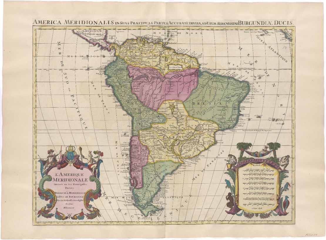
The maps section, in addition to comments and videos, gathers over 1,800 maps showing Indigenous Peoples, Cimarrones, and Afro-descendants in Abya Yala or the Americas. Most of these maps correspond to the geography of South America, Central America, Mexico, and the Caribbean, with a few covering what is nowadays the United States and Canada. It is important to stress that the maps reflect the worldview of those who produced them, as Laura Pensa explains in “The 101 of Cartography”. As can be seen in the titles and the names of peoples, many maps reflect the racism of the colonial and republican periods, as well as the ethnocentrism of academia. By reproducing these maps, our intention is not to legitimize such racist terminologies and ideologies, but rather to expose and denounce them as part of the systematic exclusion, domination, and violence against racialized peoples. We do not present the maps as sites of knowledge per se but as part of the archive students, researchers, community members, and activists can use to appreciate the historical presence of Indigenous Peoples, Cimarrones, and Afro-descendants in the territory, and understand the weight of history in the present to build more just futures.

The map collection began with a review of those existing in the territory layer of the excellent website native-land.ca. That initial compilation of maps, bibliography, and first list of Indigenous Peoples was then expanded by searching maps in historical archives, both physical and electronic, in secondary bibliography, and on governmental and non-governmental websites, both national and international. We were interested in maps from the time of colonial contact to the present. As the list of maps grew, so did the list of Indigenous Peoples, Cimarrones, and Afro-descendants represented in the territory throughout the centuries.

Each map is cataloged with a unique identifier (MAP_ID) and was coded by the research assistants on the team, according to the variables found in the database. The maps can thus be selected on our website by Peoples, the geography of present-day countries, and the period of reference of the map. Additionally, in the database, other variables can be examined, such as the author of the map, its purpose, language, and, in the case of electronic repository maps, its original website.

It should also be noted that this map collection is by no means representative or exhaustive of the entire time and space covered. It is an initial collection that can expand over time and by collective effort. It is also possible that, when cataloging the peoples mentioned in each map, some names of peoples may have been omitted by mistake or because they were assumed to be toponyms (i.e., place names) rather than ethnonyms (or names of Indigenous Peoples). If the user finds such errors, please contact us at dia-team@upenn.edu.

We hope that this initial collection of maps, while incomplete and perfectible, will help to make visible the presence of Indigenous Peoples, Cimarrones, and Afro-descendants in Abya Yala or the Americas, many of whom continue to demand their legitimate collective right to their ancestral lands.

About the Map Collection and Coding Team

The work of compiling and coding the maps was collaborative, with assistance from undergraduate, graduate, and postdoctoral fellows, directed and coordinated by the principal researcher, Prof. Tulia G. Falleti.

Undergraduate students from the University of Pennsylvania, based on their participation in the collection and coding of maps:

  • Adalyn Richards

  • Thomas Maggiola

  • Sergio Carballido Murcio

  • Norma Urrutia

  • Lía Fernández

  • Alexandra Morgan

  • Selene Bonczok Sotelo

Graduate students from the University of Pennsylvania, based on their participation in the collection and coding of maps:

  • Javier Ardila

  • Charlotte Williams

  • Santiago Cunial

  • Erin Wrightson

  • Chloe Ricks

  • Giovani Rocha

Postdoctoral fellows from the University of Pennsylvania, based on their participation in the collection and coding of maps:

  • Juan Pablo Ardila

  • Laura Pensa

  • María Atuesta

  • Daniela Fernandes Alarcon

  • George Ygarza

Citation

Falleti, Tulia G.. 2024. 'About the Map Collection'. Dispossessions in the Americas. https://staging.dia.upenn.edu/en/content/FalletiT003/

Reading in Spanish

Narrative

Sobre la colección de mapas

  • Falleti, Tulia G.

Published: 2024

Willem Janszoon Blaeu. *Americae Nova Tabula*. Map. Amsterdam,1640.

Willem Janszoon Blaeu. Americae Nova Tabula. Map. Amsterdam,1640.

Reading in Portuguese

Narrative

Sobre a Coleção de Mapas

  • Falleti, Tulia G.

Published: 2024

Willem Janszoon Blaeu. *Americae Nova Tabula*. Map. Amsterdam,1640.

Willem Janszoon Blaeu. Americae Nova Tabula. Map. Amsterdam,1640.

Resumo

A seção de mapas, além de comentários e vídeos, reúne mais de 1.800 mapas que mostram povos indígenas, cimarrones e afrodescendentes em Abya Yala, ou Américas. A maioria desses mapas corresponde à geografia da América do Sul, América Central, México e Caribe, com alguns abrangendo o que hoje são os Estados Unidos e o Canadá. É importante ressaltar que os mapas refletem a visão de mundo daqueles que os produziram, como explica Laura Pensa em “O Básico da Cartografia”. Como se pode observar nos títulos e nos nomes dos povos, muitos mapas refletem o racismo dos períodos colonial e republicano, bem como o etnocentrismo acadêmico. Ao reproduzir esses mapas, nossa intenção não é legitimar tais terminologias e ideologias racistas, mas sim expô-las e denunciá-las como parte da exclusão, dominação e violência sistemáticas contra pessoas racializadas. Não apresentamos os mapas como fontes de conhecimento em si, mas como parte do acervo que estudantes, pesquisadores, membros da comunidade e ativistas podem usar para apreciar a presença histórica dos povos indígenas, cimarrones e afrodescendentes no território, e para entender o peso da história no presente, visando a construção de futuros mais justos.

A coleção de mapas começou com uma revisão dos existentes na camada territorial do excelente website native-land.ca. Essa compilação inicial de mapas, bibliografia e primeira lista de povos indígenas foi posteriormente ampliada por meio de pesquisas em mapas em arquivos históricos, tanto físicos quanto eletrônicos, em bibliografia secundária e em sites governamentais e não governamentais, tanto nacionais quanto internacionais. Estávamos interessados ​​em mapas desde a época do contato colonial até os dias atuais. Conforme a lista de mapas cresceu, também cresceu a lista de povos indígenas, cimarrones e afrodescendentes representados no território ao longo dos séculos. Assim, os mapas podem ser selecionados em nosso site por Povos, pela geografia dos países atuais e pelo período de referência do mapa. Adicionalmente, na base de dados, outras variáveis ​​podem ser examinadas, como o autor do mapa, sua finalidade, idioma e, no caso de mapas em repositórios eletrônicos, seu site original.

Deve-se notar também que esta coleção de mapas não é de forma alguma representativa ou exaustiva de todo o período e espaço abrangidos. Trata-se de uma coleção inicial que pode se expandir com o tempo e por meio de esforço coletivo. É possível também que, ao catalogar os povos mencionados em cada mapa, alguns nomes de povos tenham sido omitidos por engano ou por terem sido considerados topônimos (ou seja, nomes de lugares) em vez de etnônimos (ou nomes de povos indígenas). Caso o usuário encontre tais erros, por favor, entre em contato conosco em dia-team@upenn.edu.

Esperamos que esta coleção inicial de mapas, embora incompleta e passível de aprimoramento, ajude a tornar visível a presença dos povos indígenas, cimarrones e afrodescendentes em Abya Yala, ou Américas, muitos dos quais continuam a reivindicar seu legítimo direito coletivo às suas terras ancestrais.

Sobre a Coleta de Mapas e o Time de Programação

O trabalho de compilação e programação dos mapas foi colaborativo, com a assistência de alunos de graduação, pós-graduação e pós-doutorado, dirigido e coordenado pela pesquisadora principal, Profª. Tulia G. Falleti.

Alunos de graduação da Universidade da Pensilvânia, com base em sua participação na coleta e programação dos mapas:

  • Adalyn Richards

  • Thomas Maggiola

  • Sergio Carballido Murcio

  • Norma Urrutia

  • Lía Fernández

  • Alexandra Morgan

  • Selene Bonczok Sotelo

Alunos de pós-graduação da Universidade da Pensilvânia, com base em sua participação na coleta e programação de mapas:

  • Javier Ardila

  • Charlotte Williams

  • Santiago Cunial

  • Erin Wrightson

  • Chloe Ricks

  • Giovani Rocha

Alunos de pós-doutorado da Universidade da Pensilvânia, com base em sua participação na coleta e programação de mapas:

  • Juan Pablo Ardila

  • Laura Pensa

  • María Atuesta

  • Daniela Fernandes Alarcon

  • George Ygarza

Citation

Falleti, Tulia G.. 2024. 'Sobre a Coleção de Mapas'. Dispossessions in the Americas. https://staging.dia.upenn.edu/pt/content/FalletiT003/

Related Content

The 101 of Cartography

The 101 of Cartography

Narrative 1492 - 2023

Dispossessions in the Americas

A project by

University of Pennsylvania

Copyright 2024

With support from

Mellon Foundation

Site design & development

Element 84

Art Credits

Willem Janszoon Blaeu. Americae Nova Tabula. Map. Amsterdam,1640.

Site Pages

  • Home
  • Explore
  • About
  • Authors
  • Art
  • Bodies
  • Curricula
  • Cultural Heritage
  • Maps
  • Territories